About the Cover

Description
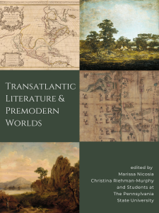
Cover images are attributed as follows: North America divided into its principall parts where are distinguished the severall states which belong to the English, Spanish, and French by William Berry and Nicolas Sanson is in the public domain (top left). An Indian Encampment by Ralph Albert Blakelock is in the public domain (top right). The Codex Quetzalecatzin is in the public domain (middle right). Mahanoy Mountain on the Susquehanna River by Russell Smith is in the public domain (bottom left).
Alternate Text:
The cover consists of six square sections, two columns of three.
The top left square is a map showing, as the title implies, “North America divided into its principal parts where are distinguished the several states which belong to the English, Spanish, and French.” The borders between the United States and Canada and Mexico are not the same as today, with a large, yellow-outlined section of the United States (the English territory) extending down into what is to Mexico today, and the Canadian southern border does not appear beyond the Midwestern United States, with some of its territory claimed by the Spanish and some by the English. The Spanish territory is outlined in pink, consisting mostly of Mexico as well as present day Cuba, and France’s are denoted in a bluish green, consisting of the Louisiana and Florida portion of today’s United States. The yellow English territory is also noted in the South American content, but the map does not extend far into this region.
The top right square is the painting An Indian Encampment by Ralph Albert Blakelock, showing an indigenous encampment from a distance. Under a blue sky, green trees and grass contrast with a few light-colored horses and tipis in the middle distance.
The middle left square shows the title of the book, “Transatlantic Literature and Premodern Worlds” in white text on an olive green background.
The middle right square is a section of a map, the Codex Quetzalecatzin. On the left side of the map, human figures are depicted sitting down and facing sideways in identical chairs decorated with symbols. Above them is a mountain range where two more highly decorated figures have been drawn. A blue wavy line denotes a river and the middle of the map. On the right side, there are a few figures but mostly landforms like trees, rivers, and buildings are represented.
The bottom left square is a painting of Mahanoy Mountain on the Susquehanna River, featuring a light blue sky, cream-colored clouds, and mountain rising from the clouds in the distance. In the foreground of the painting, there are two thin trees, one with leaves and one without, both in front of an outcropping of sand-colored rock surrounded by grassy ground. Between the mountain and the rock outcropping lies the Susquehanna, which appears almost white. In the far left corner of the image is a human figure, perhaps an explorer or a traveler, wearing a hat.
The bottom right square features white text on a forest green background that reads “edited by Marissa Nicosia, Christina Riehman-Murphy, and students at the Pennsylvania State University.”

