
3.2 CUSS 1
The CUSS I: From War Surplus to Cutting-Edge Drilling Barge
The development of the CUSS I drilling platform was a pivotal step in the realization of Project Mohole. Originally an old war surplus barge, the CUSS I was a 300-ton vessel with a 98-foot drilling derrick positioned amidships. It was owned by the Global Marine Exploration Company and named for the consortium of oil companies that supported its development: Continental, Union, Superior, and Shell Oil Companies. John Steinbeck famously described the CUSS I as “having the sleek lines of an outhouse standing on a garbage scow,” highlighting its less than majestic appearance.
Transforming the CUSS I
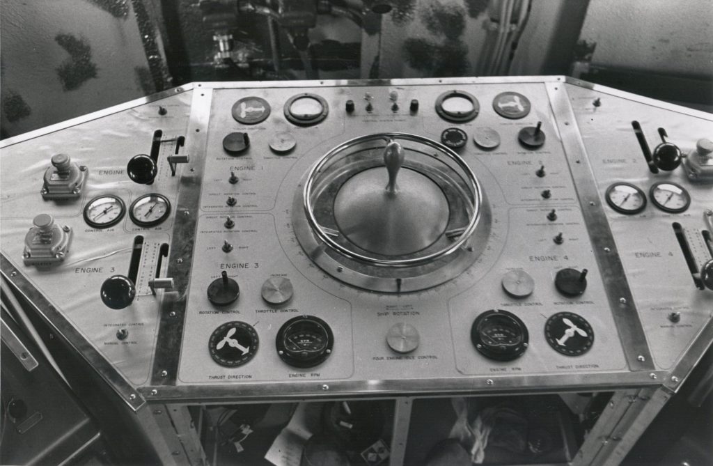
Despite its humble beginnings, the CUSS I underwent significant modifications to become the experimental drilling barge for Project Mohole. The primary goal was to have the ship perform core drilling at significant depths, approximately 180 meters into the seabed, operate in water depths of up to 3,500 meters and maintain precise positioning without relying on anchors, referred to as “dynamic positioning.” A new control center was constructed to house the steering console and navigational instruments. This would be the brain of the vessel. Normally a small craft feature, four outboard motors were installed to more closely control positioning.
The pilot can keep an eye on the ship’s position through “pings” on both the radar and sonar screen. They sounds were made by echoes received continuously from strategically placed radar buoys on the surface, and sonar buoys beneath it. Their pattern told him at any given moment, whether and where he was drifting so he could compensate by manipulating motors. With this manual control, the CUSS I could remain inside a 180-meter radius ring of preinstalled buoys both by sonar measurement and visually. This would keep the vessel close enough to allow drilling in deep water.
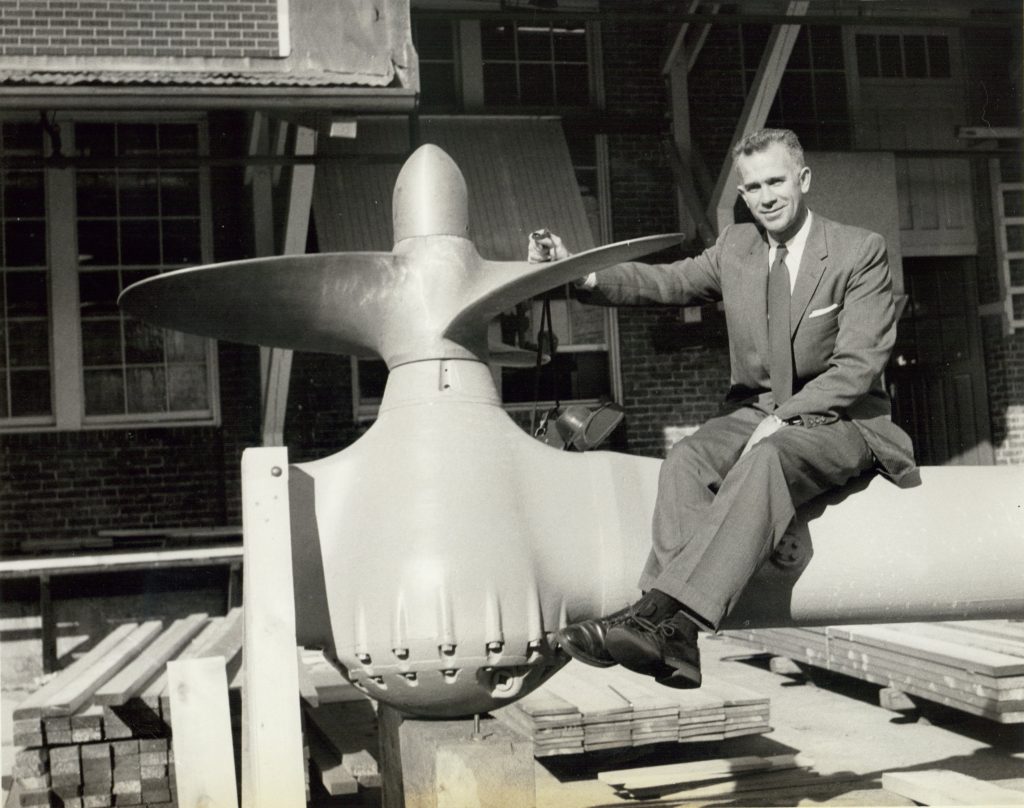
CUSS I was also fitted with four azimuth thrusters were also installed to provide the precise maneuverability essential for dynamic positioning. Advanced sonar tracking systems were added to enhance navigational accuracy and ensure the vessel remained stable over the drilling site. Finally, in order for the scientific crew to live and work on the ship for extended periods, laboratories and sleeping quarters were added.
With these innovations and modifications, Project Mohole was ready to embark on its groundbreaking mission. The challenges were immense, but so were the potential rewards. This endeavor not only aimed to penetrate the Earth’s crust but also to push the boundaries of technology and human ingenuity.
One of the six submerged buoys used for dynamic positioning in Project Mohole. They were lowered to about 200 ft (60 m) into a circular pattern. The CUSS I would then use sonar to maneuver itself in the center of that circle. (Credit: Image 1, Image 2, and Image 3 are all from The National Academies, in flickr, CC BY-NC-SA 2.0)
To see how the CUSS I was modified and maneuvered, as well as the range of collected data during Project Mohole, take a look at this video.
Exercise: The First Deep Ocean Drilling
Review the video above, The First Deep Ocean Drilling and respond to the following questions:
a) What tools, on and off the ship does the pilot use to remain positioned over the drilling hole?
b) What is the purpose of painting the drill pipes blue, red or silver?
c) What does the microscope reveal about the gray green clay core brought up from the ocean floor?
d) How is the sediment temperature measured 500 feet beneath the seafloor?
e) How does this measurement compare to the seafloor surface temperature?
