
Chapter 10: Time to Apply
Below are materials to support teaching and learning about scientific ocean drilling that connect to the content in this chapter. We also encourage you to explore the Resources for Educators page in this OER for links to additional exercises and assessments.
Time to Apply: Part A
This video documents a scientific ocean drilling project off Cape Cod, Massachusetts (USA), where researchers recovered fresh water from deep below the seabed. You can learn more about IODP3-NSF Expedition 501 in Chapter 8. Watch this video and answer the questions below:
a) How can this discovery benefit society?
b) What challenges might we face if we start to use this source of fresh water for societal needs?
c) Which of the 2050 Science Framework Flagship Initiatives would this research and discovery be best classified under? Explain your reasoning. Visit the home page of the 2050 Science Framework, or go directly to page 72 to read more about each initiative.
Exercise 2
In August-October 2023, IODP Expedition 389 took place onboard the MMA Valour in waters off the big island of Hawaii. Read through the Expedition Summary and this article that appeared in EOS, Unlocking Climate Secrets of Hawai‘i’s Drowned Reefs, then answer the questions below:
a) How can this research benefit society? Who in Hawaii can best utilize the outcomes of this expedition?
b) Which of the 2050 Science Framework Flagship Initiatives would this research and discovery be best classified under? Explain your reasoning. Visit the home page of the 2050 Science Framework, or go directly to page 72 to read more about each initiative.
Exercise 3
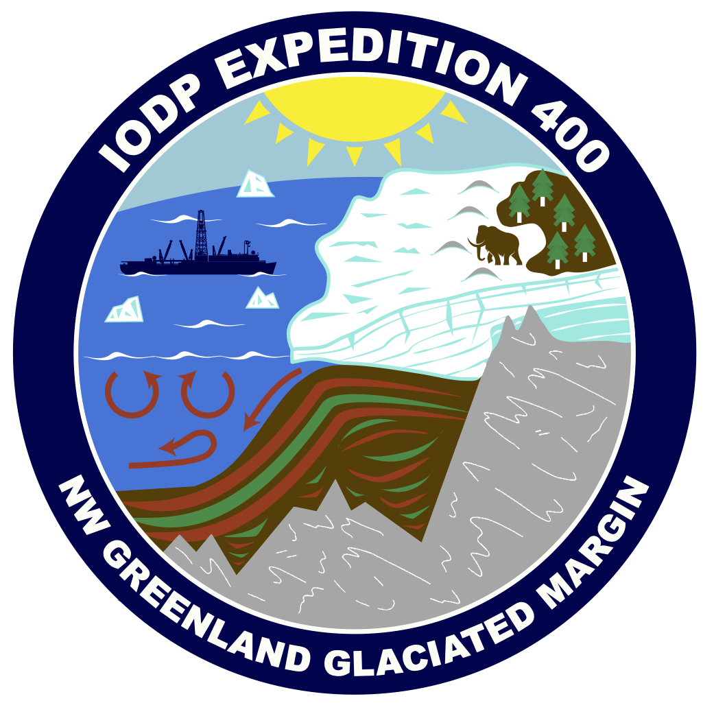
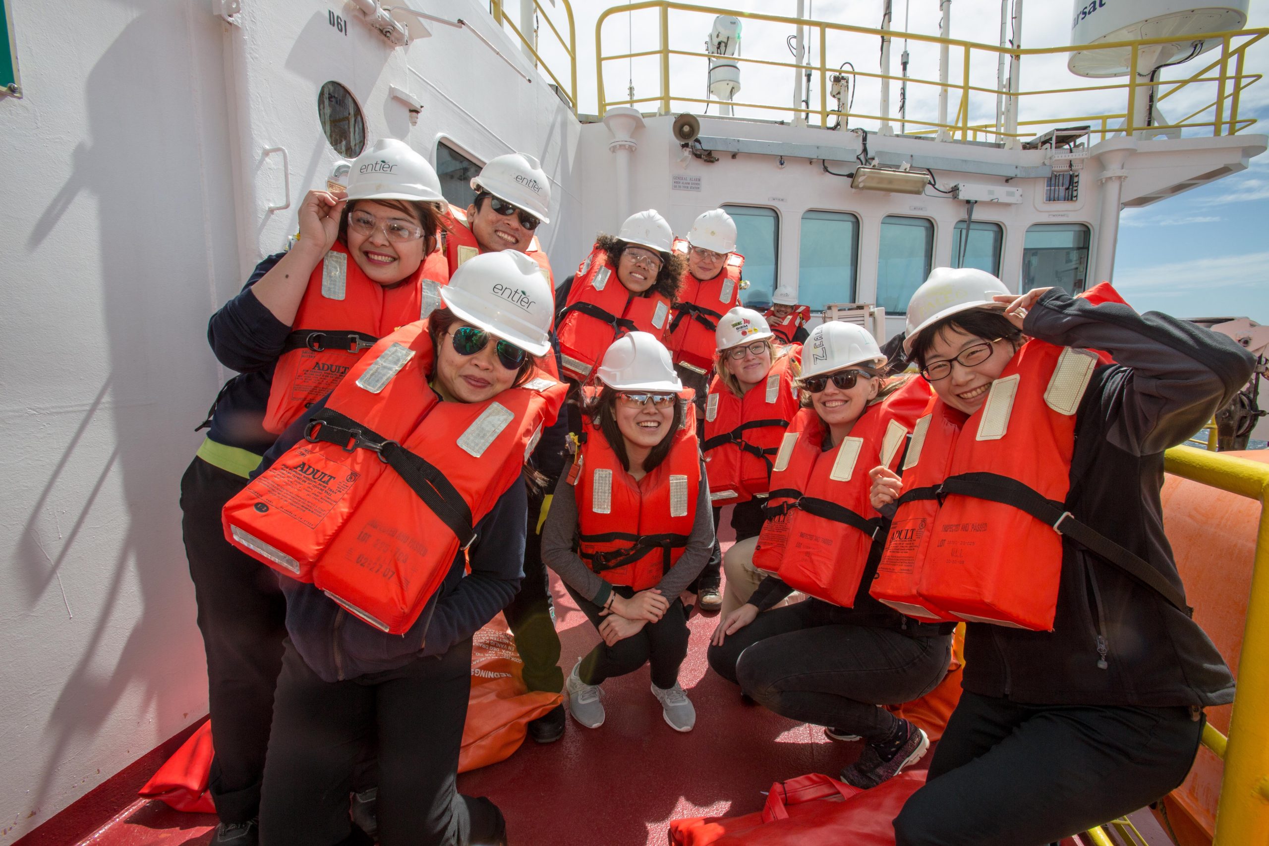
IODP Expedition 400 sailed along the Northwest Greenland glaciated margin August – October 2023. The following paragraph is the plain language summary from the expeditions’s Proceedings volume. Above is the official expedition patch for EXP 400. Read through this summary and examine the patch. Then answer the question below:
Sea level consequences of anthropogenic climate forcing hinge on how the polar ice sheets respond to global warming. If fully melted, the Greenland ice sheet has the potential to raise sea level by >7 meters, yet we know very little about its long-term responses to past climate warming or its role in Earth’s climate system. Expedition 400 seeks to address current knowledge gaps in the evolution and variability of the northern Greenland ice sheet by recovering sedimentary archives of warm and cold periods going millions of years back in time. This includes periods when the greenhouse gas content of the atmosphere was higher than it is today.
By drilling at six sites to 978 meters below seafloor along a transect crossing the northwest Greenland margin into Baffin Bay, we obtained a total of 2299 meters of sediment. This extensive and unique sediment archive will be valuable for understanding the geologic history of the Greenland ice sheet and its response to past warming going back 30 million years before present.
The sediment cores record climate conditions before Greenland became glaciated and indicate when the Greenland ice sheet first began to expand into the marine environment. We also see glacial and interglacial cycles when the ice sheet grew to its maximum position at the shelf edge and retreated toward land, possibly melting farther back than what is known from previous records.
a) Comparing the expedition patch of IODP EXP 400 with the corresponding plain language summary, how would you redraw the patch to emphasize the relevance of the scientific research to society? Either describe with words or sketch.
Time to Apply: Part B
There are lessons based on activities developed by educators and scientists who worked aboard JOIDES Resolution. They have been revised by the American Geosciences Institute (AGI) to connect to Next Generation Science Standards (NGSS) and to include additional support for student learning. All lessons can be found under Educational Resources Using Ocean Coring Data.
In addition, the JOIDES Resolution website has an entire collection of Classroom Activities that include lesson plans, data exercises, digital interactives, posters, and career information.
