
5.6 Downhole Measurements
As an essential component of JOIDES Resolution’s scientific toolkit, the Downhole Measurements Laboratory provided continuous physical and chemical data to supplement core sample analysis. Since core recovery was sometimes incomplete, and the temperature and pressure conditions at the surface differed from environments at depth, downhole measurements were crucial for accurate geological interpretations. The records of the data are called logs, and so the data-collection process is called logging.
Logging While Drilling (LWD) tools, positioned above the drill bit, collected real-time data under optimal conditions, minimizing disturbances caused by drilling However, because LWD does not retrieve cores, a separate borehole was often required, leading to increased costs. As a result, LWD was not a widely adopted practice on JOIDES Resolution. This video presents the benefits and challenges of LWD.
Once coring was finished, JOIDES Resolution would transform the borehole itself into a laboratory. Using a technique called downhole logging, sensitive instruments attached to a wireline were lowered into the borehole to measure real-time geophysical and geochemical properties of the surrounding formations. Measurements were taken as the tools were pulled up, and the data were transmitted to the surface and recorded in the downhole telemetry laboratory. These measurements complemented the analyses of core samples retrieved during drilling and gave scientists a more complete picture of the subsurface environment.
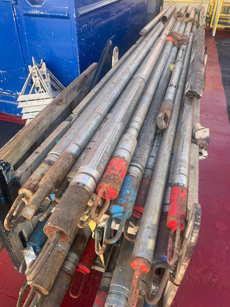
The JR’s wireline logging tools were deployed in specific configurations known as tool strings. To assess the formation’s composition and physical properties, the Triple Combo Tool String was deployed via the wireline. These instruments measured density, porosity, natural radioactivity (gamma ray emission), electrical resistivity ( a layer with weak electrical resistivity would have strong conductivity, suggesting a high water content), and borehole size. For further analysis of the formation’s content and structure the FMS-Sonic Tool was used. This included the Formation MicroScanner (FMS) which produced high resolution (detailed) images of the formation’s resistivity to create a two-dimensional picture of the borehole wall. Also part of this tool string was the Sonic Velocity Tool which recorded sound wave velocities. These velocities, when combined with density data were used to generate a synthetic seismogram – a graph illustrating the formation’s acoustic response with depth.
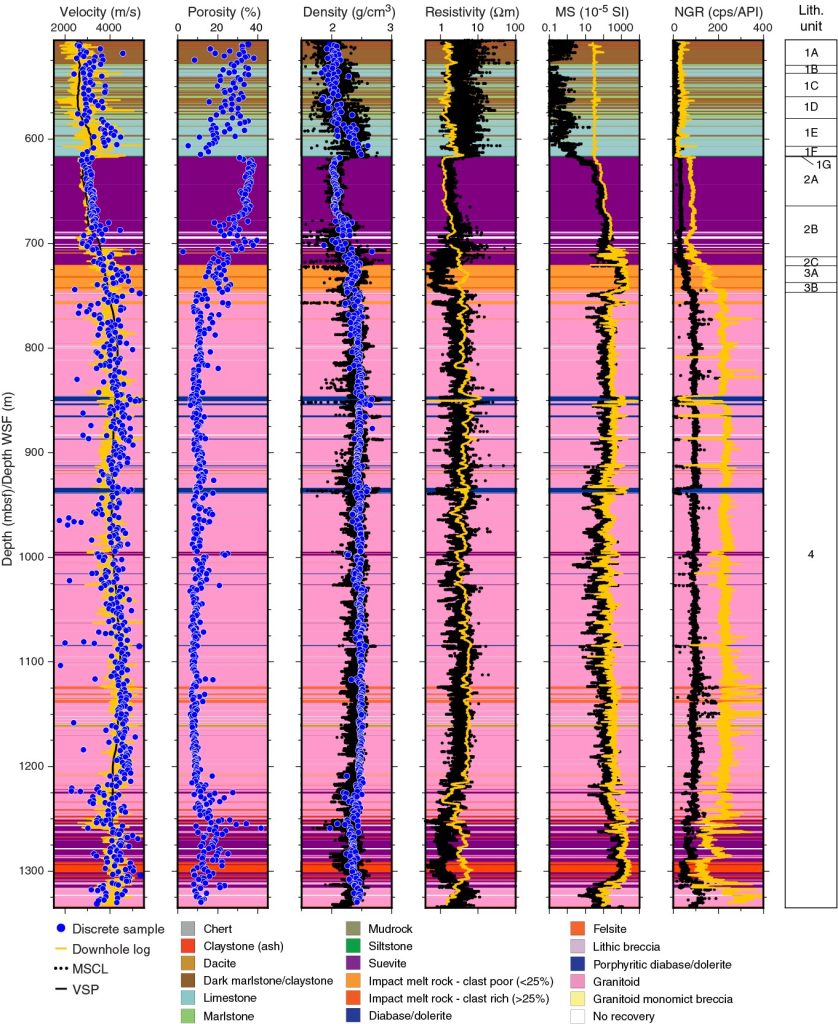
Before the downhole logging phase of the expedition, scientists analyzed seismic profiles (see “Keeping the Ecosystem Safe” for an explanation of seismic profiles) to orient their study area and determine depth through distinctive formation layers and structures. These pre-expedition profiles were created by measuring the travel times of sound waves reflected off subsurface layers. Profiles provide a broad overview of the formation. By correlating this data with detailed borehole measurements, scientists were able to construct a more accurate picture of the subsurface geology. The image below (Figure 13 , IODP Expedition 364 Summary) shows how logging data is correlated with the seismic profiles.
Expedition 364 summary
Specialty wireline tools also provided crucial data for understanding subsurface formations. Acoustic imaging created detailed images of the borehole walls, while magnetic property measurements helped to analyze the geological characteristics of the formation. Check shots were performed to refine seismic mapping by calibrating travel times of sound waves. At the borehole’s bottom, formation temperature and pressure probes gathered critical data. Temperature probes inserted into the formation was held in place for up to ten minutes to ensure accurate extrapolation of in situ temperatures. Inclination, azimuth, and core orientation tools aided in paleomagnetic studies, helping researchers investigate plate tectonics and date sediment layers. Additionally, the Pressure Core Sampler (PCS) collected core samples while maintaining in situ hydrostatic pressure, making it particularly valuable for studying gas hydrates and other pressure-sensitive materials.
The following video presents the instruments and methods that were used in downhole logging aboard the JOIDES Resolution, as well as the informative images that were generated from the data collected.
Exercises: Downhole Logging on JOIDES Resolution
After watching the above YouTube video, please answer the following questions.
a) What are the advantages of doing downhole measurements, also referred to as downhole logging?
b) What are the examples of measurements listed in the video that the instruments can collect?
c) Why does the borehole start to change shape from being a perfect cylinder to another shape during this particular expedition?
Who Works With The Tools
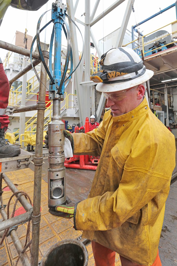
SciOD Spotlight – JR Logging Engineer Clay Furman
Below is an excerpt from a blog post that was written by Sian Proctor at the start of Expedition 383 in 2019. Sian interviewed Clay Furman, who was one of the Schlumberger Engineers that sailed on the JR. The questions (indicated with Q) were posed by Sian and the answers were given by Clay Furman (indicated by A).

Q: Please describe your job duties while on the JR. What will you be doing on a daily basis?
A: I am responsible for the care, maintenance, and running of downhole geophysical instrumentation (logging tools) as well as providing emergency severing services in the event that the pipe should become stuck.
Q: Describe one instrument or tool that is essential for you to do your job? Or a piece of equipment on the JR that is useful and why – what does it do?
A: The most critical tools for my job are, of course, my downhole tools. Schlumberger is essentially subcontracted by IODP to provide and maintain a certain set of tools that provide the measurements we routinely need here. It is my responsibility and my pleasure to look after those tools and execute the logging jobs when and as required to get the downhole data needed for this project.
Q: Why is your work (or research) important? What question are you trying to answer or how does your work/research help assist/advance scientific knowledge?
A: Downhole logs provide in-situ measurements similar to many of the core physical properties measured in the onboard labs. This is important and useful for several reasons, most notably that since downhole logs are a continuous measurement over the length of the drilled/cored interval, they fill in gaps in the data over intervals of poor core recovery. Additionally, log data serves to confirm the measurements taken on the cores at surface as well as highlight differences in certain ones that occur due to the difference in ambient conditions at surface vs. in the hole.
Q: Why the ocean? What made you choose a career at sea or career that involves the ocean?
A: I chose my currently employer, Schlumberger, primarily because such a position offered a decent salary and a lot of travel opportunities. I didn’t specifically choose the ocean per se, it just kinda works out that if you need to drill to a depth where you can find a rock of a particular age, it’s generally a lot easier to lower pipe through water than through a mountain, so we do what we do on the ocean rather than on land most of the time.
Q: What are you most excited about for this expedition and/or being on the JR?
A; I have been assigned to this vessel for about ten *years, and the part I like best about it even after all these years is that no matter the challenge, the crew, staff, and scientists who sail here always rise to meet it. It allows for a lot of out-of-the-box thinking that would otherwise be stifled if I were doing a similar type of job in the oilfield rather than for a scientific program
*Since the time these questions were answered, Clay worked an additional 4 years on JR, and thus worked a total of ~14 years.
Questions to help with reflecting upon this SciOD Spotlight:
1. Clay hints that the crew would need to adapt and pivot to changing conditions. What are some examples of situations that could lead to Clay and the crew to pivot and change their tactics?
2. How does Clay’s position and role on the ship exemplify the partnership between industry and academic scientific teams?
3. Design a hypothetical situation where core recovery is incomplete. How would you use downhole logging data to fill in the gaps?
At times, JR scientists wanted to monitor the temperature, pressure, and chemical conditions and seismic responses within the borehole over an extended period. These long-term borehole observatories – Circulation Obviation Retrofit Kits (CORKs) – were installed to isolate boreholes from seawater intrusion. CORKs are detailed in the next section of this OER.
