
1.3 Plate Tectonics
Our last chapter focused on exploring the layers of the Earth, starting with defining the crust and lithosphere, then moving down to the inner core. Let’s spend some more time with the outermost layer and ensure that we have a solid foundation in understanding the theory of plate tectonics.
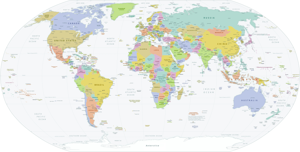
Since we have been in elementary school (and even earlier!), we have been presented the following view of the Earth. This map is known as a political geography map, as all the colors define human-generated, political boundaries. Typically, the ocean is shown in one color and does not represent the varying depths across basins.
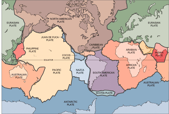
However, earth scientists like to take a different view of Planet Earth. Note how the colors are positioned differently. In this visualization, the colors represent the rigid sections of Earth’s crust, while the thick black lines between the colors are the boundaries where tectonic activity takes place (see WHOI’s Dive and Discover – Plate Tectonics to learn more)
Exercise : IODP Expedition 390 and 393 Studies the Seafloor Around the Mid-Atlantic Ridge
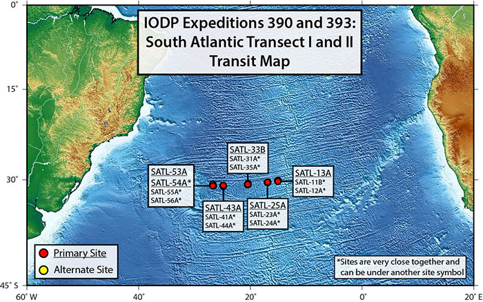
IODP Expeditions 390 and 393: South Atlantic Transect I & II set out to sail and sample the seafloor between the South America and Africa. Its focus was near the Mid-Atlantic Ridge, the part of the seafloor that is the boundary between the South American Plate and the African Plate. The Mid-Atlantic Ridge is a great example of where two diverging plates move away from each other and new seafloor is generated. Though we know about tectonic plates, these two expeditions were set to answer questions we still have in the geosciences.
Read through the blog post about the expeditions and the objectives, then answer the questions below:
a) What did Deep Sea Drilling Project Leg 3 discover after taking sediment cores?
b) Based on the image of the drilling sites and what you read in the blog post, what expected to be different between sites SATL-13A and SATL-53A?
c) Identify the three objectives of the expedition (two primary and one secondary), and contemplate on how the growing knowledge base of tectonic plates can influence other fields of science and the ability to answer their own research questions.
This video will provide you a brief overview of plate tectonics. We encourage you to visit other resources on plate tectonics for a deeper dive on the subject, such as this OER with An Introduction to Geology – Plate Tectonics.
How old is Earth’s lithosphere? As you have seen from the video, new material is always being generated, while older material is always being destroyed/recycled. As we are most interested in the ocean versus continents, this image from NOAA maps the age of the ocean crustal material.
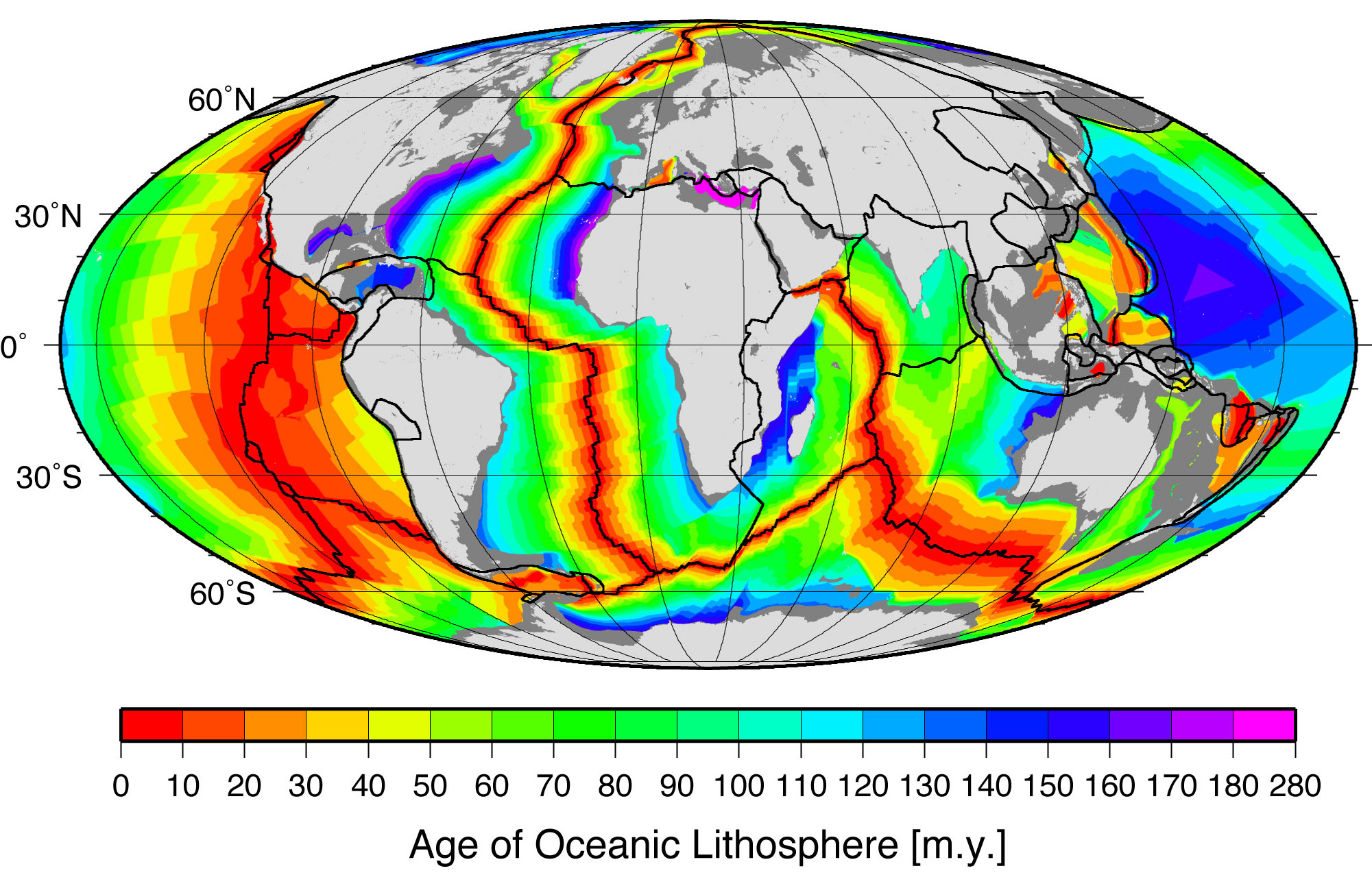
Why does the ocean lithosphere reflect this age distribution? It ties in to the tectonic history of our planet for the past 4.6 billion years, and the timing and location of the opening and closing of ocean basins. View this animation that shows the movement of Earth’s plates from 540 million years ago to the present. The light black lines are drawn in as outlines of modern-day land masses, for reference. Dark blue is for deeper water, light blue is for shallow water, green is for land exposed above sea level, and brown is for higher-elevation areas on land.
Exercise : Shaking Up Earth
Read this article from Science News, titled Shaking Up Earth and respond to the questions below: Note these questions relate to the section Crucible of Life but you are encouraged to review the entire article.
a) Is plate tectonics a requirement for life? Explain.
b) The article describes “stagnant lid” planets like Mars and icy moons like Europa that show different kinds of tectonic or volcanic activity. How might these alternative processes still make a planet or moon potentially habitable?

.svg)