
Chapter 5 – Hurricanes and Tornadoes
Tropical Cyclones in Galveston Island
Aleksey Aprishko, Economics, Penn State University
According to the National Oceanic and Atmospheric Organization, a closed low-level circulation system of clouds and thunderstorms originating over tropical and subtropical waters is called a tropical cyclone (Tropical Cyclone…, 2020). Usually, tropical cyclones develop over warm surface waters in summer months, where little vertical wind shear and low-level humidity combined with the Coriolis effect create favorable conditions. Because of the Coriolis force, in the northern hemisphere, tropical cyclones rotate counterclockwise and generally move west, intensifying over time from tropical depressions to tropical storms, hurricanes, and major hurricanes.
One of the most vulnerable places to tropical cyclones in the United States is Galveston Island, Texas. Its location in the southeastern part of Texas lies on the primary path for most tropical cyclones created in the Gulf Coast’s warm waters, making it liable to tropical storms and hurricanes. In addition to location, Eric Berger in Chron points out that the island lies five to fifteen feet above sea level, making it vulnerable to a direct impact of storm surge.
It is hard to make predictions for the future regarding environmental changes due to highly heterogeneous data. Nevertheless, the IPCC AR5 project for the end of the 21st century, based on changes to atmospheric circulation and ocean surface temperature, predicts an increase in intensity and no change to the frequency of tropical cyclones (Kossin et al., 260). Thus, we can expect hurricanes with higher maximum wind speed and participation rates to hit Galveston, TX, in the future. These stronger hurricanes could overcome the protective barriers and completely wipe out the island, forcing the local population to evacuate and relocate.
In order to withstand more intense tropical cyclones in the future, Galveston has to increase the height of its 15-foot seawall, which was built after the Great Storm of 1900. This measure, even not a panacea, should protect the city from the storm surge. Besides, the current ability to predict potential storms and hurricanes should give people enough time for evacuation if the reason for it arises. In the end, with the continuous trend of global warming, which contributes to sea level rises and warming of the ocean surface temperatures by the end of the 21st century, the population of Galveston may have only one solution – relocation.
Sources
Berger, E. (2011, August 13). How Does Galveston’s Vulnerability Compare? Chron. www.chron.com/news/hurricanes/article/How-does-Galveston-s-vulnerability-compare-1938597.php.
Kossin, J. P., Hall, T., Knutson, T. R., Kunkel, K. E., Trapp, R., Waliser, D. E., & Wehner, M. F. (2017). Ch. 9: Extreme Storms. Climate Science Special Report: Fourth National Climate Assessment, 1, 257–276. doi:10.7930/j07s7kxx.
Tropical Cyclone Climatology. (2020, November 15). National Hurricane Center and Central Pacific Hurricane Center. www.nhc.noaa.gov/climo/.
Shayleen Daley, International Relations, Penn State University
The community threatened by climate change that I chose to research was Nagano City, Japan. It lies along the western coast of Japan near the Sea of Japan. Surrounded by mountains and one of the highest cities above sea level in Japan, I found it intriguing to see how climate change is affecting a community that might not typically be considered as one affected in the near future by the effects of climate change.
Despite the apparent safety and advantages of the location, the increasing severity of typhoons in the Western North Pacific region has already caused unanticipated damage to the city and its population. Several rivers run through and around Nagano City. Recent typhoons of increasing strength have deposited rainfall over the city that it does not have the infrastructure to support, leading to severe flooding. The increased wind intensity and speeds causes further damage as these new super typhoons push further inland than ever before. Typhoon Hagibis in 2019 is an example of these new typhoons, which led to Nagano City reaching a new record for its rainfall with 5.3 inches in less than 24 hours hitting the city and flooding the surrounding rivers.
As more typhoons become super typhoons due to increasing ocean temperatures caused by climate change, the city anticipates an increase in flooding and wind damage to city structures. In the relatively near future, a possible solution is to meet these changes with building more resilient infrastructure and tightening regulations on new and existing buildings to ensure they can withstand more damage than previously expected. Without these changes, it’s possible parts of the city will become too dangerous to allow for buildings to remain which would force families and businesses to move elsewhere.
In the long term, Nagano City is pursuing a climate initiative by attempting to become a net zero carbon city. Throwing its support into nationwide climate initiatives that were set up after the Paris Climate Agreement was signed, it seeks to halt and potentially reverse the negative impacts the city has had on the climate and inspire others to do likewise. Infrastructure investment is a short term fix to a long term problem. Nagano City recognized that the increasing negative effects of super typhoons needs to be addressed at the source, the increasing global temperature and climate change.
Sources
Hornyak, T. (2020, August 12). Typhoons Getting Stronger, Making Landfall More Often. EOS. https://eos.org/articles/typhoons-getting-stronger-making-landfall-more-often
Kennedy, M. (2019, October 15). Japan’s Prime Minister Warns Of ‘Prolonged’ Effects Of Typhoon Hagibis’ Destruction. NPR. https://www.npr.org/2019/10/15/770224030/japan-draws-on-emergency-fund-to-pay-for-aftermath-of-typhoon
Margolis, E. (2021, January 16). The true cost of the climate crisis on Japan. Japan Times. https://www.japantimes.co.jp/life/2021/01/16/environment/cost-climate-change/
Tsz-Cheung, L., Knutson, T. R., Kamahori, H., & Ying, M. (2012). Impacts of Climate Change on Tropical Cyclones in the Western North Pacific Basin. Tropical Cyclone Research and Review, 1(2), 213-235. https://doi.org/10.6057/2012TCRR02.08
Ben Donovan
For this assignment, I chose to do research on the small town of Lumberton, North Carolina. This poor town has been the victim of severe hurricanes over the past few years, with Hurricane Matthew wreaking havoc in 2016 and then Hurricane Florence 2 years later, causing severe economic, emotional, and physical damage.
Given the high levels of poverty, with approximately 34% of the residents living below the poverty line, especially Native Americans of the Lumbee Tribe, according to The Intercept, the damage caused by hurricanes is even more pronounced, and the town struggled to recover from the $967 million in damages of Hurricane Matthew. The compounded effect of another hurricane in 2018 led to extreme consequences for the town and its residents, destroying recently renovated and rebuilt homes.
This town is highly susceptible to hurricanes that often hit the area due to the lack of infrastructure driven by economic factors. The federal government only allocated approximately 1% of the funding requested by the State after the damages from Hurricane Matthew. Making the flooding worse, the majority of the foundations of houses in the town are below the floodplain, which was only worsened by the fact that the town sits on the Lumber river which caused massive flooding after receiving significant rainfall from these hurricanes. The very flat landscape of Lumberton added to the accumulation of flooding within the community. However, one of the largest factors that contributed to the detrimental effects of the hurricanes was an underpass of a railroad owned by CSX. This was a main cause of the flooding from Hurricane Matthew. The City asked CSX to create a berm, but the Company failed to do so and left Lumberton exposed to the potential for similar consequences in the advent of another hurricane, which became a reality in 2018 when Hurricane Florence struck.
Although this town has had plenty of experience with hurricanes, it still remains susceptible to harsh effects if another hurricane is to hit the area. On February 19th, 2021 the town was subject to intense flooding yet again. The inability to act fast and develop the proper flood prevention infrastructure has left Lumberton unprotected from future flooding.
As a result of climate change as well as social and economic factors, Lumberton has been left highly susceptible to flooding and associated damages. To counteract this problem, the community needs much more funding to develop better infrastructure such as resilient roads and electric grids to prevent damages from these disasters. The City recently secured $3.1 million in federal funding to help develop floodgate systems, but the community will need to act quickly to prevent impending damages from future hurricanes and heavy rains.
Sources
Frederick, J. (2018, November 25). Local & State. The Charlotte Post. www.thecharlottepost.com/news/2018/11/25/local-state/2-years-2-hurricanes-lumberton-nc-faces-natural-disasters-impact/
Keyssar, N., & Brown, A. (2019, June 2). Devastated by One Hurricane, and Then Another, a Community Confronts the Company That Refused to Block the Floodwaters. The Intercept. http://www.theintercept.com/2019/06/02/lumberton-north carolina-hurricane-matthew-florence-flooding-csx/
D.V. Escobar
When one thinks of catastrophic events, it is likely that hurricanes are one of the first events that come to mind. In 2017, Hurricane Irma left Fort Liberte, Haiti, a town with a population of approximately 34,000 people, with extreme floods. The impact was quite significant in damages to their environment, but the aspect that was of key concern is the damage to agriculture. The people of Fort Liberte (and of Haiti as a whole) rely on farming and agriculture as a primary source of income. The hurricane not only caused physical damage, but also left an already poor population even poorer, since not only did they have to worry about repairs and costs associated with the storm, but also in a worse economic position than before the storm hit.
Unfortunately, Fort Liberte is located in a region where exposure to hurricanes is high, and sadly, there is not much that such a small population of people can do to prevent catastrophic events like these from occurring again. Because hurricanes are dependent on the regional climate, and are increasing due to global warming, it’s likely that their situation will improve any time soon. They will also be hit by more severe, wetter storms as the globe warms. This leaves Fort Liberte in a situation where they can only focus on preparation and mitigating risks.
Is there anything that people around the globe can do to help Fort Liberte citizens? Certainly. Being proactive with actions that lead to decreased Carbon Dioxide in the atmosphere is something we can all do to help them and us. Simple things such as recycling, using less energy when possible, sharing rides to work, and maybe even investing in fuel efficient or electric cars will certainly have positive effects long term. As for help on a much larger scale, initiatives such as the Paris Climate Agreement will be key. This agreement has several positive aspects, but one that is vital to communities like that of Fort Liberte is that the agreement suggests that better financially established nations will help nations that are not financially postured to help themselves.
Locally, Haiti needs to be provided the help to build homes higher and stronger, improve drainage, and install pumping stations if they want to be prepared for the next storm.
Global warming prevention is a responsibility for everyone. Be informed, spread the word, and act! We all need to be team players on this one.
Sources
Fort-Liberte. (2021, January 1). In Wikipedia. en.wikipedia.org/wiki/Fort Libert%C3%A9.
Law, T. (2019, September 30). These Six Places Will Face Extreme Climate Change Threats. Time. time.com/5687470/cities-countries-most-affected-by-climate-change/.
UNFCCC. (2021, March 2). The Paris Agreement. unfccc.int/process-and-meetings/the paris-agreement/the-paris-agreement.
Hurricane Katrina in Waveland, Mississippi
Robert Estephan, Political Science, World Campus
On August 29th, 2005, Hurricane Katrina last touched land on a small Gulf of Mexico coastal community, Waveland, Mississippi. At that point, Katrina was elevated to a Category 3 Hurricane with wind speeds of 120 miles per hour. Waveland has an average elevation of 16 feet and the storm surge was 26 feet, clearing the coast by more than 10 feet. With the combination of the surge and the wind, the town was decimated, levelling nearly every house and business. The surge penetrated six miles inland over the low terrain, and up to ten miles inland where the adjoining bay exists. On Google Earth, the town appears to be covered in a white substance up to 2 years later, which I assume is sand. Most trees were also eliminated by the surge and winds.
The storm killed 50 people in a community that has a population of only 6,674, according to the 2000 census. The population decreased to 6,435 in the 2010 census. The decrease could be caused by a reluctance to live in such a high-risk area. Many businesses have not returned, and the Mayor blames the high cost of insurance as a contributing factor.
The St. Louis Bay Bridge that extends US Route 90 over the bay was destroyed by the surge and winds of Katrina. It took over 2 years to rebuild the two-mile-long bridge that now has an elevation of 85 feet with the intent of being able to withstand a similar storm.
Many of the residents were evacuated one to two days prior to Katrina’s arrival, however, many of the shelters were full and could not accommodate all the residents. Many others did not believe they needed to evacuate, which could be a cause of the high death rate.
The area was able to secure funds through the “Hazard Mitigation Grant Program” that provides money to reduce the risk to life and property from future similar disasters. Some tactics are procuring generators, relocating homes and businesses to non-flood zones, and creating safe houses.
Sources
Mayor Mike Smith Welcomes You to the City of Waveland, Mississippi. (n.d.). City of Waveland.
2019 U.S. Gazetteer Files. (n.d.). United States Census Bureau.
Waveland Mississippi Profile and Resource Guide, City or community of Waveland, Mississippi Facts, Information, Relocation, Real Estate, Advertising. (n.d.). Usacitiesonline.com.
2005 NOAA Tide Predictions: Waveland. (2005) NOAA, web: NOAA-tide-tables Deep in debris, Waveland was Katrina’s ground zero Lisa Monti Clarion-Ledger Correspondent August 21, 2015 10 Yr. Katrina Report – Final – webversion1.pdf. Office of Governor Phil Bryant.
Chittagong, and the increased threat of cyclones, rising seas
Connor Freidhoff
Bangladesh is the seventh most populous nation in the world with over 170 million people. The capital city, Dhaka, houses just under 9 million people. The country is the densest in the world among countries over 2,000 square kilometers in size. In 1970, the notorious Bhola Cyclone battered the mostly agrarian country and left half a million people dead. To this day it remains the deadliest tropical cyclone in modern history. One of the heaviest impacted areas was Chittagong, a city and financial hub that today houses 9.3 million people within its metro area (2.6 million in the municipality).
With the potential increase of deadly cyclones worldwide due to climate change, Chittagong remains one of the world’s most vulnerable mega-cities to climate change. The deadliest cyclone to strike the region, the 1991 Bangladesh Cyclone, killed 138,000 people and left over 10 million people without homes. Since then, there have been 9 tropical cyclones that have left significant impacts on the region. Chittagong’s coastal placement makes it a cyclone target in Bangladesh, and with the population continuing to grow, millions remain at the mercy of nature. The elevation of Chittagong’s city center is just 95 feet (29 meters). Though not in the “danger zone” for sea level rise, much of its lower-lying coastal areas remain under threat.
In the hill tracts outside the city, aquifers and other water sources are drying up, forcing mostly indigenous peoples out of their traditional homelands. The city itself is incredibly dense, creating a movement similar to that of “urban flight.” The mass inland migration has brought up a newer issue, soil erosion. Increased sea level rise and urban development have hurt the soil’s integrity, putting a strain on agriculture and property development. The soil is suffering from increased salinity, a product of tides and cyclone storm surge. Just 6 meters of sea level rise would cause 500,000 to lose their homes as a result. Another issue is the poor infrastructure and demographic management. The Bangladeshi government struggles to bring together an accurate census because of a sizable portion of the population living either under the radar, or in hard to reach areas. An inaccurate census makes it more difficult for government subsidization of at-risk regions. In order to solve this, more resources will have to be delegated to the Bangladeshi census and the overall infrastructure grid of the country.
In addition to the climate crisis, many who have suffered have not received much aid. The chronic flooding and threats of sea level have forced many to leave, and at this rate more will follow. The Bangladeshi government and the governments of the world must take notice of this country of 170 million in order to at least compensate the farmers and laborers who have had their lives upended by climate change.
Sources
Climate change in Bangladesh. (2021). In Wikipedia. https://en.wikipedia.org/wiki/Climate_change_in_Bangladesh
Diginove. (n.d.). Bangladesh – Climate Emergency in Chittagong. Sobloo. https://astriumgeo.maps.arcgis.com/apps/Cascade/index.html?appid=137236e917b44bf78279eb7b3e85b8c2
Damage of modern hurricane seasons in Haulover village, Nicaragua
Eathan R. Gottshall
Hurricanes are capable of widespread destruction that can permanently alter the environments and communities in their paths. One such community is the village of Haulover in Nicaragua, which is a poor coastal community that subsists off fishing and foraging. Since it is a coastal community, Haulover is vulnerable to the most extreme effects of hurricanes coming from the Atlantic and making landfall under their strongest conditions. And with climate change, The strength of these storms will only increase. During the 2020 Hurricane season, Haulover was affected by two subsequent storms within weeks of each other. Hurricane Eta struck first, and then Hurricane Iota, the strongest Hurricane of 2020, further devastating the area just two weeks after Eta, causing massive concerns over the future habitability of the area for the community. After the subsequent storms, the community was irreparably changed, the surrounding mangroves were destroyed, and water now cuts straight through the village to the lagoon on the opposite side of the coast. Ecologists have since come in to evaluate the impact on surrounding ecosystems to determine how detrimentally they have been impacted by the storm and determine their ability to recover. Since Haulover is a coastal town dependent on foraging and fishing, the impact on the surrounding ecosystems means that the community may be unable to sustain itself if they are unable to recover. Community leaders, in tandem with environmental researchers, have suggested that the village move further inland to avoid the increased frequency and intensity of hurricanes that are expected due to further climate change. Many of the villagers, however, have major issues with relocation due to their cultural beliefs and the major adjustments that would accompany the relocation. Moving means leaving behind their homeland, ancestors, and the only form of subsistence they have known their whole lives. Separating themselves from the coast means they would more than likely need to adopt farming practices over less efficient fishing, which means learning whole new swaths of information and years of trial and error to become self-sufficient. Community leaders are urging for relocation, but the reality is that many villages may opt to stay and rebuild the devastated village instead of moving inland.
Sources
McDonald, B. & Bermúdez, A. F. (2021, February 3). After Hurricane’s Devastation, a Dilemma in Nicaragua: Rebuild or Relocate? New York Times. https://www.nytimes.com/2021/02/03/world/nicaragua-hurricane-eta-iota-video.html.
Crystal N. Graziano
Climate change is having an impact on the intensity of hurricanes and their devastating effects on the coastal community Port-Au-Prince in Haiti. Hurricanes are categorized based on wind speeds using the Saffir-Simpson scale and currently, the most damaging hurricanes are category 4 and 5. Studies have found that some tropical cyclones may reach wind speeds that are above the category 5 limit (Beradelli, 2019). Because of global warming, researchers expect a significant increase in intensification extremes, especially ones that increase dramatically right before landfall (Emmanuel, 2017).
Port-Au-Prince, in Haiti, is vulnerable because of the density of population in the coastal town. Not only are there tightly packed living spaces, but there is a lack of hurricane preparedness, historically, in the Haitian city (UNOPS, 2021). Port-au-Prince is also vulnerable to hurricanes because of deforestation of its mahogany, other precious hardwoods, and because of sugar plantations which contribute to landslides and flooding because of the excessive water displacement (Amadeo, 2021).
The Germanwatch Global Climate Risk Index has classified Haiti as third in the world on its list of communities most vulnerable to impacts from natural disasters, and is ranked one of the highest at risk for vulnerability to climate changes (The World Bank, 2017). The historical effects of hurricanes on Port-au-Prince have been devastating, such as flooding, landslides, and destruction of crops and natural ecosystems. In addition to the environmental impacts, there is a significant impact on the economy because most of the coastal communities’ income comes from their export of goods like clothing (Amadeo, 2021).
Together with the United Nations Office for Project Services, communities throughout Haiti are working to rehabilitate key infrastructure that can better withstand the brutal natural disasters that commonly affect the peoples of Port-au-Prince (UNOPS, 2021). In addition to cleaning up drainage systems, training on waste management to prevent instances of unsanitary environments is occurring, better roads are being constructed that will be accessible during heavy rains, better bridges are being built, residents are building improved roads to access hospitals, and schools and safer evacuation routes are all being developed in anticipation of the future hurricane seasons.
Sources
UNOPS. (2021). Building a Resilient Haiti. United Nations Office for Project Services. https://www.unops.org/news-and stories/stories/building-a-resilient-haiti
Emmanuel, K. (2017). Will Global Warming Make Hurricane Forecasting More Difficult? Bulletin of the American Meteorological Society. https://journals.ametsoc.org/view/journals/bams/98/3/bams-d-16- 0134.1.xml
Beradelli, J. (2019). How Climate Change is Making Hurricanes More Dangerous. Yale Climate Connections. https://yaleclimateconnections.org/2019/07/how-climate-change-is-making-hurricanes-more-dangerous/
The World Bank. (2017). Rapidly Assessing the Impact of Hurricane Matthew in Haiti. https://www.worldbank.org/en/results/2017/10/20/rapidly-assessing-the-impact-of hurricane-matthew-in-haiti
Amadeo, K. (2021). Haiti Earthquake Facts, Its Damage, and Effects on the Economy. U.S. & World Economies. https://www.thebalance.com/haiti-earthquake-facts-damage-effects-on-economy 3305660
David Harvey
Founded in 1815, the small town of Adjuntas is located slightly southwest of the center of the island territory of Puerto Rico. Boasting a robust population of roughly 19,500 inhabitants, the community is largely agrarian in nature, with a small portion of its economy based in tourism (Adjuntas, Puerto Rico, 2021). Being on a Caribbean island, the town of Adjuntas (along with the entire island of Puerto Rico) suffers from an abundance of hurricanes. Strong winds and heavy rains can devastate the seventeen barrios of the town, and severely damage the crops grown in the area. In addition, the strong winds and torrential downpours of a hurricane can lead to another frightening occurrence: landslides (Adjuntas, Puerto Rico, 2021). Oversaturated with rains, soil in the more mountainous region can slide downhill, smothering anything in its path. With agriculture being such a priority in the community, destruction of crops can be devastating for the economy. In fact, Hurricane Maria damaged roughly 85% of Puerto Rico’s coffee industry (Flores, 2019). Longer-term damage to viable farmland via landslides and erosion can leave a longer lasting bruise on the area as well. One of the more popular crops in the region (coffee) takes more time than other crops to recuperate and regrow after being damaged (Flores, 2019). With increasing strength of hurricanes (like Hurricane Maria in 2017), landslides due to hurricanes are an ever-present danger. The human loss of life is even more staggering. In Adjuntas, a mural memorializes the lives of over 4,600 people who were believed to have died as a result of Hurricane Maria. Though this number is disputed by the Puerto Rican government, the number of deaths reported by the Puerto Rican government is still appalling, at nearly 3,000 (Clement, Guskin, & Zezima, 2018). The official responses to the tragedy of Maria in particular were abysmal, which only exacerbates the damage. The majority of Puerto Ricans were dissatisfied with the efforts of the government at all levels to deal with the humanitarian crises that resulted from the storm (Clement, Guskin, & Zezima, 2018). What can be done about the ever-growing threat? Aside from minimizing climate change in order to prevent disasters of Maria’s magnitude, preparations for coming hurricanes can be made. Improvements in local infrastructure could allow for better responses when hurricanes strike, as well as minimizing the amount of work to be done in cleanup (Galea, 2018). To more quickly rebuild, the town of Adjuntas mobilized its female workforce to a greater extent after Maria. In the future, better preparedness, more timely responses, and utilization of all available resources could minimize the damage of hurricanes.
Sources
Clement, S., Guskin, E., & Zezima, K. (2018, September 12). Hurricane Maria: Puerto Ricans say all levels of government failed them after devastating storm. The Washington Post. https://www.washingtonpost.com/news/national/wp/2018/09/12/feature/residents-see-a failure-at-all-levels-of-government/.
Flores, J. (2019, August 14). Puerto Rico’s coffee farmers work to rebuild WHAT Hurricane Maria destroyed. NBC News. https://www.nbcnews.com/news/latino/puerto-rico-s-coffee-farmers work-rebuild-what-hurricane-maria-n1040516.
Galea, S. (2018, May 31). 3 Lessons from Puerto Rico: Mitigating the Health Effects of Future Hurricanes. Harvard Business Review. https://hbr.org/2018/05/3-lessons-from-puerto-rico mitigating-the-health-effects-of-future-hurricanes.
Adjuntas, Puerto Rico. (2021, February 20). In Wikipedia. https://en.wikipedia.org/wiki/Adjuntas,_Puerto_Rico.
Hurricanes in The Miskito Village of Haulover
Cassidy Hofbauer, Special Education, College of Education
The coastal Miskito Village of Haulover, Nicaragua already has, and will continue to be, a vulnerable community when it comes to life-threatening hurricanes. The Miskito village’s location in the Caribbean as well as its high temperatures makes it more likely that hurricanes will hit them (McDonald & Bermudez, 2021). Most recently, the village was hit with Hurricane Iota in 2020, which destroyed the majority of the community (Hurricane Iota, 2021; McDonald & Bermudez, 2021). Vast damage was done to the entire village including demolished homes and even some deaths (Hurricane Iota, 2021; McDonald & Bermudez, 2021). The majority of the Miskito villagers’ food supply including coconut trees, which are completely gone, and fish, meaning the villager’s ability to fish, were both great losses to the people. Currently, the Miskito people are living in temporary shacks, but it is unlikely that if more hurricanes were to hit Haulover, they would be able to survive again (McDonald & Bermudez, 2021).
The Miskito village has faced tremendous loss and can’t afford to take another hit. Since many Miskito villagers refuse to move inland due to their cultural connection to the land and their lack of money, we need to begin enforcing solutions to help stop destructive hurricanes from happening (McDonald & Bermudez, 2021). There is a high possibility that more hurricanes like Iota will hit the Miskito village and completely destroy it once and for all, if solutions aren’t put in place. It is difficult to completely stop hurricanes from occurring, but we know that as the temperature and sea level of the oceans increase, so does the intensity of hurricanes, therefore we can use a few solutions to lessen the intensity. One solution we can do to lessen the intensity of hurricanes is to reduce greenhouse emissions by reducing your carbon footprint (Center for Climate…, n.d.). Everyone can reduce their carbon footprint by using a hybrid car or riding your bike, recycling, or cutting back on your electricity (How to Reduce…, 2021). Another way we can help decrease future hurricane intensities is to build offshore wind farms to help reduce the speed and impact of approaching hurricanes (McGuire, 2018). If we could use the solutions previously stated, we can help decrease the intensity of future hurricanes making them less destructive to those vulnerable to them, like the Miskito village.
Sources
Center for Climate and Energy Solutions. (n.d.). Hurricanes and Climate Change. https://www.c2es.org/content/hurricanes-and-climate-change/
How to Reduce Your Greenhouse Gas Emissions. (2021, January 12). WikiHow. https://www.wikihow.com/Reduce-Your-Greenhouse-Gas-Emissions#:~:text=How%20to%20Reduce%20Your%20Greenhouse%20Gas%20Emissi ons%201,4%3A%20Changing%20Consumption%20Habits.%20Eat%20less%20meat.% 20
Hurricane Iota. (2021, February 9). In Wikipedia. https://en.wikipedia.org/wiki/Hurricane_Iota
McDonald, B. & Bermudez, A. F. (2021, February 3). After Hurricane’s Devastation, a Dilemma in Nicaragua: Rebuild or Relocate? New York Times. https://www.nytimes.com/2021/02/03/world/nicaragua-hurricane-eta-iota-video.html
McGuire, B. (2018, April 27). How to stop a hurricane. Science Focus. https://www.sciencefocus.com/planet-earth/how-to-stop-a-hurricane/
Claire Jablonski, Mathematics, Eberly College of Science
Hurricane Harvey started as a tropical wave and then was categorized as a tropical storm on August 17, 2017. Harvey made landfall on a variety of Caribbean Islands before rapidly intensifying into a hurricane on August 24, 2017. Hurricane Harvey first made landfall in the United States in Texas at a high intensity. Then, Harvey returned to tropical storm status, and a large amount of rain flooded Texas, specifically in the Houston area. As Hurricane Harvey continued to drift inland, it weakened until it finally dissolved at the beginning of September 2017. Hurricane Harvey gravely affected Texas and Louisiana and will be remembered for its extreme rainfall.
The environmental threat to Houston, Texas is hurricanes in late summer and early fall. For a hurricane to form, there needs to be warm temperatures, abundant moisture, and converging winds. The ocean continues to warm as temperatures on land also continue to rise. The rising temperatures of the oceans cause there to be an increase in moisture in the air. This has caused hurricanes to increase in strength. Hurricane Harvey first made landfall in southern Texas at the end of August 2017, gravely affecting Houston with its extreme rainfall. In just one week, Houston experienced 52 inches of rain. Houston is comprised of homes, factories, skyscrapers, and businesses. Because of Houston’s layout, the pavement and the buildings made Hurricane Harvey a flooding disaster. Little consideration was put towards draining the city, which led to massive destruction after Hurricane Harvey hit.
The intense rainfall and wind speeds from Hurricane Harvey left unrecoverable damage throughout the state of Texas. Many people’s lives were lost, and great damage was done to buildings around the city. Because of global warming, Hurricane Harvey had deadlier impacts than most other hurricanes. With the sea levels continuing to rise and storms moving slower when on land, hurricanes will continue to horrifically impact the United States. There are many different solutions to this threat of hurricanes in Houston. One is doing everything possible to stop the production of greenhouse gases and taking global warming seriously. Another is putting more regulations in place for flooding precautions in the city. Putting more effort into zoning areas and drainage will also help. Hurricane Harvey affected Houston terribly but some impact could have been prevented if proper precautions were set into place beforehand.
Sources
Fernandez, M. (2018, September 3). A Year After Hurricane Harvey, Houston’s Poorest Neighborhoods Are Slowest to Recover. The New York Times. www.nytimes.com/2018/09/03/us/hurricane-harvey-houston.html.
Hersher, R. (2018, November 14). Houston Got Hammered By Hurricane Harvey – And Its Buildings Are Partly To Blame. NPR. www.npr.org/2018/11/14/666946363/houston-got-hammered-by-hurricane-harvey-and-its-buildings-are-partly-to-blame.
Hurricane Harvey. (2021, February 13). In Wikipedia. en.wikipedia.org/wiki/Hurricane_Harvey.
The Impact of Hurricane Harvey. (2020, August 24). University of Houston. uh.edu/hobby/harvey/.
Jenna Kaczmarkiewicz, Mechanical Engineering, Penn State University Park
Key Biscayne, Florida, is an island town that sits east off the coast of Miami. Key Biscayne is Florida’s most southern barrier island, but it is typically one of the first areas of Miami to be evacuated before a hurricane hits. Miami sits at the top of the list, if not in first place, for the most susceptible city in the US to hurricanes. Key Biscayne becomes an extremely dangerous place to live as hurricane season approaches.
2020 was predicted to be one of the most active hurricane seasons for the Atlantic, with a forecast of 19-25 storms according to the NOAA Climate Prediction Center. They predicted about 6-11 of these would become hurricanes, at least 3 being major hurricanes. The final outcome was 30 storms, 13 became hurricanes, bringing about 6 major hurricanes.
La Niña conditions set in around August-September of 2020, right in time for hurricane season. The warmer temperatures, for both the ocean surrounding Florida and land in Florida, had a large effect on Key Biscayne’s extreme hurricane season.
In September 2017, Hurricane Irma arrived in Key Biscayne as a category 3 storm with winds of about 73 mph. The island had to be evacuated, and it was inundated about 2-3 feet. Luckily, no lives were lost, but the storm cost the village alone almost $2.5 million. As sea level rises and intensity of storms increase, this only puts Key Biscayne at more of a risk for future hurricanes.
As environmental conditions change and the planet warms, coastal cities and islands, like Key Biscayne, become vulnerable to flooding. The atmospheric warming causes more evaporation, which then causes more precipitation. As sea level rises, more water becomes available during high tides. Such environmental changes allow for the intensity of storms, especially hurricanes, to grow. These factors put Key Biscayne at risk of extreme flooding and storm surge, especially being it is only 3 feet above sea level.
Key Biscayne, and almost all of Miami, is quite unprepared for hurricanes and the flooding that comes with it, although they have been hit by several extreme hurricanes. In order to best protect the island and its citizens from the impact of hurricanes, Key Biscayne relies on its natural and unnatural solutions.
Key Biscayne relies on its natural barriers: reefs, barrier islands, etc. They also use their beach dunes and continually add sand to limit coastal erosion.
As for the unnatural solutions, Key Biscayne has been elevating their sea walls along with the elevation of sea level. However, they more so rely on a pump and drainage system that was built in 1996. More recently they have installed backflow valves to allow rainwater to run towards the ocean, but prevent the water from coming back to the drainage pipes. They have also been raising roads, homes, and buildings. They are also improving their technology every day to keep up to date on when a storm is approaching and how to best keep the citizens safe from the dangerous effects.
Sources
Cardona, A. C. (2020, December 1). We Made It, Miami: Hurricane Season Is Over. Miami New Times. www.miaminewtimes.com/news/record-breaking-2020-hurricane-season-ends-november-30-11756508.
Ferris, R. (2015, August 27). Why Miami Is Mostly Unprotected from Hurricanes. CNBC. www.cnbc.com/2015/08/27/why-miami-is-largely-unprotected-from-hurricanes.html.
Floodplain and Flooding Information. (2013). Village of Key Biscayne. www.keybiscayne.fl.gov/index.php?src=gendocs&ref=FloodDamagePreventInfo&category=HurricaneFlood.
Key Biscayne, Florida. (2021, February 6). In Wikipedia. www.en.wikipedia.org/wiki/Key_Biscayne,_Florida.
US Department of Commerce, NOAA. (2018, July 23). Hurricane Irma Local Report/Summary. National Weather Service. www.weather.gov/mfl/hurricaneirma.
Hurricanes in Les Cayes, Haiti
Sarah Kern, Environmental Resource Management, College of Agricultural Sciences
One threat to the community of Les Cayes, Haiti is devastating hurricanes. Since this community is coastal, it is easily exposed to the strong winds and storm surge associated with hurricanes. Flooding, mudslides, and fallen trees are also threats and have occurred during previous hurricanes that have hit this community (CBS, 2016). Hurricane season threatens Haiti each year due to its location in the tropics.
This community is vulnerable because it is poor and lacks infrastructure. Many of the homes in this area are shacks and are not well built. Entire homes were destroyed during Hurricane Matthew in 2016. Roads and bridges were also flooded or destroyed during this hurricane (CBS, 2016). Les Cayes is also on a peninsula, which increases its vulnerability. When storm surge and flooding occur, the peninsula is easily cut off from receiving help from the rest of the country. Most of Les Cayes’s vulnerability is due to extreme flooding from storm surge during hurricanes (CBS, 2016).
When a hurricane occurs in Les Cayes, it takes a long time to rebuild due to poverty and lack of resources. When hurricane Matthew hit, Les Cayes lost its methods of communication, experienced a lack of freshwater, and the hospitals were unable to support the needs of everyone (CBS, 2016). Residents of Les Cayes also experienced trauma, loss of property, and loss of loved ones. Recovering from hurricanes is not easy for this community (SOS, 2017). While emergency response may improve in the future, it is likely that the impacts on this community will continue to be destructive when future hurricanes hit as well.
One solution to the threat of hurricanes is to address the issue of climate change. As climate change worsens, sea level rise and hurricane intensity will worsen as well. Les Cayes is especially vulnerable to climate change and working on solutions to combat it will help communities like Les Cayes survive. Improving the infrastructure of Les Cayes would also help lessen the impacts of hurricanes, however, this is challenging due to the lack of financial resources. Rebuilding more secure structures and improving emergency response programs would help the people in Les Cayes recover faster from future hurricanes (OCHA 2017).
Sources
CBS. (2016, October 4). Resident of Les Cayes in Haiti: “It’s like a bulldozer just passed by.” CBS NEWS. https://www.cbsnews.com/news/hurricane-matthew-resident-of-les-cayes-in-haiti-everything-is-gone/
SOS. (2017, October 4). One year on: Rebuilding after Hurricane Matthew. Reliefweb. https://reliefweb.int/report/haiti/one-year-rebuilding-after-hurricane-matthew
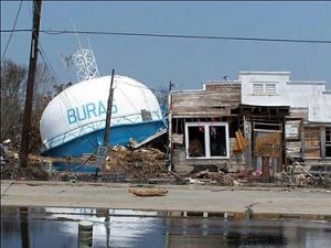
Hurricanes in Buras, Louisiana
Ian King
For my first community, I have chosen Buras, Louisiana, which was where Hurricane Katrina made landfall on August 29, 2005. I have chosen this community because I go fishing there. I have seen firsthand the extraordinary damage and loss that occurred and felt shock and awe at the devastation.
The threats for Buras, and what will be continued threats, are hurricanes of any magnitude that reach that part of the Gulf near New Orleans. Buras is vulnerable because it is within 3 feet above sea level (Buras-Triumph…, 2020) and much of the levee system is not above 12 feet high (Oswald, 2020).
When I spoke to locals, they said the wall of water that hit Buras was as high as 26 feet where Katrina came ashore, and the winds were over 145 mph (Davis, 2005). It destroyed buildings, homes, businesses, and many boats. One of the charter guides said to me that it was worse to have had one’s fishing boat in inside storage than outside. Due to the height of the water, the boats floated up to the ceiling where they were turned into sticks by bashing into each other and the ceiling. When I first went there after Katrina, there was a side-by-side refrigerator that was 12 feet up in a tree. They actually left it for a period of time as a sort of memorial until I think they decided that it was a tourism deterrent. The last time I was down there, it was no longer in the tree.
The impacts to the community were massive. They lost their only grocery store and most small businesses in the area. Few decided to rebuild. They also lost their middle and high schools and ultimately had to build a new school that served a wider district (Buras-Triumph…, 2021). As to forecasted impacts, it is impossible to tell how long the continued rebuild might take. Many people left and simply did not return. It has taken a long time for the fishing industry to recover. It is a matter of time until they are hit again by another large storm, which are only forecasted to get larger and more frequent.
Solutions to the threat are few and far between. They can raise the levels of their levees hoping to avoid storm surges. If the storm surge is lower than the levees, they will fare better than not. Early weather detection and evacuation are critical to prevent loss of life and a certain amount of property. One of my guides once said that his rule of thumb was to hook onto the most expensive thing that he owned with his truck and tow it out of the state long before the storm arrives. His choice was based on how new his boat was versus the value of his mobile home trailer. Beyond that, any global solutions that we can create that will slow the warming of the atmosphere will help to reduce the frequency of severe hurricanes will also be in the best interest of Buras, Louisiana.
Sources
Buras-Triumph, Louisiana. (2020, August 14). In Wikipedia. https://en.wikipedia.org/wiki/Buras-Triumph,_Louisiana
Davis, A. C. (2005, September 19). Buras, La., area residents start to see what’s left of their towns after Katrina. McClatchy DC Bureau. https://www.mcclatchydc.com/latest-news/article24450004.html
File:Hurricane-Katrina-Buras-Louisiana-watertower-EPA.jpg. (2005). In Wikimedia Commons. https://commons.wikimedia.org/wiki/File:Hurricane-Katrina-Buras-Louisiana-watertower-EPA.jpg
Oswald, S. (2020, August 31). A look at Louisiana’s rugged side, 15 years after Katrina. KMOV 4. https://www.kmov.com/news/a-look-at-louisiana-s-rugged-side-15-years-after-katrina/article_d38b9db2-e39a-5414-8ad8-2c785a449a73.html
South Plaquemines high school. (2021, January 25). In Wikipedia. https://en.wikipedia.org/wiki/South_Plaquemines_High_School
Image source: https://upload.wikimedia.org/wikipedia/commons/thumb/a/a2/Hurricane-Katrina-Buras-Louisiana-watertower-EPA.jpg/375px-Hurricane-Katrina-Buras-Louisiana-watertower-EPA.jpg
Storm Surge on The Cayman Islands
Joshua Kuplen
The Cayman Islands, like many other islands, are going to have to overcome intense hurricanes, rising sea levels, and devastating storm surges. The Cayman Islands are located 218 miles south of Cuba. There are three islands, Grand Cayman, Little Cayman, and Cayman Brac, who are under British rule. The Cayman Islands are known for their crystal blue waters, miles of beach, and boast no taxes for residents! Unfortunately, the Cayman Islands are at the top of the list of places with low-lying coastal land under 10 meters from sea level. When my family and I visited Grand Cayman a decade ago, I remember there being a hurricane that ripped up parts of the hotel we were staying at just a couple of years prior. These stories are all too common for islanders. Hurricanes bring intense winds and massive storm surges. In 2020 alone, The Cayman Islands were hit or brushed by 7 hurricanes. Grand Cayman is built around tourism and international finance. Tourism is heavily impacted by storms, especially storm surges. Hotels, like the one I stayed at, are only a couple of meters above sea level. When water breaks over the beach, there is no wall to block the waves from leveling buildings. George Town, the capital of Grand Cayman, is especially susceptible to storm surges, as the whole town is included in the low elevation coastal zone area. George Town, being the capital, has the only hospital and airport on the island. If George Town is ever flooded, Grand Cayman is split into two pieces without a major hospital or an airport to accept relief aid. This reality was unfortunately seen in 2004 when Hurricane Ivan devastated Grand Cayman. Ivan, a category 5 hurricane, flooded approximately 81% of the island with a storm surge of 8 to 12 feet that came pouring across the island. Damages were over 2 billion and this hurricane was a wake-up call for the island to have an emergency protocol. This emergency protocol includes upgrading isolation shelters, construction of sea walls, increasing the elevation of crucial infrastructure, and advancing their national response team to detect incoming storms. With the rising of oceans at 3mm per year and the likelihood of large storms increasing, George Town must continue to renovate its infrastructure safety and emergency plans to help protect Grand Cayman’s residents and their tourism sector. The main highway through George Town borders the Ocean. These roads need to be walled in and lifted high above the ground to increase the likelihood of surviving storms like hurricane Ivan. Fortunately, Grand Cayman, due to its international finance sector, is a very rich island. If the right plans are designed early and implemented without flaws, Grand Cayman has a chance of retaining its unique island.
Sources
Economy of the Cayman Islands. (2021). In Wikipedia. https://en.wikipedia.org/wiki/Economy_of_the_Cayman_Islands
Elevation of Cayman Islands. (2021). Worldwide Elevation Map Finder. https://elevation.maplogs.com/poi/cayman_islands.415.html
George Town Latitude and Longitude. (2021). Distancesto.com. https://www.distancesto.com/coordinates/ky/george-town-latitude-longitude/history/18844.html
Hurricane Ivan Remembered. (2010, September 9). Relief Web. https://reliefweb.int/report/cayman-islands/hurricane-ivan-remembered
List of Cayman Islands hurricanes. (2021). In Wikipedia. https://en.wikipedia.org/wiki/List_of_Cayman_Islands_hurricanes
Ragoonath, R. (2020, September 11). Hurricane Ivan still haunts survivors. Cayman Compass. https://www.caymancompass.com/2020/09/11/hurricane-ivan-still-haunts-survivors/
Hurricanes in New Orleans, Louisiana
Madison Lapetina, Political Science, College of Liberal Arts
New Orleans, Louisiana is one of the US’s most at risk cities from climate change. Over the past 20 years, tropical storms and hurricanes have increased in intensity. These storms, combined with rising sea levels, are a major threat to New Orleans because it is located on a river delta below sea level. Some parts of the city even reach 15 feet below sea level. Areas like New Orleans are protected from rising waters using pumping systems, but these systems can only do so much. Wetlands (or levees) have also helped to shield the city from storms, but they are gradually being destroyed by human activity (Climate Change…, 2021). So, if sea levels continue to rise and storms continue to increase in intensity, New Orleans could be submerged underwater in the future. A NASA study in 2016 found that certain parts of New Orleans are sinking at a rate of 2 inches per year. This would be the city on track to be submerged underwater by 2100 (Greicius, 2016). The population of New Orleans is 390,845 people, and all of those people will be displaced if these threats aren’t properly combatted. These people would not only lose their homes, but also their jobs. The fishing industry in New Orleans alone employs over 50,000 people. This would be a major blow to the economy and Louisiana’s fishing industry would likely never recover.
One solution that would save New Orleans from sinking is to rebuild the wetlands. This was actually proposed and approved in 2007 after Hurricane Katrina hit, but has yet to be carried out because Congress hasn’t funded the project yet. To do so, sediment would be piped in to replenish the wetlands, stop erosion, and increase storm surge protection. Another solution would be upgrading the system of pumps and drainage canals. This pumping system was created over 100 years ago, and it is certainly in need of renovation. The system doesn’t have capacity to handle the rapid intake of rainwater, so the water just sits in the streets until it can catch up. Rebuilding and upgrading the pumping system to a more efficient one would certainly slow the sinking of New Orleans. A final solution would be the creation of canals that could serve as parks and pathways. These canals would be allowed to flood during storms when a greater water storage capacity is needed. But the canals would also have a recreational purpose, allowing residents to kayak to work or the store (Gratz, 2015). Overall, it is essential that we do something quickly to combat the sinking of New Orleans, or hundreds of thousands of people will lose their homes and livelihoods.
Sources
Climate Change in Louisiana. (2021). In Wikipedia. en.wikipedia.org/wiki/Climate_change_in_Louisiana.
Gratz, R. B. (2015, June 29). How to Save New Orleans From Sinking. The Nation. www.thenation.com/article/archive/how-save-new-orleans-sinking/.
Greicius, T. (2016, May 16). New Study Maps Rate of New Orleans Sinking. NASA. www.nasa.gov/feature/jpl/new-study-maps-rate-of-new-orleans-sinking.
Hurricane Vulnerability in El Zapotito, Mexico
Kayla McCauley, Meteorology and Atmospheric Science, Pennsylvania State University
El Zapotito, Mexico is a small community of only 310 residents, as of 2011, and resides within the Ursula Galvan municipality located in the State of Veracruz, Mexico. Bordering the Gulf of Mexico, the State of Veracruz is vulnerable to hurricane risk due to the location in North America coupled with the majority of the population living within 25km from the coast (Krishnamurthy et al., 2011). Within the state, El Zapotito has been identified as one of the regions most impacted by hurricanes. The community’s vulnerability to hurricanes has led to significant financial loss with damage to goods, animals, and infrastructure. Additionally, there is an economic reliance on agriculture, with labor patterns focused on the crop yields of sugarcane. During the hurricane season, the workforce comes to a halt due to flooding and storm surge leading to a reduction in job security for the community (Krishnamurthy et al., 2011).
Along with economic loss, severe hurricanes pose an imminent life threatening situation to the residents of El Zapotito. Due to the community’s location on a floodplain, roads that connect the community to the federal road network easily flood during severe storms. Flooding of the surrounding roadways completely isolates the residents and prevents evacuation. After severe flooding during Hurricane Dean in 2007 forced the government to send helicopters to evacuate residents, the government began an effort to build bridges and roads that allowed for evacuation (Krishnamurthy et al., 2011). However, these measures taken do not account for the threat of loss of livelihood that hurricanes also pose.
As the ocean continues to warm in the coming years as a result of climate change, hurricanes are expected to grow in intensity. Many North Atlantic hurricanes each year affect the Ursula Galvan municipality, and El Zapotito is at high risk of being impacted by severe storms. In order to protect the community, both mitigation and adaptation efforts need to be put in place. Installation of bridges and elevated roadways is an adaptation effort that will aid in imminent threats to life, however livelihoods also need to be protected. In order to improve the communities resilience to storms, further measures such as establishing effective warning systems, implementing crop diversification, and diversifying livelihoods should be put in place (Krishnamurthy et al., 2011).
Sources
Krishnamurthy, P. K., Fisher, J. B., & Johnson, C. (2011). Mainstreaming local perceptions of hurricane risk into policymaking: A case study of community GIS in Mexico. Global Environmental Change, 21(1), 143–153. https://doi.org/10.1016/j.gloenvcha.2010.09.007
Hurricanes in Grand Isle, Louisiana
Brett Miller
Grand Isle is a small town and island just off the coast of Louisiana, lying in the Gulf of Mexico. It is extremely susceptible to sea-level rise, hurricanes, tropical storms, and even regular rainstorms. Also, tides and storm surges cause significant erosion along its coastline. This area is vulnerable due to just about the entire island lying between 0-8 feet above sea level. As temperatures warm and notable ice caps like Antarctica and Greenland melt further, it will raise the sea level to the point where much of the town is now underwater. Its location is prime for hurricane strikes, and instances of these storms (like Hurricane Katrina) can flood just about the entire town, causing extreme damages to property and infrastructure, such as buildings and bridges collapsing, as well as many injuries and drownings from storm surges (which are already evident). By 2040, the sea level in this area is projected to rise about 2.2 feet if no mitigation or preventative efforts are acted upon. This will leave the area at about 85-90 percent inundated, which basically means that everybody will be forced to move elsewhere. It is projected that storms and hurricane development will worsen as global sea surface temperatures (especially in the mid-Atlantic where hurricanes that hit the Gulf of Mexico often develop) continue to rise from climate change, meaning that hurricanes will carry much further and with more force over water than they have in the past. This can lead to additional property damages, as well as more and occasions of drownings to occur. In an effort to combat and solve these problems and threats, many projects and mitigation plans have been developed. For instance, the “Grand Isle and Vicinity Beach Erosion and Hurricane Protection Project,” is aimed to create 31,000 feet of an anchored sand dune on the gulf side of the island, with the purpose to slow and deflect incoming storm surges that will erode and flood much of the town. The town enforces strict building codes to protect its citizens/tourists and their property including the elevation of particular buildings and structures, as well as prohibited wired electricity on the ground-level. Additionally, mandatory and voluntary evacuation orders by the mayor can be issued to protect the residents from incoming severe weather.
Sources
Grand Isle Storm Damage Reduction. (n.d.). US Army Corps of Engineers. https://www.mvn.usace.army.mil/About/Projects/Grand-Isle/
Hunter, M. (2020, June 11). 6 Grand Isle drowning deaths in 6 weeks: Man dies after saving godson from current. Nola. https://www.nola.com/news/crime_police/article_476ee896-ac14-11ea-9ddb-e3a59f9f0892.html
PROJECT FACT SHEET. (2009, December). US Army Corps of Engineers. https://www.mvn.usace.army.mil/Portals/56/docs/PD/Projects/Grand%20Isle/45.pdf
Sea Level Rise Viewer. (n.d.). NOAA. https://coast.noaa.gov/slr/#/layer/sce/1/-10018475.872667633/3405317.254875168/12/satellite/40/0.8/2050/interHigh/midAccretion
Hurricanes and Tropical Storms in North Key Largo, Florida
Brett Miller
The main threats to the small coastal communities of North Key Largo, Florida, are flooding, sea level rise, tropical storms, and hurricanes like Hurricane Irma. Low land, combined with its location on the coast of South Florida, puts the area at risk of severe damage from strong tropical storms and hurricanes. Due to the complementary effects of high-pressure systems in the west-southwest to low-mid latitudes and a series of low pressure wind fields eastward, Atlantic hurricanes traversing from east to west often eventually strike Florida and the east coast of the United States, as the path of a hurricane will follow the low-pressure system more closely. In addition, climate change and the melting of polar ice caps in Antarctica and the Arctic have caused sea levels to rise, posing a flood threat to most of North Key Largo. Specifically, if the sea level rises by only 1 foot, the land area of North Key Largo will be flooded by about 50-55%. From 2100, global sea levels are expected to rise by approximately 60 cm (almost 2 feet). About 70% of this community is expected to be flooded at that time if mitigation/resilience measures are not taken. In addition, high tide floods pose a serious threat to about 60% of the North Key Largo region, including most of the Crocodile Lake National Wildlife Refuge, which is a valuable and unique habitat for crocodiles. As the frequency and severity of storms increase, the threat to life and property is only expected to increase along with this trend. To prevent flood and storm damage, a combination of structural and non-structural measures should be taken. Since the beaches along the east coast are very shallow and usually non-existent, soft structures such as the creation/extension of dunes and/or swamps will be difficult and expensive. Rigid structures such as seawalls and breakwaters seem to be a more practical option, although they may harm local tourism due to their lack of aesthetic appeal. I think the implementation of Oyster Reef may be a very useful supplement and will not cause much damage to the aesthetic appeal of this Key. Oyster reefs will help reduce wave and tidal energy, reduce flooding and the size of storm surge. In the Florida Keys area, people have seen and will experience the elevation and selective abandonment of highways threatened by rising sea levels and storm surge. For example, construction of Old State Highway 4A, which is even less than 3 miles away in Key Largo, to reach sea level and storms in 2060 is expected to cost $181 million. Since more than half of the 314 miles of roads in the area are at risk of sea level changes, it is extremely expensive to raise them and it is better to abandon these roads, and in some cases, certain properties, rather than continually rebuild them. North Key Largo officials will issue evacuation warnings / requests to tourists, residents, etc., depending on the scale of the approaching storm and the path to its protection.
Sources
Harris, A. (2019, December 6). Florida Keys may abandon some roads to sea rise rather than raise them. Tampa Bay Times. https://www.tampabay.com/news/environment/2019/12/06/florida-keys-may-abandon-some-roads-to-sea-rise-rather-than-raise-them
North Key Largo, Florida. (2021). In Wikipedia. https://en.wikipedia.org/wiki/North_Key_Largo,_Florida
Sea Level Rise Viewer. (n.d.). NOAA. https://coast.noaa.gov/slr/#/layer/sce/1/-10018475.872667633/3405317.254875168/12/satellite/40/0.8/2050/interHigh/midAccretion
Kevin Mouck, Statistics, Eberly College of Science
New Orleans is a city in Louisiana that has a lower elevation than sea level, making the city extremely vulnerable to hurricanes and the flooding associated with these massive storms. The city is especially vulnerable to hurricanes due to its low elevation and the damage that storm surges from hurricanes can cause to a city. New Orleans is no stranger to strong hurricanes, as Hurricane Katrina made landfall in the city in 2005. The storm brought devastating damage as multiple levees in the city were breached and the roads flooded. Thousands of lives were lost in the storm along with over 100 billion dollars of property damage. However, with rising ocean temperature levels, hurricanes are predicted to become more intense, bringing more precipitation and flood waters. With New Orleans’ vulnerability due to low elevations, combined with the rise of sea level heights, the city must take action to avoid more catastrophic events like Katrina. There are multiple precautions that New Orleans could take to mitigate the damage of climate change. One solution included raised buildings. By elevating every structure, flood water from hurricanes will not cause substantial damage to buildings. Flood waters that are too high damage the interior of multiple buildings and homes, displacing thousands of residents from the city for weeks. To ensure that the flood water does not cause this destruction or displacement, buildings can be higher above the ground on raised platforms or levees can be strengthened to keep the water out of the city. During Katrina, most of the city’s levees were destroyed, causing New Orleans to be flooded. After Katrina, the levees were raised around the city. However, there is still more that could be done, like funneling more money into the natural disaster response units. New Orleans is a city that is vulnerable to the intensified hurricanes caused by climate change, but there are precautions the city can take to make sure another disaster like Katrina does not occur again.
Sources
New Orleans, Louisiana: Identifying and Becoming More Resilient to Impacts of Climate Change. (2011). Natural Resource Defense Council. www.nrdc.org/sites/default/files/ClimateWaterFS_NewOrleansLA.pdf.
The Editors of Encyclopedia Britannica. (2020). Hurricane Katrina. Encyclopedia Britannica. www.britannica.com/event/Hurricane-Katrina.
Hurricanes in Staten Island, New York
Eric Myskowski, Meteorology, College of Earth and Mineral Science
In October of 2012, Hurricane Sandy devastated parts of Staten Island New York with a substantial storm surge. This flooded many of the low-lying areas and caused the residents to reconsider living there, especially due to sea level rise caused by climate change. Staten Island is an area naturally vulnerable to flooding. Many of the current houses were built on what were previously wetlands. These wetlands used to block most of the storm surges, but now that they are gone, the houses on the island are more vulnerable to flooding. These factors caused property values to plummet after the storm and this prevented many people from selling their houses at all. Many residents were trapped there, unable to move and leave the area before the next storm. Stuck there, they also had to deal with rising flood insurance premiums caused by the floods becoming more and more frequent. On top of this, with sea level rise, even more minor hurricanes or even winter storms are forecasted to cause more flooding, turning flooding into a yearly problem.
One of the many proposed solutions to this is a home buyout. In 2013, the year after Sandy hit, the state of New York started an unprecedented voluntary buyout of homes from the area. The state bought hundreds of these homes at pre-Sandy property value price points and demolished them, turning the land into natural areas. This process is intended to save FEMA and other insurers the cost of rebuilding these houses time and time again after future floods.
While some residents are hesitant to leave, others are leaving as soon as they can. In the Fox Beach part of Staten Island, one of the harder hit areas, 133 of 165 people decided to sell their houses to the program while in the Rockaways district, only 3 of 300,000 people decided to participate in the program. The state is also incentivizing the program. It is offering 5 percent bonuses to residents in the most flood prone areas and 10 percent bonuses if the whole block is willing to sell. However, there are also limits to the program. To avoid spending extra money buying out more expensive houses, the state put a cap on the price it is willing to pay for each house. Also, the state is only able to put as much money in the program as the legislature approves. There are also some other future benefits of this program. The land purchased by the state could be turned back into wetlands or other quickly disappearing natural habitat that will be able to help species that rely on these areas to survive.
Sources
Kaplan, T. (2013, February 04). Cuomo Seeking Home Buyouts in Flood Zones. New York Times. https://www.nytimes.com/2013/02/04/nyregion/cuomo-seeking-home-buyouts-in-flood-zones.html
Associated Press. (2013, November 19). State to buy homes in flood-prone NYC area. Times Union. https://www.timesunion.com/news/article/State-to-buy-homes-in-flood-prone-NYC-area-4992328.php
Megan Neely
Bayside, Texas, a town of a little more than three hundred, is located along the Gulf of Mexico. In recent years, hurricanes have devastated the area, and may mean the end of the town altogether (Schwartz, 2017).
Hurricanes are predicted to get more severe as the effects of climate change get more severe. “Researchers suggest that the most damaging U.S. hurricanes are three times more frequent than 100 years ago…” (How Climate…, n.d.). Warmer oceans mean the air holds more water vapor, in turn creating heavier rainfall. The rising sea levels will make storm surges worse. Hurricanes may also intensify faster (How Climate…, n.d.).
Hurricane Harvey, which hit Texas in 2017, is evidence of this. “80 percent of the structures in Bayside were destroyed or damaged” (Schwartz, 2017). This was mostly due to the devastating one hundred thirty mile per hour winds. Almost ten percent of the population decided to abandon their homes and move elsewhere (Schwartz, 2017).
Bayside is particularly vulnerable because of their economic situation. In the media following the disaster, large cities like Houston were the focus, while small towns barely got any attention, even if there was more damage in these towns. “In smaller communities, natural disasters often impact a greater percentage of the population than they do in big cities…” (Collins, 2018). Karen Clark, the assistant city secretary in Bayside, admitted that the town’s government does not have enough expertise to get back to normal (Schwartz, 2017). Bayside does not have as much financial flexibility and their credit will likely suffer in the long run. In addition, if they are not able to recover, property values and tourism will be forever reduced (Collins, 2018).
With 2020 the most active hurricane season in the Atlantic on record, the problem is not forecasted to get better (2020 Atlantic…, 2020). The solution for this town is not to try to lessen the effects of climate change on hurricanes, a feat that would take global cooperation, but to get rid of governmental bureaucracy that makes it harder for small towns to bounce back. Half the issue is that small towns cannot compete with larger cities. It is near impossible to try to find grants and funds when small towns are treated differently and thrown by the wayside during recovery (Collins, 2018).
Sources
2020 Atlantic Hurricane Season. (2020, December 1). Center for Disaster Philanthropy. https://disasterphilanthropy.org/disaster/2020-atlantic-hurricane-season/.
Collins, S. W. (2018, September 22). In Small-Town Texas, Harvey’s Overlooked Victims Face Unique Challenges. Statesman. https://specials.mystatesman.com/harvey-communities/.
How Climate Change Makes Hurricanes More Destructive. (n.d.). Environmental Defense Fund. www.edf.org/climate/how-climate-change-makes-hurricanes-more-destructive?utm_source=google&utm_campaign=edf_none_upd_dmt&utm_medium=cpc&utm_id=1606920135&gclid=CjwKCAjwvMqDBhB8EiwA2iSmPFW3Hg6AHXZ7wH9s3YWM8Vmp0kLlOwXubV6x4lJYp4i81G_g2WyhoC5D8QAvD_BwE&gclsrc=aw.ds.
Schwartz, J. (2017, September 28). Blown Away. Mystatesman.com. http://specials.mystatesman.com/harvey-texas-coast/.
Hurricanes and Flooding in Otter Creek
Sabian Neidich, Philosophy, Penn State Behrend
In the middle of Florida facing the Gulf of Mexico is a small town by the name of Otter Creek which rests right at the intersection of two highways. The town only has a small population of one hundred and thirty four residents. Looking at maps put out by the Northern Oceanic and Atmospheric Administration (NOAA) it is clear to see that this town is no stranger to hurricanes and has been victim to a number of the NOAA’s picks for the fifteen most destructive hurricanes to hit the Florida Keys. The most recent of which being hurricane Irma in 2017 in which the Otter Creek United States Geological Survey Streamgage was reported destroyed by USGS on their website. Looking back at the maps put out by the NOAA, the towns location has been in the area most likely to be struck by a hurricane since 1622 and falls almost directly in line with the average tropical storm formations for the month of September as put out by the National Hurricane Center and has faced flooding due to this predicament. Without a doubt, this town faces severe threats from yearly hurricanes, and with the likely increase in the amount of high intensity hurricanes, the town’s outcome looks grim. Floodfactor states that an increase of 138% of properties will be at flood risk within the next 30 years.
So, is there any hope to save this small town? Though it is hard to protect a town from the devastating force of a hurricane, there is a way to minimize the damage from the flooding that may ensue. Thankfully it rests on a creek that moves from swamp to marshes, leaving water places to collect. This is likely the town’s best protection from becoming a real world Atlantis. Overall, Otter Creek is at high risk of devastation from both the hurricanes that come through and the flooding that could follow. Its only relief from this is the land surrounding the creek being a natural way to store water, limiting the flooding.
Sources
Hurricane history & info. (n.d.). Emergency Management Monroe County, FL. https://www.monroecounty-fl.gov/1037/Hurricane-History-Info
NWS Key West. (n.d.). NOAA Maps. https://noaa.maps.arcgis.com/apps/MapSeries/index.html?appid=795c97208a234a22be68f487854478c5
Otter Creek, Florida. (n.d.). Flood Factor. https://floodfactor.com/city/otter-creek-florida/1253500_fsid#community_solutions
Steele, J. (2020, October 30). Otter Creek. Florida Paddle Notes. https://www.floridapaddlenotes.com/otter-creek/#:~:text=Otter%20Creek%20is%20an%20approximately,Hwy%2024%20and%20Hwy%2019.
USGS streamgage destroyed by Hurricane Irma. (2017). USGS. https://www.usgs.gov/media/images/usgs-streamgage-destroyed-hurricane-irma
Chris Nicola, Civil Engineering, Penn State University Park
Hurricane Michael, according to scientists, was one of the most destructive hurricanes since the occurrence of Hurricane Andrew in 1992. The National Hurricane Center claimed that hurricane Michael had arrived at the coasts of Florida as a category 5 with winds reaching 160 mph (Sanchez, 2018). Mexico Beach, a small town on the Gulf Coast of Florida, endured havoc created by Michael’s landfall. Although the population of Mexico Beach, currently at 1,072, is quite negligible compared to other towns, the devastation was memorable. Not only were countless houses upended, but the famous landmark of the town, El Governor Motel, was destroyed along with its supplied amenities (Sullivan, 2018). Staff Sgt. Andrew Pliscofsky, a member involved in hurricane rescue, claimed he had never seen anything as devastating as that of Hurricane Michael (Sullivan, 2018, para. 4). CNN stated that of the $25 billion in damage, $18.4 billion was accounted for in the state of Florida alone.
This town, along with the entire state of Florida, is vulnerable to hurricanes for several reasons. For one, the inhabitants of this southeast region live in denial that such a place is susceptible to destruction. In reality, living in a low-lying region poses a major threat. Mexico City is located on the panhandle of Florida and it is not very elevated, and certain storm surges can exceed 20 feet upon arriving at landfall. Another component to the vulnerability are the poor decisions made by property investors, who fail to pay heed to the risks at hand (Leber, 2017). A final contributing factor is climate change. A hurricane needs warm water, wind, and a heavy content of moisture to drive tropical development (Campos, 2020, para. 1). With the increased temperatures Earth has sustained, moisture levels have risen by roughly 3%. Also, these warmer ocean temperatures can be directly linked to greater volumes of water generated by hurricanes. It is evident climate change is fueling hurricane development, or, at least, causing sea level rise, a potential factor for future destruction. Mexico City, being located by the warm Atlantic, is a primary reason for its susceptibility.
Researchers at Colorado State University state that trends in global climate will be responsible for a 65% chance of an above average hurricane season (Miller, 2020). Excess tropical development will certainly be plausible, given the steady, gradual increase of global temperature. Towns like Mexico City are expected to see more intense tropical hurricanes, especially in the case of rising sea levels.
There are many ways to mitigate destruction that ensue from hurricanes. One involves improving foundational structures. Although controlling the frequency of hurricanes is impractical, reducing damage and flooding is plausible. One solution may be a mass implementation of levees and seawalls on strong material to protect houses from the impact of the storm surge. Another solution may involve implementing measures for how foundations are to be set into the ground to improve their effectiveness against hurricanes, or moving the community inland.
Sources
Campos, C. (2020, July 16). These are the top 3 factors for hurricane development. WKMG. https://www.clickorlando.com/weather/2020/07/16/these-are-the-top-3-factors-for-hurricane development/
Leber, R., B., Baptiste, N., Holthaus, E., Schwartz, M., Blasi, B. R., Oh, I., Mogensen, J. F., Baptiste, N., Berman, A., Lakhani, N., Corn, D., Dias, I., & Choma, R. (2017, September 8). Here’s why Florida is so much more vulnerable to a hurricane like Irma right now. Mother Jones. https://www.motherjones.com/environment/2017/09/heres-why-florida-is-so-much-more vulnerable-to-a-hurricane-like-irma-right-now/
Miller, K. T. P. B. P. (2020, December 23). Early 2021 storm season prediction is in: You may not want to read what it says. Palm Beach Post. https://eu.palmbeachpost.com/story/weather/2020/12/21/colorado-states-2021-hurricane-season forecast-predicts-another-busy-one/3990520001/
Patricia, Wax-Thibodeaux, & Gowen. (2018, October 12). “It’s all gone”: Tiny Florida beach town nearly swept away by Hurricane Michael. The Washington Post. https://www.washingtonpost.com/national/its-all-gone-tiny-florida-beach-town-nearly-swept away-by-hurricane-michael/2018/10/12/f1a110c0-ce56-11e8-a3e6-44daa3d35ede_story.html
Sanchez, R. C. (2019, April 19). Hurricane Michael was a Category 5 storm at the time of US landfall, scientists say. CNN. https://edition.cnn.com/2019/04/19/weather/hurricane-michael-upgraded category-5/index.html
Zachary Plunkett, Software Engineering, Penn State Behrend
Stronger Hurricanes and rising sea levels have caused significant damage across the United States in recent times. Higher tides are being caused by polar glacier melt as well as warming oceans. The higher tides and warmer oceans both contribute to stronger hurricanes that devastate coastal regions. Strong hurricanes can cause significant beach erosion through ocean surges and large waves. If the sea surges overtake protective dunes, the root structure that holds dunes in place can be damaged or destroyed. Once this happens the beach becomes more vulnerable.
One town facing a significant threat of beach loss is Nags Head, North Carolina. Located on the Outer Banks or OBX, the area acts as protection for the mainland. The OBX blocks a significant amount of a storm’s energy before it hits land. Another reason beach loss is so prominent in Nags Head is due to the elevation of the area. At only two to seven feet above the sea level, most residential buildings are built upon stilts to avoid water damage in heavy storms.
The combination of global sea level rise and expected increase in hurricane severity threaten Nags Head. In the past, towns used to move along with the movement of the OBX, but today, the area is primarily focused on tourism and large structures have been built that force the area to resist the natural processes that move the OBX. The OBX erodes at a rate of about six feet per year and has to be constantly maintained.
To combat the effects of climate change the community of Nags Head has begun building teams to come up with Vulnerability Consequences and Adaptation Planning Scenarios (VCAPS). These scenarios are meant to educate the local community and find suitable solutions to the VCAPS. The community is intending on creating a resilient version of the current town that will be able to handle disruptions related to climate change without long term effects be it environmentally or economically. Currently, the only real mitigation technique pursued by the town is to dredge sand back onto the shoreline. Every year the town pays millions to replenish its ten miles of beach. Some people are suggesting that the massive beach homes stop being built and instead build moveable structures, but local officials feel that will never happen.
Sources
Slip Sliding Away. (2015, December 4). Audubon. www.audubon.org/magazine/march-april-2015/slip-sliding-away.
Building Climate and Coastal Resilience in the OBX. (2021). Climate.Gov. www.climate.gov/news-features/climate-case-studies/building-climate-and-coastal-resilience-obx.
Hibbs, M. (2021, April 30). Signs Of Change Are Clear, If Language Is Not. Coastal Review Online. www.coastalreview.org/2020/05/signs-of-change-are-clear-if-language-is-not.
Kusnetz, N. (2020, November 30). In the Outer Banks, Officials and Property Owners Battle to Keep the Ocean at Bay. Inside Climate News. insideclimatenews.org/news/28112017/nags-head-north-carolina-beach-erosion-climate-change-sea-level-rise.
Sarah Raver, Chemical Engineering, College of Engineering
New Orleans, Louisiana is well known for its vibrant night-life, tasty restaurants, and cultural spirit. However, it is also at risk for severe flooding caused by hurricanes, and this threat is likely to increase as the world sinks deeper into the reality of climate change. One of the more recent and well-known storms in New Orleans was Hurricane Katrina in August of 2005. This storm had devastating flooding effects on the city, causing nearly 3000 deaths, costing upwards of eighty billion dollars just in property damages, with even more financial impact on the city’s economy (11 FACTS…, n.d.). Though this is one of the more well known hurricanes to hit New Orleans, the city has experienced many other intense and damaging storms in the past (Hurricane preparedness…, 2021). New Orleans is particularly vulnerable to flooding because much of the area is below or at sea level, due to sinking as the city has expanded and developed. Additionally, there have been failures in proper blockading and redirecting of water through man-made technology and natural means, such as wetlands and barrier islands (Below et al., n.d.). After the mountainous task of repairing the damage from Hurricane Katrina, New Orleans has needed to find ways to be more prepared for future storms. As global temperature rises, hurricanes are likely to become more devastating, as they have the potential to hold much more water and also to move at a slower speed, leading to longer storms. Additionally, as sea level rises due to melting of glaciers and ice sheets, the city will face even more issues with flooding (Bice & Bralower, n.d.). In order to prepare for this, there are a few things that can be done; however, some will be costly. Luckily, during Katrina, many people were able to evacuate the city before the storm hit landfall (Hurricane preparedness…, 2021). Not everyone was able to successfully evacuate, though, such as poor, disabled, and elderly citizens. Local governments can work to improve their emergency protocols to ensure the entire population is prepared and knows what to do when the next storm comes. There are also engineering methods to lessening the flooding impacts of a storm surge, such as levees, surge barriers, sea gates, canal control, improving and creating additional drainage systems, and improving pumping stations so that they can operate more effectively under heavy flooding conditions. From an environmental standpoint, the destruction of wetlands and barrier islands has contributed to New Orleans’s flooding vulnerability; therefore, if policy could be enacted to rehabilitate these natural areas, it could lessen the effects of future hurricanes (Below et al., n.d.).
Sources
Below, C., Dierich, C., Erickson, K., & Kjos, R. (n.d.). HOME. Environmental Hazards Storm Surge Induced Flooding In New Orleans. https://people.uwec.edu/jolhm/eh3/group7/Home.htm
Bice, D. M., & Bralower, T. J. (n.d.). Course Home Page. Earth in the future. https://www.e-education.psu.edu/earth103/node/508
11 FACTS ABOUT HURRICANE KATRINA. (n.d.). Do Something.org. https://www.dosomething.org/us/facts/11-facts-about-hurricane-katrina
Hurricane preparedness in New Orleans. (2021). In Wikipedia. https://en.wikipedia.org/wiki/Hurricane_preparedness_in_New_Orleans#Post-Katrina
Hurricanes in Westerly, Rhode Island
Kate Ready
The small, coastal beach town of Westerly, Rhode Island in Washington County has had threats of hurricanes in its past. One historical storm that is well referenced within the town is the infamous Hurricane of 1938. The category 3 storm came unannounced on September 21, 1938 and unloaded a great amount of power and damage onto the town. Remnants of the damage can be seen on the coastlines after major storms.
Another powerful storm that is more recent is Hurricane Sandy that hit Rhode Island on October 29, 2012. With Sandy came a 4-6 ft storm surge that destroyed Rhode Island’s coastlines, immobilized residents in their own homes living both near the ocean coast and away with no power, and caused $11.2 million in damages statewide.
Westerly has two main coastal attraction areas; Misquamicut State Beach and Watch Hill. Both areas are key to the tourism and economy of the small town and although Misquamicut endured stronger destruction, both areas took months and the help of local citizens to return to normal.
Atlantic Ave (fig.1) is a two-lane road that is situated between the Atlantic Ocean and Winnapaug Pond. It is the main access road to Misquamicut Beach, Westerly Town beaches, and a number of attractions. Due to the rising sea levels and storm surge, when Hurricane Sandy hit, Atlantic Ave was completely submerged by sand and water. Homes located on this strip were flooded and some were stripped away from their foundation, fully relocating.
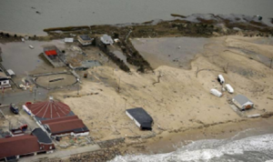
Rhode Island, although the smallest state, is leading the way in climate warming and rising sea levels in both New England and globally. According to a study from the Westerly Sun, Westerly’s local newspaper, Rhode Island is the first state where average temperatures have risen more than 3.6 degrees Fahrenheit in the last 130 years. Washington County, where Westerly is located, has had a 4-degree temperature rise. In addition, according to NOAA, it has been recorded in Newport (a close by Rhode Island city) that sea levels have been rising 4.1 milliliters per year, which is higher than the global average. Both of these findings will impact Westerly not just during hurricanes, but also in smaller, major storms. One storm that can be used as an example is the catastrophic floods of 2010.
These findings, as they continue to increase, will impact the community on a number of levels. There are many local residents, as well as seasonal tourists, that live by the shore. The damage that they had to deal with during Hurricane Sandy was astronomical. Million-dollar homes were destroyed, families were displaced, and some businesses that thrived during the summer months could not afford the damage. It is also important to note that residents that lived more inland were also affected. Different ponds, like Chapman Pond, completely flooded roads and actually trapped residents in their homes in the area with no access to stores or help. Rescue crews had to kayak to reach families until the flooding subsided many days later.
Solutions to this problem require a lot of work from many different angles. Due to the small state having extremely high sea level and temperature rise, even the most rigorous courses of action may take longer to show improvements in the small coastal towns. Fossil fuels need to be reduced as they have a detrimental impact on the warming of the planet causing sea ice to melt. Rhode Island is located in New England and has almost 400 miles of coastline, making it one of the most beautiful tourist attraction states in the country. For a state that relies heavily on seasonal tourism, its beautiful shorelines and ocean attractions will be at risk if carbon emissions do not drop.
Sources
Aerial Hurricane Sandy damage photos. (n.d.). The Day. https://www.theday.com/apps/pbcs.dll/gallery?Site=NL&Date=20121030&Category=MEDIA02&ArtNo=103009996&Ref=PH
Faulkner, D. P. (2019, August 13). Watch Hill talk focuses on dangers of sea level rise. The Sun. lhttps://www.thewesterlysun.com/news/westerly/watch-hill-talk-focuses-on-dangers-of-sea-level-rise/article_1842f3f4-bd32-11e9-bfe8-c338bf935898.html
Historical information. (n.d.). RI.gov. https://www.ri.gov/facts/history.php
Hurricane Impacts. (n.d.). Hurricane Resistance: Long Range Planning for the Port of Providence. https://www.portofprovidenceresilience.org/historical-storms-in-ri.html
Warburton, R. (2020, August 25). Rhode Island leading the way among New England states in climate warming. The Sun. https://www.thewesterlysun.com/news/westerly/rhode-island-leading-the-way-among-new-england-states-in-climate-warming/article_5069e01c-e71b-11ea-8dad-7b498a4f12b3.html
Image Source: https://www.theday.com/apps/pbcs.dll/gallery?Site=NL&Date=20121030&Category=MEDIA02&ArtNo=103009996&Ref=PH
Hurricanes in Lower Ninth Ward, New Orleans
Hannah Richardson, General Arts and Sciences, Penn State Behrend
It’s become quite clear that social justice and climate justice have a strong correlation. Looking at how Hurricane Katrina affected (devastated, more like) the Lower 9th Ward, a predominantly black neighborhood with a higher rate of poverty compared to other parishes like that of Orleans Parish, where the French Quarter and Garden District (some of the highest ground in the city) are, demonstrates that relationship.
Given the average income of Lower 9th Ward residents, purchasing or renting a home in areas that were less susceptible to flooding wasn’t an option; neighborhoods that were close to flood levees, like Lower Nine, were what could be afforded. The richer neighborhoods also had the advantage of higher elevation. We’ve seen the footage, done the lab in class, witnessed that the levees broke during the hurricane, causing incredible flooding. Many articles argued that it was poor infrastructure and levee maintenance that caused the levees to malfunction and break. There is strong evidence that suggests the reason for this is the ever widening socioeconomic gap, or to put it bluntly, institutionalized racism. When compared to the relief and access to disaster planning other more affluent areas of New Orleans received, it almost seems like the damage was inevitable.
Today, the city has implemented some changes, like better levees and planning, but the neighborhood of the Lower 9th Ward is still having difficulty making a comeback. Houses and apartment buildings stay stuck in the disrepair and devastation Katrina left them in, wildlife and plants are doing their best to take over. There is hope for larger chains like Wal-Mart or Raising Cane’s to come to the area in the hopes that they’d revitalize the neighborhood, bring new business, jobs, and opportunities, but council members like Cyndi Nguyen don’t place too much faith in the prospect. Like the villagers in Rezeshk, the people of the Lower 9th Ward cannot afford to move back; the struggle to keep up with the climate’s changes carries on.
Sources
Aftermath of Katrina: A Time of Environmental Racism. (n.d.). Arcgis.com. www.arcgis.com/apps/Cascade/index.html?appid=2106693b39454f0eb0abc5c2ddf9ce40 .
Lee, B. (2011, May 25). A Katrina Retrospective: Structural Inequality, Environmental Justice and Our National Discourse on Race. HuffPost. www.huffpost.com/entry/a-katrina-retrospective-s_b_702911
Simerman, J. (2020, August 29). New Orleans’ Lower 9th Ward Is Still Reeling from Hurricane Katrina’s Damage 15 Years Later. NOLA.com. www.nola.com/news/katrina/article_a192c350-ea0e-11ea-a863-2bc584f57987.html.
Caitlin Ruiz Jimenez, Labor and Employment Relations, College of Liberal Arts
Lumberton, North Carolina is a small, impoverished town about 90 miles away from the Atlantic Ocean. Lumberton sits in Robeson County, home to about 132,000 people. 40% of said population is Native American and belongs to the Lumbee tribe. This tribe is named after the Lumber River, which flows across over 100 miles within the state. Lumberton’s economy is largely intertwined with the Lumber River; it is a crucial part of the town’s landscape. Unfortunately, the Lumber River is also what puts the citizens of Lumberton in grave danger. This danger comes from both unexpected heavy rain and devastating floods brought on by hurricanes.
Lumberton is particularly vulnerable to catastrophic flooding due to the fact that most of the homes in the town were built below the 100-year floodplain. This means that when the Lumber River swells, any additional heavy rainfall could spell disaster for the community. This was evident after Hurricane Matthew hit in 2016, and again after Hurricane Florence in 2018. The community was drowning as a result of these storms, both literally and metaphorically. Most of Lumberton’s residents had barely completed home renovations or rebuilding after Hurricane Matthew when Florence struck, just to have their homes and belongings destroyed yet again. To further add insult to injury, the vast majority of federal aid that was requested for rebuilding efforts was denied. These storms left an already financially vulnerable community in total shambles.
Because of the unpredictable nature of hurricanes, the future of Lumberton and its citizens is unknown. However, many predict that the town has not seen the last of its struggle with hurricanes. Lumberton is not only a low-income town, it is also a town populated primarily by minorities, and it was let down by the federal government during two major hurricanes. If the town is to be able to survive another “1,000-year” flood, the United States government must step in and provide the financial means to allow it to do so. Dam and levee upgrades need to be made as soon as possible in order to prevent further loss of life and property. A permanent floodgate is also necessary moving forward, provided that the town receives approval from railroad company CSX. Homes must also be built on higher ground if possible.
Sources
Clark, D., & Bethea, C. (2018, September 18). Two years after a devastating hurricane, a North Carolina town is again at the center of the flood. The New Yorker. https://www.newyorker.com/news/dispatch/two-years-after-a-devastating-hurricane-a-north-carolina-town-is-again-at-the-center-of-the-flood.
Frederick, J. (2018, November 25). 2 years, 2 hurricanes: Lumberton, NC faces natural disasters’ impact One of state’s poorest areas pounded by storms. The Charlotte Post. http://www.thecharlottepost.com/news/2018/11/25/local-state/2-years-2-hurricanes-lumberton-nc-faces-natural-disasters-impact/
Mettler, K. (2018, October 31). ‘It was Just ERASED.’ a North Carolina community, devastated by hurricane flooding twice in two years, contemplates the future. The Washington Post. https://www.washingtonpost.com/national/it-was-just-erased-north-carolina-community-devastated-by-hurricane-flooding-twice-in-two-years-contemplates-the-future/20 18/10/24/cf0f24e8-d635-11e8-aeb7-ddcad4a0a54e_story.html
Hurricanes in Cape Hatteras, North Carolina
Kira Soricelli, Penn State University
The recent increase in intensity of hurricanes has made the topic of global warming apparent in the lives of many individuals across the world. However, one place in particular, Cape Hatteras in North Carolina, is especially susceptible to hurricanes and the severe damages they cause. In 2019, Hurricane Dorian hit Hatteras so powerfully that it caused a flood emergency. The winds were close to 90 mph, cutting all sources of power on the island. Houses were being torn apart and people were in fear for their lives. They were cut off from any and all supplies and aid and many people had to evacuate their homes because of this. Cape Hatteras has experienced wind and water damages from multiple hurricanes in the last couple of years (Talmazan & David, 2019).
First, the community is particularly vulnerable because it has a low-lying barrier accompanied by rising and warming waters. The new developments (right by the water) have disregarded safety precautions, making the island increasingly vulnerable to hurricanes. In addition, the intense washover, high wave heights, and high coastal zone erosion rate on the island contribute to its vulnerability. Lastly, Hatteras has a tidal range classified as high vulnerability, with the wet months from August to October leaving the exposed position of the island at risk of being washed out (Finley, 2018).
In the future, the forecasted impacts on this community are quite dreadful. If hurricanes continue to hit the island at such intense rates, the routes, roads, and main highways will be washed out, the lighthouse will likely be destroyed, and, ultimately, there will be a diminishment and loss of the islands. To add, the population will decrease in terms of both humans and animals. Finally, the mainland will likely flood from heavy rains, considering the land is so flat on the island and the water is so high in comparison. This will result in catastrophic damage (Pendleton et al., 2019).
In order to provide a solution to this threat from hurricanes, the community will have to come together in terms of smart development. In recent times, communities have simply been building over shorelines that have been eroded and expended by storms. Instead, community members must learn that the shorelines need to move accordingly when addressing the drastic sea level rise (up to seven feet in two hours during Dorian). The people must retreat from the barrier islands and build dunes to help protect the island from storms.
Sources
Finley, B. (2018, September 14). Why North Carolina Is Vulnerable to Hurricanes. Madison.com. www.madison.com/news/national/why-north-carolina-is-vulnerable-to-hurricanes/collection_5360e3cd-43c4-57d8-9f91-ae2cd776e7f6.html#3.
Cape Hatteras. (2021). In Wikipedia. https://en.wikipedia.org/wiki/Cape_Hatteras.
Pendleton, E. A., Thieler, E. R., & Williams, S. J. (2004). Coastal Vulnerability Assessment of Cape Hatteras National Seashore (CAHA) to Sea Level Rise. US Geological Survey. https://pubs.usgs.gov/of/2004/1064/images/pdf/caha.pdf.
Talmazan, Y., & David, K. L. (2019, September 6). Hurricane Dorian Moves Away from North Carolina after Making Landfall over Cape Hatteras. NBC News. www.nbcnews.com/news/weather/hurricane-dorian-now-category-1-buffets-north-carolina-s-coast-n1050586.
Chincoteague Island Affected By Hurricanes
Jacob Ehrbaker, Biochemistry, Penn State Eberly College of Science
Nobody wants to get caught in the middle of a hurricane, but storms and hurricanes can be far more dangerous on Chincoteague Island, Virginia. Hurricanes can create storm surges, large waves of water that can reach as high as twenty feet high. These storm surges mean that anything under twenty feet tall, which is a lot, can be submerged in water. Even worse than property damage, if Chincoteague locals do not evacuate the island during a severe weather event, they are in physical danger. The Town of Chincoteague directly calls storm surges a “deadly killer.”
Chincoteague is particularly vulnerable compared to other areas closer inland for several reasons. The most significant reason is that Chincoteague is only 1 foot above sea level- and that height is shrinking. Chincoteague’s low elevation means that any water over 1 foot above sea level will cause flooding, which happens in almost every severe weather event that hits the island. Chincoteague is also an island, with only one bridge on and off of it, which means that there can be severe congestion when mass evacuation is required, making reaching safety a difficulty (Franklin, n.d.).
According to the Town of Chincoteague, residents are used to severe storm events, which means they are also used to taking precautions against these storms. Storm prepping reduces the damage done by storms, and residents are resilient and always repair and find a way to thrive again after storm damages. Storms will continue to worsen, becoming slower, wetter, and slower moving, and residents will be able to hold their ground for a while. However, after so much time, Chincoteague Island will inevitably become a casualty of climate change (Franklin, n.d.).
As previously mentioned, Chincoteague residents have become experts at storm prepping; using everything from sandbags to boarding up windows, they manage to find ways to minimize damage. However, in the future, measures such as raising houses will be necessary. Property damage pales in comparison to the safety risk many of the residents undergo from not evacuating. This safety risk can be minimized by preparing those who refuse to evacuate with safety items such as AM/FM Radio, first aid items, food, and much more. While it is unlikely Chincoteague will remain habitable forever, the current residents are ready to put in the work to stay (Severe Weather, n.d.).
Sources
Franklin, A. (n.d.). Chincoteague Island Vulnerability Assessment. arcgis.com. https://www.arcgis.com/apps/Cascade/index.html?appid=5074a03b29fa4ec1aeaaf3c7894 92a3c.
Severe Weather. (n.d.). Town of Chincoteague. https://chincoteague-va.gov/severe-weather/.
Hurricanes in Low-Income Communities
Ethan Rothermel, Mechanical Engineering, Penn State College of Engineering
For my first entry, I chose to focus on a more figurative “community.” The low-income and minority communities of America often suffer the worst home and economic damage from severe hurricanes (Krause & Reeves, 2017). As the frequency and intensity of these mega-storms increase in years to come, so too will the poverty rates along coastal communities. Poorer communities are more vulnerable to extreme hurricanes for several reasons. First, those in the lowest income bracket often live in homes or affordable housing units with lower structural integrity. As a result, these buildings suffer the most damage when a hurricane strikes. Additionally, these housing units are often located in flood-prone areas, where less than adequate drainage almost ensures that they will need to evacuate their homes during any major hurricane. Low-income dwellings are often located near large industrial plants, which means poorer communities are also the most susceptible to chemical spills and leaks following a hurricane. Economically, low-income communities face long-term setbacks in the years following a storm as most people in this income bracket do not have flood or property insurance to cover the damages caused by a severe hurricane. Research looking into the after-effects of hurricane Harvey in Houston in 2017 found that within the poorest communities, only 17 percent of homeowners had flood insurance. Finally, low-income communities are also most vulnerable to severe hurricanes because unlike the wealthiest groups, they are unable to relocate to safer areas both during and after a storm. As a result, not only do they bear the brunt of the storm surge when it strikes, but they will also be the first to be hit when the next storm arrives (Krause & Reeves, 2017). This sets them back even further financially as they struggle to make up their losses from the previous hurricane.
The future does not look any better for these low-income communities. As more severe storms hit the coastal U.S in the years to come, poverty rates will continue to increase and housing prices will decline. This will effectively put an additional large amount of people into poverty with each subsequent storm (Krause & Reeves, 2017). With the more affluent community members moving out of the area, the economic value of these communities drops and those in poverty are unlikely to get out. Unfortunately, severe hurricanes will continue to hit the U.S in the future more frequently, and are predicted to get bigger, wetter, and more slow moving. The overarching concern is that one day these coastal storms will become so strong that the coastlines become uninhabitable long-term. This will leave those who cannot afford to move vulnerable when severe hurricanes hit, as emergency protection and prevention measures leading up to and during a storm will be decreased with far fewer people living in the coastal regions (Krause & Reeves, 2017). So, for long-term prevention, climate change must be dealt with head-on to slow down the effects it will have on super hurricanes. In the short-term, communities can set up more awareness and protection seminars and information-sessions to help get low-income community members more prepared leading up to a large storm surge (Rutgers University, 2019). Also, federal assistance to help relocation for those cannot provide this for themselves is needed.
Sources
Krause, E., & Reeves, R. V. (2017, November 3). Hurricanes hit the poor the hardest. Brookings. https://www.brookings.edu/blog/social-mobility-memos/2017/09/18/hurricanes-hit-the-poor-the-hardest/.
Rutgers University. (2019, May 20). Preparing low-income communities for hurricanes begins with outreach. ScienceDaily. www.sciencedaily.com/releases/2019/05/190520115709.htm
Matthew Bowers, Earth Sustainability Certificate, World Campus
Virac, the capital of the island province of Catanduanes, Philippines, is a town that is threatened annually by typhoons (LGU Profile, 2021). It was severely impacted by Super Typhoon Goni in early November of 2020, with as much as 90% of the town’s buildings being damaged by the category 5 storm (Typhoon Goni…, 2020). Goni was the strongest tropical cyclone to ever make landfall in the Philippines, with winds reaching 195 mph. Initial help was delayed since all communication lines were destroyed, and this problem was amplified by the COVID 19 pandemic and the fact that Virac can only be accessed by sea or air (Super Typhoons…, 2020). This community is vulnerable to typhoons because of its location in the Pacific Ocean. Catanduanes is on the eastern side of the Philippines, meaning that typhoons will make landfall – and be strongest – there before weakening. Additionally, the ocean temperatures surrounding Virac help fuel typhoon development: average monthly sea temperatures range from 80 to 85 degrees F (Virac Sea…, 2021). These conditions lead to the Philippines being hit by around 20 storms and typhoons annually (Typhoon Goni…, 2020). Specifically, Virac was impacted by six tropical storms or typhoons within a four-week period in October and November of 2020 (Super Typhoons…, 2020). Following Super Typhoon Goni, many residents were still living in makeshift shelters with little to no access to electricity and clean water as Typhoon Vamco hit the town (New storms…, 2020). The forecasted impacts on the community appear even more intense. As climate change progresses and oceans continue to warm, typhoons will have the ability to become even more intense (Lyu et al., 2021). For the residents of Virac, rebuilding will be a constant struggle as the wind, rain, and storm surge from storm after storm damage homes and businesses. While there is no way to prevent typhoons from impacting Virac, there are preventative measures that can be taken to lessen the blow on the town’s infrastructure and economy while improving the rehabilitation time. The establishment of a government department committed to disaster preparedness will allow for more efficient and direct aid in reconstruction and relocation of residents, as well as provide funding for improved fortification of current structures within the community (Lin, 2017). In general, as Virac recovers from one of the strongest typhoons of all time, its residents must use this storm as a baseline for years to come.
Sources
Typhoon Goni: Fears after Philippine town said to be 90% damaged (2020). BBC. https://www.bbc.com/news/world-asia-54775430
Super Typhoons Goni and Typhoons Molave and Vamco. (2020). Center for Disaster Philanthropy. https://disasterphilanthropy.org/disaster/super-typhoon-goni/
New storms hits towns devastated by Super Typhoon Goni. (2020). IFRC. https://www.ifrc.org/press-release/new-storms-hits-towns-devastated-super-typhoon-goni
LGU Profile. (2021). Virac (Capital), Catanduanes. DILG. https://lgu201.dilg.gov.ph/view.php?r=05&p=20&m=11
Lin, L. (2017). Preparing for Disaster in the Philippines. The Diplomat. https://thediplomat.com/2017/11/preparing-for-disaster-in-the-philippines/
Lyu, K., Church, J., & Zhang, X. (2021). How much will our oceans warm and cause sea levels to rise this century? Phys.org. https://phys.org/news/2021-09-oceans-sea-century.html
Virac Sea Temperature. (2021). SeaTemperature.org. https://www.seatemperature.org/asia/philippines/virac.htm
Typhoons in Manila, Philippines
Marabelle DeLaurentis, Civil and Environmental Engineering, Penn State University
Manila is the capital of the Philippines. It is the Philippines second most populated city, but not to be confused with the region Metro Manila of the Philippines which includes Quezon City and the Makati Central Business District (Manila, 2021). Manila is on the island of Luzan located on the eastern shore of Manila Bay. It has a river flowing through it and has 16 administrative districts. Manila, along with the rest of the Philippines, is within the tropics and has hot temperatures and high humidity year round. It has a normally long wet season and is usually hit with 5 to 7 typhoons occurring from June to September (Manila, 2021). However, in recent years, Manila and the Philippines is being threatened by more extremely strong and unpredictable typhoons. Since 2006, five of the ten deadliest typhoons have hit the Philippines (How Is Climate…, 2016). For example, Typhoon Goni was a tropical cyclone making landfall as a category 5 super typhoon in 2020 (Typhoon Goni, 2021). It went west through dense capital city Manila and left 22 people dead (Associated Press, 2020). Additionally, the 2013 typhoon Haiyan was one of the deadliest typhoons ever recorded and caused more than 6300 deaths, 4 million displaced citizens, and massive amounts of economical damage in the Philippines (How Is Climate…, 2016). Fortunately, Manila was not badly hit by this typhoon, but this caused massive numbers of people migrating to an unprepared Manila which is already a densely populated city. The behavior of these typhoons is explained by climate change because while the number of typhoons is not expected to rise, they will hit harder and in more unpredictable ways as shown these past couple years. The rise in air temperatures corresponds to a rise in water temperature which helps gives tropical typhoons their energy. Warmer air also can hold 7% more water vapor per degree of warming as another explanation for the heavier rains (Palatino, 2009).These typhoons are also causing abnormally massive damage because the Philippines is geographically very vulnerable. The Philippines is located in in the western Pacific Ocean (with Manila being very close to the shore) and lacks natural barriers. The Philippines used to have an amazing mangrove ecosystem that acted as a natural barrier against storm surges, but it has disappeared by half since 1918 due to humans destroying them (How Is Climate…, 2016). The future of Manila and other low-lying cities of the Philippines is unknown. If climate change continues on its current trajectory, the people of the Philippines, known for their resilience to typhoons, may soon not be able to withstand the extreme weather conditions and will be forced to relocate forever. While I can’t find anything Manila is doing to combat the typhoons, the country has a typhoon mitigation plan in progress. One action the Philippine Department of Energy took was to declare a temporary prohibition on all new coal projects in hopes of reducing national emissions and trying to stop contributing to the global warming that is affecting them so negatively (Board, n.d.). Other solutions include building mangrove forests and stopping large scale mining as well as educating the public about the issues of climate change. Fortunately, one positive thing to come from these typhoons is that there is an increase in awareness among Filipinos regarding climate change and this should push both citizens and the government to take more direct action (Palatino, 2009).
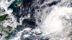
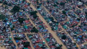
Sources
HOW IS CLIMATE CHANGE AFFECTING THE PHILIPPINES? (2016, January 19). The Climate Reality Project. https://www.climaterealityproject.org/blog/how-climate-change-affecting-philippines
Board, J. (2020, November 14). 21 typhoons have hit the Philippines this year with increased intensity, foreshadowing a ‘really scary’ future. CNA. https://www.channelnewsasia.com/climatechange/philippines-typhoon-climate-change-haiyan-goni-vamco-1339996
Manila. (2021). in Wikipedia. https://en.wikipedia.org/wiki/Manila
Palatino, M. (2009, October 12). Philippines: Typhoon disasters and climate change. Global Voices. https://globalvoices.org/2009/10/12/philippines-typhoon-disasters-and-climate-change/
Associated Press. (2020, November 1). Super typhoon Goni weakens after slamming Philippines, at least 7 dead. NBC. https://www.nbcnews.com/news/world/super-typhoon-goni-weakens-after-slamming-philippines-least-7-dead-n1245668
Typhoon Goni. (2021). in Wikipedia. https://en.wikipedia.org/wiki/Typhoon_Goni
Images source: https://www.channelnewsasia.com/climatechange/philippines-typhoon-climate-change-haiyan-goni-vamco-1339996
Hurricanes in Yabucoa, Puerto Rico
Clare Gibson, Atmospheric Sciences, Penn State University
Major hurricanes, such as Hurricane Maria, have left Puerto Rico in shambles. Hurricane Maria was a powerful category 4 storm when it made landfall over the town of Yabucoa on September 20th, 2017 (Effects of… , 2021). At its strongest, the maximum sustained winds were 155 mph (Effects of…, 2021).
Because of the devastating effects of Hurricane Maria, Yabucoa and the rest of Puerto Rico were left to pick up the pieces and were unable to recover quickly. The storm hit at the end of September 2017, and it wasn’t until August 2018, 11 months later, that power was restored to the whole island (Robles, 2018). The territory received insufficient help from the federal government at the time, as Puerto Rico doesn’t receive money and aid the same way the states do. This further slowed their recovery (Hurricane Maria, 2021).
Yabucoa, like many towns in Puerto Rico, has a high poverty rate (Acevedo, 2018). And the continued impact of hurricanes makes it difficult to catch a break and recover from the financial and infrastructural damages. Many of these small towns in Puerto Rico are also largely populated by older people with pre-existing health conditions (Acevedo, 2018). This puts them at a higher risk of death during hurricanes. In the aftermath of particularly devastating hurricanes, the lack of plumbing and clean water allows diseases to spread easily. After Hurricane Maria, for example, there was an outbreak of leptospirosis that was believed to be due to lack of fresh water (Effects of…, 2021). Additionally, the COVID-19 pandemic has affected the island by crowding their hospitals and has put further strains on existing financial issues and food insecurity for many Puerto Ricans (Declet-Barreto, 2021). Puerto Rico not being an official state in the US also causes issues for the territory when it comes to lack of official congressional representation and even the right to vote in elections (Federal Voting…, 2021).
The hurricane season of 2021 has proved to be an active one and is predicted to continue to be very active (Declet-Barreto, 2021). This leaves Puerto Rico and other US territories at risk of being bombarded by these hurricanes. Farms in Yabucoa were destroyed, affecting its imports, which impacts the economy (Declet-Barreto, 2021). If places like Yabucoa are consistently being hit by severe hurricanes, the economy may never have a chance to recover, leading to more problems outside the physical effects of these storms.
Investing more money into infrastructure and creating contingency plans for the inevitable could lessen the blow on Puerto Rico. When the island loses power, there needs to be a better way of getting it back, it should not take nearly a year. Also, allowing the territory more rights would make it easier for them to receive money and other resources in the aftermath of devastating hurricanes.
Sources
Robles, F. (2018, August 14). Puerto Rico Spent 11 Months Turning the Power Back On. They Finally Got to Her. The New York Times. https://www.nytimes.com/2018/08/14/us/puerto-rico-electricity-power.html
Declet-Barreto, J. (2021, June 8).The 2021 Hurricane Season in Puerto Rico Catches the Population Unprepared. The Equation. https://blog.ucsusa.org/juan-declet-barreto/2021-hurricane-season-puerto-rico-catches-population-unprepared/
Effects of Hurricane Maria in Puerto Rico. (2021). in Wikipedia. https://en.wikipedia.org/wiki/Effects_of_Hurricane_Maria_in_Puerto_Rico
Federal voting rights in Puerto Rico. (2021). In Wikipedia.
https://en.wikipedia.org/wiki/Federal_voting_rights_in_Puerto_Rico
Yabucoa, Puerto Rico. (2021). in Wikipedia.
https://en.wikipedia.org/wiki/Yabucoa,_Puerto_Rico#Hurricane_Maria
Acevedo, N. (2018, June 14). 10 poor towns in Puerto Rico had more deaths after Hurricane Maria than in 2015 and ’16. NBC News. https://www.nbcnews.com/storyline/puerto-rico-crisis/10-poor-towns-puerto-rico-had-more-deaths-after-hurricane-n882861
Hurricane Maria. (2021). In Wikipedia. https://en.wikipedia.org/wiki/Hurricane_Maria
LaPlace Louisiana and Hurricane Ida
Noah Leedom, Mathematics, Penn State University
In August 2021, LaPlace, Louisiana was visited by Hurricane Ida. With winds up to 150 miles per hour, Ida has continued the trend of hurricanes ever increasing severity. The threats caused by Ida included mass flooding, destruction of buildings, and loss of electricity and running water (O’Donoghue, 2021). Just after the storm, LaPlace experienced a particularly intense heatwave. Without power to provide cooling, the effects of this heatwave were more damaging than they would be without the intervention of Hurricane Ida (Wolfe, 2021).
Louisiana, being directly connected to the Gulf of Mexico, is a Hurricane hotspot. Laplace, like most of the New Orleans region, is nearly at sea level, which makes flooding a very real risk. In addition to the geography, LaPlace suffers from the deterioration of essential infrastructure. It is this lack of infrastructure that led to LaPlace’s power and water systems swiftly failing (Wolfe, 2021). The twin issues of geography and failing infrastructure are exemplified by LaPlace’s levee, or lack thereof (Sledge, 2021). In 2005, the levees and flood protection infrastructure surrounding New Orleans was upgraded following Hurricane Katrina, but small towns like Laplace were neglected (O’Donoghue, 2021). With hurricanes becoming more violent, this neglect was presented in stark reality.
The community of LaPlace is fairly split. Many of the residents have long experience with natural disasters. Some are tired of having to rebuild or repair their homes, while others are more determined than ever to remain and rebuild their town (Sanchez & Stix, 2021). Frustration over the waffling surrounding the construction of a proper levee has caused many to abandon LaPlace in favor of a safer, higher elevation environment (Sledge, 2021). Those who choose to remain are dealing with loss of cell phone service, lack of food, and unsanitary living conditions (Wolfe, 2021).
In the short term, Laplace will need solutions to its more pressing problems, mainly those of acquiring enough food, having clean running water, and a functioning power grid. Aid for Laplace residents has been organized from several sources, such as the Red Cross and the Louisiana National Guard (Chatlani & Wendland, 2021). An estimated 2150 meals have been distributed between September 10th and September 24th (Romero, 2021). Efforts to repair the town’s infrastructure are still ongoing. As of late 2021, It is still too early to say what the long term effects of hurricane Ida on Laplace will be, but there are a few plans to help Laplace weather future natural disasters. To try to avoid future flooding, a levee costing 760 million dollars is being planned, but its projected completion date of 2024 is an understandable cause for worry amongst Laplace’s residents that it won’t be built by the time another disaster strikes (Sledge, 2021).
Sources
O’Donoghue, J. (2021, August 31). In LaPlace, residents prepare for a long recovery after Hurricane Ida. Louisiana Illuminator.
https://lailluminator.com/2021/08/31/in-laplace-residents-prepare-for-a-long-recovery-after-hurricane-ida/.
Sanchez, R., & Stix, M. (2021, September 6). ‘I won’t leave.’ residents of hard-hit Louisiana town undeterred by another deadly hurricane. CNN. from https://www.cnn.com/2021/09/06/us/laplace-new-orleans-ida-hurricane-aftermath/index.html.
Chatlani, S., & Wendland, T. (2021, September 3). Days after Hurricane Ida, laplace residents are desperate for help. WWNO.
https://www.wwno.org/news/2021-09-03/days-after-hurricane-ida-laplace-residents-are-desperate-for-help.
Wolfe, R. (2021, September 1). Hurricane Ida destroyed this town. residents hope help arrives soon. The Wall Street Journal.
https://www.wsj.com/articles/hurricane-ida-destroyed-this-town-residents-hope-help-arriv es-soon-11630520241.
Sledge, M. (2021, September 12). After hurricanes isaac and Ida, some laplace residents say they’re done waiting for levee. NOLA.com. https://www.nola.com/news/environment/article_f322128c-11ba-11ec-a6b3-df0c66fb2c5b .html.
Romero, M. (2021, September 22). Health Solutions provides hurricane relief assistance to laplace residents. WGNO. https://wgno.com/news/local/health-solutions-provides-hurricane-relief-assistance-to-laplace-residents/.
Joseph McManus, Political Science, Penn State University
New York City is a large community that has been increasingly threatened by devastating hurricanes over the past decades. Hurricane Sandy, the devastating 2012 storm that claimed 44 lives and caused $19 billion in damages (Impact of…, n.d.) immediately comes to mind, as well as the more recent destruction caused by Hurricane Ida in early September 2021. The increasing frequency and power of hurricanes such as these, coupled with sea level rise due to the warming of Earth’s atmosphere, could leave a significant part of the city under water by 2100 (Fishbein, 2015).
Like much of the eastern seaboard of the United States, New York City is vulnerable to hurricanes due to its coastal location. It sits at a low elevation, which compounds the risk. In Manhattan, elevation is about 33 feet above to right at sea level. In the lower areas near the southern tip the elevation is closer to 5 feet (McKinley et al., 2021). This makes it clear why parts of lower Manhattan flooded during Hurricane Sandy, whose storm surge was reported to be over 13 feet (Hurricane Sandy, 2021).
New York’s iconic subway system, which moves millions of passengers a day, is also exposed to flooding and storm surge caused by hurricanes. In 2012, several tunnels under the east river were flooded. Hurricane Ida, though less intense, pummeled the subway system as well.
Climate change will lead to more powerful hurricanes. When the atmosphere heats up, more moisture is stored, which provides big storms with more energy. As the city with the most population density in the United States (List of…, 2021), the danger of ever increasing losses of life due to stronger hurricanes is severe. Secondly, as an expensive developed real estate market that is home to Wall Street and mega-skyscrapers that soar over 1000 feet, damage to property from powerful storms should increase as well.
Thankfully, some action is being taken on storm-proofing New York City for 21st century. The city has secured funding to contract the construction of a storm surge barrier around much of lower Manhattan (Shorris, 2016). Sea walls are also being built in hard-hit areas like Rockaway Beach. On outdoor railroads, walls are being built to keep flying debris off the tracks (Rebuilding the…, n.d.).
$3 billion has also been invested to retrofit buildings (Varinsky, 2016). These upgrades include building flood walls in basements and moving electrical and water pumping equipment to higher floors where it is less likely to be damaged (Tobias, 2018). The city is also paying homeowners in the most high risk communities to move inland.
Though smaller communities will surely become uninhabitable due to the effects of climate change, a large, rich one like NYC will have vast resources to use to stave off the worst effects. We will need to wait and see whether it will be enough.
Sources
Impact of Hurricane Sandy (n.d.). City of New York. https://www1.nyc.gov/site/cdbgdr/about/About%20Hurricane%20Sandy.page
Fishbein, R. (2015, October 13). New Interactive Map Shows Climate Change Turning NYC Into Atlantis. Gothamist. https://gothamist.com/news/new-interactive-map-shows-climate-change-turning-nyc-into-atlantis
McKinley, J., Rubinstein, D., & Mays, J. C. (2021, September 27). The Storm Warnings Were Dire. Why Couldn’t New York Be Protected? The New York Times. https://www.nytimes.com/2021/09/03/nyregion/nyc-ida.html
Google Earth. (2021). http://www.google.com/earth/index.html
Hurricane Sandy. (2021). In Wikipedia. https://en.wikipedia.org/wiki/Hurricane_Sandy#Mid-Atlantic_2
List of United States cities by population density. (2021). In Wikipedia.
https://en.wikipedia.org/wiki/List_of_United_States_cities_by_population_density#List_of_incorporated_cities_in_the_United_States_with_over_75,000_residents
Shorris, A. (2016). One NYC 2016 Progress Report. The City of New York. https://www1.nyc.gov/html/onenyc/downloads/pdf/publications/OneNYC-2016-Progress-
Report.pdf
Rebuilding the Rockaways After Hurricane Sandy: The Recovery. (n.d.). MTA.
http://web.mta.info/nyct/service/RebuildingRockawaysAfterHurricanSandy.htm
Varinsky, D. (2016, October 29). 6 ways New York City is preparing for the next Superstorm Sandy. Insider. https://www.businessinsider.com/new-york-city-preparing-storms-2016-10#the-city-is building-more-emergency-shelters-2
Tobias, M. (2018, September 6). How NYC is Improving its Buildings Against Hurricanes and Other Natural Disasters. Nearby Engineers. https://www.ny-engineers.com/blog/how-nyc-is-improving-its-buildings-against-natural disasters
Patrick, L., Solecki, W., Jacob, K. H., Kunreuther, H., & Nordenson, G. (2015, February 16). New York City Panel on Climate Change 2015 Report Chapter 3: Static Coastal Flood Mapping. Ann. N.Y. Acad. Sci., 1336: 45-55. https://doi.org/10.1111/nyas.12590.
Rice, A. (2016, September 5). This is New York in the not-so-distant future. Intelligencer.
https://nymag.com/intelligencer/2016/09/new-york-future-flooding-climate change.html?mid=nymag_press
Hurricanes – Abaco Islands, Bahamas
Michael Taradash, Supply Chain and Information Systems, Penn State University
When thinking of the Bahamas, one almost immediately envisions the beautiful beaches and crystal clear Caribbean blue waters. More specifically, Great Abaco, and the Abaco Islands, a group of islands in the northern Bahamas that nearly 20,000 people call home, have been disproportionately impacted by recent Hurricanes. Hurricane Dorian of 2019, for example, knocked out power, water, telecommunications, and sewage on the islands. It also flooded the Marsh Harbour Airport on Great Abaco for a while. The damage to the islands was extensive and approximately 90 percent of the infrastructure in Marsh Harbour was damaged. Unfortunately, the shantytowns, or improvised crude settlements that typically sit on the outskirts of cities, were absolutely demolished by the hurricane. In Marsh Harbour, the shantytowns were completely destroyed. Additionally, 60 percent of the homes in northern Abaco were damaged as well (Effects of…, 2021). The list of damages, casualties, and destruction from Hurricane Dorian in 2019 goes on, and it seems like these kinds of devastating hurricanes are not only going to become stronger in the future, but also much more frequent. The Caribbean and the Abaco Islands are prone to hurricanes because hurricanes need thunderstorms, warm water, and wind in order to form. The Abaco Islands have high levels of humidity and warm water, especially in the summer months, and Caribbean inhabitants accept hurricanes as a natural function of life (Hurricane Season…, n.d.). The Abaco Islands are at risk because of the climate and the underdeveloped infrastructure. Every time a large hurricane strikes the Abaco Islands and underdeveloped areas in the Caribbean, the effects are devastating and highly fatal. Warmer sea surface temperatures as a result of climate change will increase the strength and likelihood of hurricanes in the Bahamas, and in order to protect the area, more funding and international aid must be provided. Developing better hurricane resistant infrastructure is also important. Hurricanes in the Abacos are an urgent humanitarian matter and as it stands, they are left exposed to the increasing deadliness of hurricanes.
Sources
Effects of Hurricane Dorian in the Bahamas. (2021, September 17). In Wikipedia. https://en.wikipedia.org/wiki/Effects_of_Hurricane_Dorian_in_The_Bahamas.
Hurricane Season in the Caribbean. (n.d.). Responsiblevacation.com,
https://www.responsiblevacation.com/vacations/caribbean/travel-guide/hurricane-season-in-the-caribbean#:~:text=Why%20is%20the%20Caribbean%20so,in%20the%20soggy%20summer%20
months.
Zac Vandevelde, Political Science, Penn State World Campus
On September 20th, 2017, Hurricane Maria made landfall in Puerto Rico. While the initial death toll in December of 2017 was 64, the Puerto Rican government has since verified that nearly 3,000 people perished during Hurricane Maria and in its aftermath. The effects of Maria were felt in every part of Puerto Rico. About 70,000 landslides occurred during and after Hurricane Maria, but no community suffered from landslides more than the remote town of Utuado.
Out of the tens of thousands of landslides registered in Puerto Rico due to Hurricane Maria, approximately 170 were recorded within one square kilometer near Utuado. That’s by far the highest concentration of landslides recorded at the time. In the days and weeks and even months following Maria, residents were stuck in place due to wiped-out roads and trails from landslides, often having to go without power for extended periods. It wasn’t just roads but bridges and dams and schools and recreational areas that were washed out or even buried in some cases, causing food and water shortages for weeks and, in some cases, months. Sediments that washed down the mountain from landslides found their way into the island’s water reservoirs and contaminated Puerto Rico’s drinking water for months after the hurricane. Some residents were forced to hike for several hours to get access to clean drinking water, and many rescue efforts in the area were made impossible due to the sheer remoteness of some of the homes. Since Maria, hundreds of thousands of residents have moved off the island. It is estimated that an additional 80,000 residents will have left the island by 2024.
While landslides are not uncommon in a place like Puerto Rico, the number of landslides that occurred due to Hurricane Maria was extreme. Likely caused by sustained periods of dryness, followed by heavy, extended rains, landslides could sadly become an often-recurring issue. There were three prominent landslides in Puerto Rico during and after Maria. Rockfalls are the fastest type of landslide when they strike but can take years to develop. Another type is the flow landslide; this is usually slower but mainly depends on the amount of water involved. Finally, there is the slide type of landslide, moving the slowest but still doing massive damage. These landslides can have several effects depending on the type, from sinking of foundations and rock impacts to lateral movement of homes and property and complete burial of houses. A likely secondary cause for the landslides is sediment build-up from unpaved roads. Sediments such as dust and small rocks from dirt roads can accumulate over time. This sediment then adds to the volume of the landslides.
Unfortunately, climate projections do not bode well for landslides in Puerto Rico and the Caribbean. There will likely be continued periods of dry weather followed by more intense storms, exactly what landslides need to form. Data shows that because of landslides compounded with sea level elevations, Puerto Rico is one of the most susceptible areas for riverine flooding on the planet. In response to this likely future, The Natural Hazards Center, as well as the United States Geological Survey and The University of Puerto Rico, have developed a landslide guide for communities to help in not just the aftermath of landslides but also to help educate communities on how to build in the future with minor damage from landslides. Other longer term methods involve collective action on a much larger scale than just one island in the Caribbean.
Sources
Schmidt, S., & Hernandez, R. A. (2017, October 17). Trapped in the Mountains, Puerto Ricans Don’t See Help, or a Way Out. The Washington Post. https://www.washingtonpost.com/national/trapped-in-the-mountains-puerto-ricans-dont see-help-or-a-way-out/2017/10/01/7621867e-a647-11e7-ade1-76d061d56efa_story.html
Puerto Rico Particularly Vulnerable to Climate Change, Research Suggests (2021, June 21) Stormwater Report.
https://stormwater.wef.org/2021/06/puerto-rico-particularly-vulnerable-to-climate change-research-suggests/
West, J. (2020, June 4). Landslides in Puerto Rico. Storymaps.arcgis.com https://storymaps.arcgis.com/stories/f79a372e98f0429581b211222558f5ea
The Facts: Hurricane Maria’s Effect on Puerto Rico. (2018, January 19) Mercy Corps. https://www.mercycorps.org/blog/quick-facts-hurricane-maria-puerto-rico#:~:text=The%20storm%20left%20thousands%20of,deaths%2C%20released%20in%20Dece mber%202017.
Jessica Barth, Philosophy & Biobehavioral Health, Schreyer’s Honors College, Penn State University
Fair Bluff, a small rural town off the coast of North Carolina, has been and continues to be threatened by the intensification of hurricanes that have resulted from a warming climate, and namely, the warming of our oceans. Following Hurricane Matthew in 2016, the destruction of community structures, homes, essential industries, and most importantly, identity, came to represent the severe threat of climate fueled hurricanes for small, non-affluent communities. This threat is only continuing to grow, as another four hurricanes have hit the town since 2018. This region of North Carolina has an increased susceptibility to the damages of hurricanes due to their flat topography. More so, Fair Bluff is particularly vulnerable to damages from hurricanes due to their small population, low median income, dependence on a singular industry, and their reliance on government assistance to rebuild or relocate. The population of Fair Bluff rarely exceeded 1,000 and was decimated to nearly half following Hurricane Matthew. Among there was a mere 500 residents, the median annual income sat around $20,000. The main industry of this town was a vinyl factory, and when it was destroyed, so was the economic livelihood of the town that was fragile to begin with. With funds few and far between, residents have to rely on government programs to rebuild their town, which falls short, as others simply choose to relocate. With hurricanes only intensifying in the area, the outlook for Fair Bluff is grim. If another storm were to hit the area, it is expected that the population will decrease further, to a point where the town may become abandoned, and residents be left with no choice but to relocate with little money to do so. The solutions for Fair Bluff are also minimal. Current options titer between rebuilding the town or relocating residents, where the former option raises safety and economic concerns due to the high probability that another hurricane will sweep the area. If residents were to stay, they could potentially be harmed by a storm. If businesses were to move into Fair Bluff, they risk a loss of investment if their storefronts get destroyed. Thus, it is unwise to revive the community despite it being home to current residents. Ultimately, the best solution would be for agencies such as FEMA to buyout properties in Fair Bluff to allow residents to evacuate the area and rebuild their lives in an area less vulnerable to climate fueled hurricanes. While costly, this represents a major obligation of the government entity to vulnerable communities as climate change worsens.
Source
Flavelle, C., & Belleme, M. (2021, September 2). Climate change is bankrupting America’s small towns. The New York Times. https://www.nytimes.com/2021/09/02/climate/climate-towns-bankruptcy.html
Hurricanes in Isle de Jean Charles, Louisiana
Jessica Barth, Philosophy & Biobehavioral Health, Schreyer’s Honors College, Penn State University
Isle de Jean Charles, Louisiana, is among one of the first communities to become climate refugees. This area has been threatened by the effects of climate change, with much of the area sinking into the sea and becoming waterlogged. The land has begun to erode, taking properties with it, and climate-fueled hurricanes have only made matters worse. Additionally, subsidence due to oil extraction has devastated the marsh, leading to extreme erosion of properties. This community is particularly vulnerable to climate disasters, as they have run out of options to protect their land. Their community is beyond repair, with no foreseeable drainage systems or levees that can withstand the increasing damages, and the escalating threats to the bridges and roadways that lead to their island. Even the proposed blockade around this coastal area of Louisiana would not protect Isle de Jean Charles, as it is outside of the planned parameters. They are further vulnerable due to their limited economic resources, as many residents live in poverty and rely on the land to survive and as a source of income. Making matters worse, many native residents are hesitant to leave their homes behind and have become distrustful of the government entities encouraging them and even paying them to relocate. With no other available options, the only one left for the residents of Isle de Jean Charles is to accept the $48 million dollar grant and leave their life there behind. This grant is part of a much larger operation enacted by the Department of Housing and Urban Development that has set aside $1 billion dollars to help communities bearing the burdens of the climate crisis. While this solution is unacceptable for some, other residents are beginning to accept relocating as the only way. Some residents express hope for their future in a new location, as the lives they will be leaving behind are not worth saving due to the unlivable conditions. The rest of the residents are willing to die with their land, as leaving their ancestors behind in the graveyards is too difficult to imagine. The threat to Isle de Jean Charles is not uncommon, and as the climate crisis worsens, more communities like it will be met with the same future—becoming climate refugees. Although the logistics and moral dilemmas of these mass migrations are yet to be solved, many areas like Isle de Jean Charles have run out of time.
Sources
Davenport, C., & Robertson, C. (2016, May 3). Resettling the first American ‘climate refugees’. The New York Times. https://www.nytimes.com/2016/05/03/us/resettling-the-first-american-climate-refugees.html
Hurricanes: Climate Change in New Orleans, Louisiana
Sierra Chromiak, Human Development and Family Studies, Penn State Lehigh Valley
The community of New Orleans has seen some of the most severe hurricanes in the United States. Hurricanes are a common occurrence in this community, which often leads to widespread flooding. Considering New Orleans’s low elevation in comparison to sea level and lack of wetlands and barrier islands, the community is prone to hurricanes and flooding (Below et al, n.d.). Therefore, a $14.5 billion system was built to protect New Orleans from flooding (Flavelle, 2021). Hurricane Ida is a prime example of the severe hurricanes this community experiences. Hurricane Ida hit New Orleans on August 29, 2021 as a Category 4 hurricane (Omer, 2021). Though the flood defense system in New Orleans stayed intact amidst the widespread flooding, the electrical grid that powers the city did not. The natural gas power plant designed to power New Orleans in an emergency also failed to kick in. Thus, some parts of the community were left without electricity for weeks (Flavelle, 2021).
The desperate situation in which Hurricane Ida left New Orleans caused an urgency for answers. A unique aspect of this particular hurricane was how quickly it escalated in severity. So, why did this hurricane intensify so quickly? And what can we do to better prepare a community for a severe hurricane?
Unfortunately, hurricanes are predicted to become more severe in nature. As climate change progresses, hurricanes will be able to acquire more energy from warm ocean water. This will cause hurricanes to intensify at a rapid rate, similar to the way Hurricane Ida became a Category 4 over the course of a few days. A warmer climate will also cause more extreme rainfall in hurricanes, worsening flooding in affected communities (Flavelle, 2021). Considering the projected increase in intensity of future hurricanes, it is important to consider how to protect vulnerable communities such as New Orleans.
In order to prevent the desperate situation that occurred in New Orleans following Hurricane Ida, we must recognize the effects of climate change on hurricanes. We anticipate that a warming climate will lead to more severe hurricanes. Therefore, we must take precautions for severe hurricanes to better protect our communities. For example, we should find a better way to protect New Orleans’ power grid to prevent massive outages during future hurricanes. We should also improve infrastructure by building higher, stronger, and moving inland. The goal is to prevent devastation from future hurricanes, especially in communities like New Orleans, which experience hurricanes frequently and are prone to their damaging effects.
Sources
Below, C., Dierich, C., Erikson, K., Kjos, R. (n.d.). Why is New Orleans Vulnerable? Environmental Hazards Storm Surge Induced Flooding In New Orleans. https://people.uwec.edu/jolhm/eh3/group7/WhyNOVulnerable.htm.
Flavelle, C. (2021, September 1). A Monster Storm Tests New Orleans. The New York Times. https://www.nytimes.com/2021/09/01/climate/hurricane-ida-new-orleans.html.
Omer, S. (2021, September 22). 2021 Hurricane Ida: Facts, FAQs, and How to Help. World Vision. https://www.worldvision.org/disaster-relief-news-stories/2021-hurricane-ida-facts.
The First American Climate Change Refugees, Isle de Jean Charles, Louisiana
Ava Drum, Industrial Engineering, Penn State University Class of 2022
The Isle de Jean Charles is an island in the marshlands off the coast of Louisiana, home to the Biloxi-Chitimacha-Choctaw tribe. This community is facing a multitude of issues, including land subsidence, salt water intrusion, and sea level rise (Spanne, 2016). Particularly, the threat of stronger and more frequent hurricanes with higher storm surge (How climate…, n.d.) is exacerbating these issues (Yawn, 2020).
Louisiana’s marshes are disappearing at an average rate of one football field of coastal land every hour (King, 2018), and the Isle de Jean Charles has been reduced from 22,000 acres in 1955 to 320 acres in 2019, a 98% reduction (Yawn, 2020). This is due to human decisions, along with human-caused climate change (causing stronger and more frequent hurricanes and sea level rise), that are negatively changing the marsh. To help prevent higher storm surge from hurricanes, levees were built along the coast. These levees prevented the movement of freshwater (Yawn, 2020) and nutrient rich sediment (Colten, 2021) into the marshes during annual floods. In addition, starting in 1953, oil companies began creating their own navigation canals, thereby reducing marshland, and drilling for oil. The oil drilling led to saltwater intrusion, which has killed grasses in the marsh (Yawn, 2020; Colten, 2021). Following these changes, in 1964 during Hurricane Hilda, the Isle de Jean Charles elders recorded, for the first time, hurricane floodwaters reaching the residents (Yawn, 2020).
The loss of marshland and worsening hurricanes have left the Isle de Jean Charles susceptible to repeated hurricane damage. Marshes act as a buffer, a form of flood protection to take the brunt of hurricanes and their storm surge (Narayan & Beck, 2018). Trees in the marshes died due to saltwater intrusion, taking away another form of hurricane protection (Yawn, 2020). Hurricanes are showing higher storm surges, which is causing faster erosion and destroying more homes (Yawn, 2020; Faheid & Livingstone, 2021). With each hurricane, more residents leaving their destroyed homes to relocate. For example, there were 68 homes 2002, then 54 homes in 2005, and 25 homes in 2008 (Faheid & Livingstone, 2021).
Unfortunately, it is forecasted that this community will eventually be completely underwater (Yawn, 2020; Faheid & Livingstone, 2021). Homes have increasingly moved onto higher stilts to protect from storm surge, and now sit on 12-foot stilts (Yawn, 2020). Much of the community has had to relocate, and the US government has given $48 million to resettle the community (Spanne, 2016). There is a plan for a massive 98-mile system of levees, floodgates, and other structures off the coast of Louisiana (Morganza to… n.d.). This system is meant to protect the coast from hurricane storm surge. However, the Isle de Jean Charles is not included in the plan because it would cost an additional $120 million to extend the system (versus the $48 million to relocate) (Yawn, 2020). The remaining residents needing to relocate is inevitable, and members of this community are known as the first American Climate Refugees (Davenport & Robertson, 2016).
Sources
Spanne, A. (2016, March 23). The lucky ones: Native American tribe receives $48m to flee climate change. The Guardian. https://www.theguardian.com/environment/2016/mar/23/native-american-tribes first-nations-climate-change-environment-indican-removal-act.
How climate change makes hurricanes more destructive. (n.d.). Environmental Defense Fund. https://www.edf.org/climate/how-climate-change-makes-hurricanes-more destructive?utm_source=google&utm_campaign=edf_none_upd_dmt&utm_medium=cpc &utm_id=1606920135&gclsrc=aw.ds&gclid=Cj0KCQiA0p2QBhDvARIsAACSOONNV lS-yVYgkc3Fl6Z_WzLPwMvYQmAMqtuRuwSpWfOlyxrnJtP7aF8aApvNEALw_wcB
Yawn, A. J. (2020, February 27). As Gulf swallows Louisiana island, displaced tribe fears the future. Daily Advertiser. https://www.theadvertiser.com/in-depth/news/2020/02/27/isle de-jean-charles-louisiana-climate-refugees-resettlement/2448973001/
King, M. (2018). A Tribe Faces Rising Tides: The Resettlement of Isle de Jean. LSU Journal of Energy Law and Resources, 6(1). https://digitalcommons.law.lsu.edu/jelr/vol6/iss1/13
Colten, C. E. (2021, September 20). Louisiana’s coastal cultures are threatened by the very plans meant to save their wetlands and barrier islands. The Conversation. https://theconversation.com/louisianas-coastal-cultures-are threatened-by-the-very-plans-meant-to-save-their-wetlands-and-barrier-islands-167331
Narayan, S. & Beck, M. (2018, October 11). Protecting wetlands helps communities reduce damage from hurricanes and storms. The Conversation. https://theconversation.com/protecting-wetlands-helps-communities-reduce-damage-from hurricanes-and-storms-104670
Faheid, D. & Livingstone, K. (2021, July 18). To Flee, or to Stay Until the End and Be Swallowed by the Sea. Inside Climate News. https://insideclimatenews.org/news/18072021/to-flee-or-to-stay-until-the-end-and-be swallowed-by-the-sea/
Morganza to the Gulf Project Purpose. (n.d.). https://www.facebook.com/usacenola
Davenport, C. & Robertson, C. (2016, March 2). Resettling the First American ‘Climate Refugees.’ The New York Times. https://www.nytimes.com/2016/05/03/us/resettling-the-first-american-climate refugees.html?_r=0
Increased Severity of Hurricanes in Houston Texas Houston
Sydney Dutton, Biology, Penn State University
Texas is a city that is continuing to grow, and with that, the risk of more severe flooding and damage due to hurricanes also grows. Climate change is one of the main factors in causing this increase in severity. As surface temperatures warm, water temperatures also warm, and hurricane severity increases. This is because warmer water provides more energy to the storms, thus creating stronger hurricanes. Unfortunately for the growing city of Houston, it is very prone to damage from these hurricanes. In the past 25 years, the city of Houston has grown over a million people, so the demand for more homes, jobs, etc., has also gone up substantially. This means areas in Houston that were originally wetlands used to soak up water are being turned into commercial or residential areas, thus leading to half the number of wetlands that there used to be. Also, being on the coast of Buffalo Bayou, the city is not much higher than sea level and it is very flat, so smaller storm surges from hurricanes can still cause flooding. Although the city has some flood protections in place like drainage systems, reservoirs, and levees, it is not enough to keep fighting the growing strength of the coming hurricanes.
To determine the impacts that increased severity of hurricanes will have on the city, one can look back at other hurricanes that have already hit the city to determine the threats. Hurricane Harvey hit in 2017, and it is one of the most expensive hurricanes ever. It was a category 4 storm that had winds up over 130 mph. In less than a week, the rain accumulation was up to 52 inches, 300,000 buildings were destroyed/damaged, and in total it cost over $120 billion to repair everything. 68 people died. Hurricane Ike hit in 2008 with winds over 110 mph and being classified as a category 2 hurricane. Ike killed 214 people and cost $38 billion for repairs. This data provides insight into how intensified hurricanes will affect the Houston area, and it can only be assumed that unless measures are taken, the damages, deaths, and flooding will grow with every storm.
Unfortunately, there is no way to stop hurricanes from happening, but there are ways to limit the damage caused by them. One way to limit the damage would be to restore reservoirs and wetlands to allow for more water to be soaked up and held without flooding the area around it. Another would be to fix zoning laws so that no residential areas are located in flood plains. It would also be helpful to add infrastructure such as levees, sea dikes, and sea walls. Galveston Texas has a 17 ft tall seawall which has helped with flooding, while Houston doesn’t have a sea wall at all. By adding hard infrastructure, the flat topography of the city would not flood as much due to the storm surges from hurricanes, therefore leading to less damages and deaths.
Sources
Fountain, H. (2020, May 18). Climate Change Is Making Hurricanes Stronger, Researchers Find. The New York Times. https://www.nytimes.com/2020/05/18/climate/climate-changes-hurricane-intensity.html
Associated Press. (2017, August 27). Why Does Houston Flood So Often and So Heavily? NBC News. https://www.nbcnews.com/storyline/hurricane-harvey/why-does-houston-flood-so-often-so heavily-n796446
Ahmed, A. (2021, July 13). Communities of Color in Houston Will Face Another Hurricane Season without Adequate Flood Control. Texas Observer. https://www.texasobserver.org/communities-of-color-in-houston-will-face-another-hurricane-season-without-adequate-flood-control/
Zamora-Nipper, B. (2021, March 2). 8 of the most destructive storms in Houston’s history. Click2Houston. https://www.click2houston.com/weather/2019/09/20/8-of-the-most-destructive-storms-in-houstons-history/
Hurricanes in Caguas, Puerto Rico
Anton Fatula, Environmental Resource Management, Penn State University
Here in State College, we are relatively unaffected by extreme weather. In fact, other than the occasional snow storm, it’s easy to forget altogether that dealing with mother nature is a regular and burdensome part of many people’s lives. Many parts of our climate system can remind us how relatively small we as humans are. This includes such things as volcanoes, forest fires, and, in the case of this paper, hurricanes. Specifically, we should consider that increasing hurricane intensity due to global warming will make life for communities in the Caribbean nearly impossible; communities such as San Juan, Puerto Rico.
In 2017, Hurricane Maria ransacked Puerto Rico, killing close to 3,000 people and leaving residents without homes and even more without power. Increased hurricane intensity coincides with the warming of our atmosphere over the Atlantic Ocean. Warmer air holds more moisture and essentially “adds fuel to the fire” in terms of a hurricane’s power and, while Maria was clearly one of the most impactful storms felt on the island, it is by no means alone. Since 2000, scientists have recorded 46 Atlantic hurricanes clocking in above a Category 4, and many of our hurricane records for wind speed, deaths, and similar statistics have been broken within the last two decades. This shows a trend toward more frequent/intense storms, and is expected to increase even further according to a study published by the American Meteorological Society (Knutson et al. 2013).
For San Juan this has heartbreaking implications. A lack of controlled and clear government response exposed major flaws after Maria and many problems have still gone unsolved today, 5 years later. With this, some economic sectors are experiencing a job shortage due to a lack of employable candidates whereas other sectors are experiencing saturated job markets while current employees remain grossly underpaid. This is only made more unstable by the increase in individuals moving off the island in search of better pay and more suitable living conditions. The threat of additional intense storms further jeopardizes an already strained situation.
Some of the solutions that could be implemented are improving infrastructure by building stronger, taller buildings further inland, away from the effects of hurricane storm surge. The unfortunate truth about this is that we have very little understanding about what we can immediately do to reduce this threat apart from combating global warming. Improving government, infrastructure, and the economy are all steps in the right direction, yet they mean nothing if continued hurricanes roll through and tear everything down again. There’s no ignoring that, at some point, San Juan and other similar island communities could become uninhabitable if we do not take action to reduce the warming of our atmosphere.
Sources
Allen, G., & Peñaloza, M. (2019, July 3). ‘I don’t feel safe’: Puerto Rico Preps for next storm without enough government help. NPR. https://www.npr.org/2019/07/03/737001701/i-don-t-feel-safe-puerto-rico-preps-for-another-maria without-enough-government
Berardelli, J. (2021, April 5). How climate change is making Hurricanes more dangerous. Yale Climate Connections. https://yaleclimateconnections.org/2019/07/how climate-change-is-making-hurricanes-more-dangerous/
Global warming and Hurricanes. GFDL. (n.d.). https://www.gfdl.noaa.gov/global-warming-and-hurricanes/
Knutson, T. R., Sirutis, J. J., Vecchi, G. A., Garner, S., Zhao, M., Kim, H., Bender, M., Tuleya, R. E., Held, I. M., & Villarini, G. (2013). Dynamical Downscaling Projections of Twenty-First-Century Atlantic Hurricane Activity: CMIP3 and CMIP5 Model-Based Scenarios. Journal of Climate, 26(17), 6591-6617. https://journals.ametsoc.org/view/journals/clim/26/17/jcli-d-12-00539.1.xml
Sanibel Island and the Hurricane Threat
Anthony Sadler, Economics, Penn State University
As the earth continues to warm at an unprecedented rate, low-lying communities around the world are beginning to face threats from rising temperatures and sea levels. Specifically, communities are experiencing increased hurricane risk including intensification, stalling, and storm surge (Gutmann et al., 2018). Sanibel Island, a community which I have personally known, has been under constant attack from hurricane threat and is at the center of the climate change debate.
At a maximum of only four feet above sea level, this small barrier island is at particular risk of deadly storm surges caused by hurricanes (Wilkinson, 2022). Factor in the rise of sea levels, measured at incremental levels of millimeters per year, and it will eventually be enough to push this island paradise over the edge (Wilkinson, 2022). When Hurricane Michael came ashore in 2018, it caused enough storm surge to push water onto the second floors of many buildings (Wilkinson, 2022). Sadly, with the prospect of climate change, stronger and slower moving hurricanes may make the island uninhabitable without changes in combating these troubling symptoms.
Again, Sanibel Island’s most vulnerable feature is the fact that it is only four feet or less above sea level. However, this isn’t the only part of the reason that the community is particularly vulnerable. Looking at the island, we can see that it is densely populated, containing over 7,500 homes with real estate valued at over $6.3 billion dollars (Quickfacts, n.d.). Unfortunately, this generates an economic profit-loss analysis which continues to attract residences despite the forecasted danger. Additionally, the island can only be reached by a few causeways, and with hurricanes forecasted to thrash the island with increased frequency, residents may be stranded for weeks at a time with infrastructure upgrades.
Even with aggressive intervention, the island may find itself uninhabitable in the upcoming century. Sanibel Island’s sea level is forecasted to build up on the Gulf side of the island which will ultimately lend itself to increased hurricane damage from storm surge (Wilkinson, 2022). Additionally, the sea water’s salinity will pollute the water table as a result of sea level rise to such a degree that it will cause irreparable harm to both agriculture, plants, and wetlands (Sea level…, 2022).
Unfortunately, this is the crux of the problem with the solutions proposed for the island. Sanibel Island residents are resistant to the type of concrete seawall being placed around high-impact areas for both sea-level and hurricane control (Wilkinson, 2022). To this end, the primary goal of hurricane control has been wetland preservation, which may only serve as only a temporary solution. Even so, the island has been successful in preserving approximately 70% of the marshland surrounding the barrier island, which may help to counter the increased storm surge coming with climate change (The City of Sanibel, n.d.). Unfortunately, this may not be enough for the island, which will probably be rendered uninhabitable in the coming century!
Sources
Wilkinson, F. (2022, June 12). Sanibel Island’s Last Stand against Rising Seas. The Washington Post.
https://www.washingtonpost.com/business/sanibel-islandslast-stand-against-rising seas/2022/06/12/63fd10d8-ea50-11ec-9f90-79df1fb28296_story.html.
The City of Sanibel, Florida. (n.d.). Conservation Lands.
https://www.mysanibel.com/Departments/Natural-Resources/Protecting-Our Land/Conservation-Lands.
Gutmann, E. D., Rasmussen, R. M., Liu, C., Ikeda, K., Bruyere, C. L., Done, J. M., Garrè, L., Friis-Hansen, P., & Veldore, V. (2018). Changes in Hurricanes from a 13-Yr Convection-Permitting Pseudo–Global Warming Simulation. Journal of Climate, 31(9), pp. 3643–3657., https://doi.org/10.1175/jcli-d-17-0391.1.
Sea Level Rise: A Threat to Coastal Wildlife, Ecosystems. (2021, January 14). Santiva Chronicle. https://santivachronicle.com/news/sea-level-rise-a-threat-to-coastal-wildlife-ecosystems/.
U.S. Census Bureau Quickfacts: Sanibel City, Florida. (n.d.). QuickFacts Sanibel City, Florida. https://www.census.gov/quickfacts/sanibelcityflorida.
Josh Rowe, Penn State University
The community being considered in this entry is the Haitian City of Gonaives. This is the largest coastal city on the south side of Haiti. This city faces threats from increasingly common severe hurricanes. Most of the hurricanes that originate from the Atlantic make landfall on the south side of Haiti first, making Gonaives the first major city impacted most times. This community is vulnerable for several reasons, one is that most of Haiti is deforested, leading to increased risk of flooding, and landslides due to heavy rainfall in and around the city. Another reason is that Haiti, and Gonaives, suffer from poverty, making cleanup efforts after events such as tropical storms and hurricanes much more difficult. So much still water can lead to increased cases of insect and mosquito-borne illnesses, which are also difficult to tackle due to poverty. Lastly, in Haiti, there is a lack of proper building codes and a large population of people who live in poverty, which results in many buildings not being built to withstand hurricane-force winds. The intensity of hurricanes is likely to continue to increase as a result of climate change, estimated at an approximate 5- 10% increase in wind speeds and about 25% increase in rainfall by 2050 according to the world bank. Knowing this we can assume that with more rain and more winds, we will see greater loss of life in Gonaives as the intensity of storms continues to increase. Steps can, and already have been taken to try to mitigate the risks this city faces. One solution is reforestation, this will help reduce the number of landslides. Canals to reduce the effects of flooding and to help drain the city have already been dug, continuing to build infrastructure to help reduce the effects of hurricanes will be beneficial to Gonaives. Lastly implementing building standards would help reduce the amount of destruction caused by intense winds from hurricanes and tropical storms.
Sources
Flick, K. (2021, January 24). Impacts of Climate Change on Haiti. https://storymaps.arcgis.com/stories/ce933e572c0c451a87c89f2ad3066fde
HAITI – IOM Programme Builds Hurricane Shelter, Repairs Drainage and Irrigation in Hurricane Prone Communities. (2010 July 9). ReliefWeb. https://reliefweb.int/report/haiti/haiti-iom-programme-builds-hurricane-shelter-repairs-drainage-and-irrigation-hurricane.
PAST: strengthening hurricanes and rising sea levels in Gonaïves. (2017, November 17). Climate Tipping Points. https://www.climatetippingpoints.com/places/past-strengthening-hurricanes-and-rising sea-levels-in-gonaives
Haiti. (n.d.). Climate Change Knowledge Portal. https://climateknowledgeportal.worldbank.org/country/haiti/vulnerability.
Melissa Lopez, Penn State University
Visiting beaches is on many people’s bucket lists. Who doesn’t love a good vacation lounging at the beach, sipping a pina colada or daiquiri, relaxing watching the endless ocean feeling the breeze? While life on the coast is desirable by many, climate change has increased the vulnerability of many coastal cities. Many of our coastal cities are facing serious vulnerabilities due to projected increased temperatures, sea level rise, and storm surges, such as the city of Clearwater Florida. Clearwater’s biggest vulnerability is its risk of hurricanes, especially with sea levels on the rise which have already risen 9 inches since 1947 (Dennis, 2022). Such a rise leads to an increase in the severity of storms which include higher storm surges, coastal flooding, erosion, infrastructure damage, and much more. By 2050 the state is expected to see sea levels rise by 18 inches, putting Clearwater in an extreme state of vulnerability when hurricanes hit (Coleman, 2022). With the combination of sea level rise, warming oceans, and rising temperatures, hurricanes are projected to increase in occurrence and severity. Clearwater has already experienced 71 hurricanes since 1930 (Homefacts, 2022). It is projected that a category 5 would cause devastation, having the potential to cause a 26-foot storm surge inundating most of Clearwater and Tampa Bay (Resnick, 2019). The location and desirable atmosphere make this city heavily populated and put more people in the path of devastating storms. The population is currently 116,616 and growing despite vulnerabilities which will only lead to an increase in death tolls and damages in future years due to such severe storms (Florida Demographics, 2021). As projections continue to worsen Clearwater has begun looking for solutions by conducting research studies that provide data on the highest risk areas and the best possible solutions to minimize damages such as mangroves or elevating infrastructure such as roadways (Gonzalez, 2022). Eventually, the buildings will need to move away from the coast.
Sources
Dennis, B. (2022, Seotember 27). Low-Lying and Flood-Prone, Tampa Bay Area Braces for First Major Storm in a Century. The Washington Post.
https://www.washingtonpost.com/climate-environment/2022/09/26/hurricane-ian-tampa-flood risk/.
Coleman, T. (2022, November 27). What Climate Change Means for Florida’s Future. The Week. https://theweek.com/feature/briefing/1018352/what-climate-change-will-mean-for the-future-of-florida.
Homefacts.com. (n.d.). Home. https://www.homefacts.com/hurricanes/Florida/Pinellas County/Clearwater.html.
Resnick, B. (2019, September 11). 26 Feet of Water: What the Worst-Case Hurricane Scenario Looks like for Tampa Bay. Vox. https://www.vox.com/energy-and-environment/2019/9/11/18485563/hurricane-florida-climate-change-tampa.
Florida Cities by Population. (n.d.). Florida Outline, https://www.florida-demographics.com/cities_by_population.
Gonzalez, R. (2022, November 11). Studying Climate Change, Sea Level Rise in Clearwater Could Prevent Catastrophic Damage, Officials Hope. FOX 13 Tampa Bay. https://www.fox13news.com/news/studying-climate-change-sea-level-rise-in-clearwater-could prevent-catastrophic-damage-officials-hope.
Dan Plummer, Penn State University
Stark images of destruction demonstrate the aftermath of Hurricane Dorian on the community of Sand Banks – no structures appear standing, only mountains of debris (Lai et al., 2019). Sand Banks is a shantytown on Great Abaco Island in the Bahamas populated largely by Haitian immigrants (Lai et al., 2019).
Hurricane Dorian, which made landfall on September 1, 2019, was a Category 5 hurricane and the strongest ever experienced by the Bahamas – it killed 74 people and caused $3.4 billion in damage during the 48 hours it remained over the islands (ReliefWeb, 2020).
While hurricanes naturally vary in strength, the warming climate creates more evaporation, giving more fuel to hurricanes, causing them to be stronger and last longer (EDF). Hurricane Dorian devastated Sand Banks both due to its intensity and its duration, and it was a harbinger – the conditions that created Dorian will only become more likely as the climate warms.
Sand Banks demonstrates the uneven distribution of the climate change threat, which is determined by location and economic resources. As an island community in the Caribbean, it is vulnerable to stronger hurricanes and rising sea levels (EDF). As a poor community – its structures were built with flimsy materials and most lacked foundations – it lacks the resources to build resilience against storms (Lai et al., 2019). With its limited resources, Sand Banks as a community can do little to protect itself against the stronger hurricanes created by warming oceans. Instead, it will have to hope that the developed nations that signed the Paris Agreement will fulfill their promises to both prevent further warming as well as provide aid to developing nations (UNFCC).
Sources
How climate change makes hurricanes more destructive. Environmental Defense Fund. (n.d.). Retrieved February 14, 2023, from https://www.edf.org/climate/how-climate-change-makes-hurricanes more-destructive
Key Aspects of the Paris Agreement. United Nations Framework Convention on Climate Change. (n.d.). Retrieved February 14, 2023, from https://unfccc.int/most-requested/key-aspects-of-the-paris agreement
Lai, R. K. K., Watkins, D., Koppel, N., Singhvi, A. (2019, September 25) They Survived Hurricane Dorian. Their Community Will Not. The New York Times. Retrieved February 14, 2023, from https://www.nytimes.com/interactive/2019/09/25/world/americas/hurricane-dorian-abaco island-bahamas.html.
The facts: Hurricane Dorian’s devastating effect on The Bahamas. ReliefWeb. (2020, August 15). Retrieved February 14, 2023, from https://reliefweb.int/report/bahamas/facts-hurricane-dorian s-devastating-effect-bahamas
Steven Vitale, Penn State University
For this entry, I would like to speak about the threat Houston Texas faces from hurricanes in the future. The main threat Houston faces from hurricanes is the increase in strength, the lingering nature of the storms, and a mix of Houston’s urban planning and topography, highlighted by the devastating outcome of Hurricane Harvey in 2017. First, there is the data related to the climate, which shows that the Gulf of Mexico is getting warmer, which can lead to more intense hurricanes and rising sea levels in the Gulf from sea level rise, which exacerbates storm surges (NCEI). Houston has grown significantly in recent times, and that growth mixed with lax standards has led to poor water flow and run-off issues that stand to increase the chances of a “500-year storm” level of flooding (Popovich). On top of that, Houston sits on the coast of the Gulf of Mexico, with some parts close to sea level, and many experts believe that the increasingly warm Gulf will feed future hurricanes with moisture and increase the probability of extreme events capable of dropping up to 53 inches of rain as they saw in 2017 (Friedman). The solutions range from better city planning, dikes, and reservoirs to control the flow of water, and more drastic measures such as moving neighborhoods and rezoning areas in the most dangerous so that they cannot be developed. The hardest reality is that some areas near the coastline may need to be abandoned completely (Kimelman). None of these are politically easy, as they displace and cost money, but for a place like Houston on the coast of the Gulf of Mexico, even the best climate projections put it in danger of future storms of this magnitude.
Sources
Popovich, N., & O’Neill, C. (2017, Aug 30). A 500-year flood could happen again, soon. New York Times (1923- ). https://ezaccess.libraries.psu.edu/login?qurl=https%3A%2F%2Fwww.proquest.com%2Fhistorical newspapers%2F500-year-flood-could-happen-again-soon%2Fdocview%2F2463243706%2Fse 2%3Faccountid%3D13158
Friedman, L., & Schwartz, J. (2017, Aug 29). Warm gulf fuels the rain and gives it nowhere to go. New York Times. https://ezaccess.libraries.psu.edu/login?qurl=https%3A%2F%2Fwww.proquest.com%2Fhistorical newspapers%2Fwarm-gulf-fuels-rain-gives-nowhere-go%2Fdocview%2F2463553393%2Fse 2%3Faccountid%3D13158
Kimmelman, M. (2017, November 11). Lessons from hurricane harvey: Houston’s Struggle Is America’s tale. The New York Times. https://www.nytimes.com/interactive/2017/11/11/climate/houston-flooding-climate.html
The Gulf of Mexico is getting warmer. National Centers for Environmental Information (NCEI). (2023, February 1). https://www.ncei.noaa.gov/news/gulf-mexico-getting-warmer.
Tropical Cyclones in Puerto Cabezas, Nicaragua
Sarah Berholtz, Penn State University
Climate change is intensifying and so is the impact of the resulting forces on everyday life around the world. One of the biggest results of climate change is the ever-growing intensity of tropical cyclones. Hurricane Iota came rolling through Nicaragua’s Caribbean coast in late November of 2020. The towns that are coastline are always the most vulnerable, seeing as they’re front line to the cyclone as it comes off an energy-building cruise across the ocean. The cyclone reached category five marks while at sea before reaching landfall near the town of Puerto Cabezas, ranking in as a category four storm. Winds approximating 155 miles per hour were recorded. Electricity was cut off as the streets were engulfed in flooding. People’s homes were damaged in ways they never imagined possible. The town was damaged so intensely that it will undoubtedly take them years to recover, if they can recover, seeing as they never truly recovered from Hurricane Felix in 2007. In all recorded history, Iota tops the charts as the strongest, most energetic, storm to come through the town of Puerto Cabezas. No casualties were reported as 40,000 or more people were evacuated. One of the main reasons evacuations were taken so seriously in a place where a storm of this magnitude has never been seen before, is due to the experience these residents faced just two weeks earlier. Hurricane Eta made landfall in early November of 2020, just about two weeks before Iota. Eta met land only 15 miles north of where Iota met land. The majority of Puerto Cabezas residents rely on local fishing and vegetable growth, as their land is rich with natural resources, which can be catastrophic to a community after facing such a storm. Indigenous people call Puerto Cabezas home, many have constructed their buildings from locally sourced materials, making them fragile to these weather catastrophes. In just a few weeks, Puerto Cabezas residents had seen two category 5 storms. Climate change is intensifying to the borderline of no recovery for small, self-sufficient, fragile, towns such as Puerto Cabezas. The community will need to build higher up and move inland. The people of the world all have to do their part in slowing climate change so towns such as Puerto Cabezas can build back stronger before being dislodged completely.
Sources
Agriculture, Forestry, and Fishing. (n.d.). Encyclopædia Britannica, Encyclopædia Britannica, Inc., https://www.britannica.com/place/Nicaragua/Agriculture-forestry-and-fishing.
Hurricane Iota: Category Four Storm Hits Nicaragua. (2020, November 17). BBC News, BBC. https://www.bbc.com/news/world-latin-america-54969400.
Hurricanes in Cameron Parish, LA
Carlin Blash, Penn State University
The risk of stronger, more damaging hurricanes due to climate change threatens Cameron Parish, Louisiana (Rojas, 2022). Cameron Parish is situated along the southern coast of Louisiana and therefore has been hit by strong hurricanes in the past two years including Hurricanes Laura and Delta (Rojas, 2022). These hurricanes struck the community within two months of each other and since then, many houses are still missing roofs or stripped bare inside (Rojas, 2022). Since so many people are still recovering, further damage from intense hurricanes would devastate this community which makes them vulnerable to the possibility of stronger hurricanes.
Weather forecasters are predicting the formation of 10 hurricanes between June and November this year (Rojas, 2022). With no climate change mitigation, global temperatures will continue to rise which will contribute to the formation of more intense hurricanes each hurricane season in the future (Rojas, 2022). These stronger storms will include greater wind speeds, more precipitation and flooding, and higher storm surges. If Cameron Parish continues to fall within the path of these strong storms every year, there will become a point when they are no longer able to recover from these storms. Additionally, sea level rise is exacerbating the effects of these storms. Eventually, the town will be decimated.
One solution would be to rebuild houses so they are further off the ground and out of possible flooding range. To combat the strong winds of hurricanes, houses could also be built of more sturdy, weather-proof materials. To take this route, the people of Cameron Parish would need aid from hurricane relief funds or construction charities since so much of their savings has already likely been spent on rebuilding from previous hurricane damage. The best solution for this threat would be a managed retreat where the U.S. government would buy and demolish houses from people living in flood zones (Flavelle, 2020).
People would then be able to buy new houses further inland, out of the range of extreme hurricane damage (Flavelle, 2020). While relocating people from their homes in Cameron Parish (and eventually communities all along the coasts of the U.S.) is not ideal, it would enable people who no longer want to continually recover from devastating hurricane damage to not have to (Flavelle, 2020). For people who do choose to remain in their community, earlier decisions on evacuation mandates and rescue missions planned before storm landfall would help them better prepare to wait out the storm and make last-minute decisions to leave for their safety.
Sources
Rojas, R. (2022, September 05). On the Gulf Coast, a Quiet Hurricane Season (So Far!) Brings Little Relief. The New York Times. https://www.nytimes.com/2022/09/05/us/hurricane-season louisiana.html?action=click&pgtype=Article&state=default&module=styln-extreme-weather&variant=show®ion=MAIN_CONTENT_1&block=storyline_top_links_recirc
Hurricanes along Coastal Miami
Aubree High, Penn State University
The coastline of Miami is a popular vacation spot for tourists. While the area is well known for its nightlife and beautiful beaches, those who live permanently in the area know that it is not always glamorous living alongside the ocean. The area commonly experiences hurricanes that have detrimental effects on life and properties nearby; unfortunately, as global temperatures continue to rise, we will continue to see increasing levels of damage done by these hurricanes. One 2014 study concluded that hurricanes are 25-30% more likely to be Category 4 or 5 for each °C of global warming (Holland and Bruyère, 2014). The community of coastal Miami is particularly vulnerable to this increase in hurricane severity as it is right around sea level, meaning it doesn’t have the natural protection from flooding as other higher elevation areas do. Additionally, the area has already been experiencing increasing sea level rise; the NOAA concluded that since 2006, sea levels have gone from an increasing rate of 3 ± 2 mm/year to 9 ± 4 mm/year (McAlpine and Porter, 2018). Since the sea level is already high, storm surges from hurricanes can easily rise above coastal barriers like sea walls and sand dunes. Therefore, as hurricanes increase in severity, the aftermath of their destruction will be even worse in this poorly protected community (McAlpine and Porter, 2018). Scientists and policymakers alike have been working on mitigation tactics to reduce the impacts of future hurricanes, with much of their focus being on reducing the number of lives lost. Interviews conducted in Miami-Dade County showed that many residents do not understand how to interpret hurricane communication products such as the cone graphic (Bostrom et al., 2018). The use of communication methods that are comprehensible to the knowledge of the general public is very important for them to form a proper hurricane plan and keep up to date on current storm warnings. Furthermore, the U.S. Army Corps of Engineers proposed building a 6-mile-long sea barrier up to 20 feet high along the Miami coastline to reduce flooding (Mazzei, 2021). The same plan suggested surge barriers at the mouth of the Miami River. However, this plan isn’t definite and may take five or more years to progress. Overall, the city of Miami needs to begin taking measures to protect its people and their property.
Sources
Bostrom, Ann, et al. “Eyeing the Storm: How Residents of Coastal Florida See Hurricane Forecasts and Warnings.” vol. 30(A), (2018) 105-119. doi:10.1016/j.ijdrr.2018.02.027
Holland, Greg, and Cindy L Bruyère. “Recent Intense Hurricane Response to Global Climate Change.” Climate Dynamics vol. 42, (2014) 617–627. doi:10.1007/s00382-013-1713-0
Mazzei, Patricia. “A 20-Foot Sea Wall? Miami Faces the Hard Choices of Climate Change.” The New York Times, (2021).
McAlpine, Steven A, and Jeremy R Porter. “Estimating Recent Local Impacts of Sea-Level Rise on Current Real-Estate Losses: A Housing Market Case Study in Miami-Dade, Florida.” Population research and policy review vol. 37,6 (2018) 871-895. doi:10.1007/s11113-018-9473-5
Hurricanes in San Juan, Puerto Rico
Sarah Hornick, Penn State University
For my first Capstone assignment, I researched hurricanes affecting the community of San Juan, Puerto Rico. The threat that San Juan faces is that this city is located where hurricanes typically form (US Department of Commerce, 2013), which has had detrimental effects on the state of the community (BBC, 2017). This community is vulnerable to hurricanes due to its location in the Caribbean; where repetitive hurricanes form (US Department of Commerce, 2013), and has risks of flooding (Santiago et al., 2020). According to the BBC (2017), after Hurricane Maria arrived in Puerto Rico in 2017; San Juan was left with major flooding and without power for a significant amount of time. San Juan has been facing the problem of coastal erosion which exacerbates the trouble of flooding that occurs from a hurricane (Santiago et al., 2020). San Juan’s community faces some conflicts on the topic of coastal erosion because some members believe that the city’s urban development worsens the issue while others believe economic growth is more important for the city (Santiago et al., 2020). When parts of the land that naturally contained mangroves and dunes were removed in favor of real estate development, some community members argued that this had negatively impacted the land’s natural way of dealing with flooding (Santiago et al., 2020). Another vulnerability the community faces is its population is poverty-stricken. With lower incomes, some community members are at a disadvantage in being able to recuperate from damages caused by hurricanes (Santiago et al., 2020). The community has a few solutions that can help mitigate the flooding that occurs after a hurricane (Santiago et al., 2020). One solution is the idea of introducing channelization, or the redirection of rivers, to the city to help reduce flooding (Santiago et al., 2020). The other solution offers ideas using natural-based or green areas to help reduce the community’s flooding in a nonstructured fashion (Santiago et al., 2020). Another solution involves informing the community about how they can better prepare for themselves and others in the event of an upcoming hurricane (Santiago et al., 2020). If none of the solutions are implemented in San Juan, the forecasted impact for this city will be continued damage to infrastructure, and buildings and citizens being displaced from their homes by the destruction made by upcoming hurricanes (Santiago et al., 2020).
Sources
BBC. (2017, September 21). Hurricane Maria: Puerto Rico may be months without power. BBC News. https://www.bbc.com/news/world-latin-america-41340392
Santiago, L., Flores, D., & Hong, C. Y. (2020). The impact of extreme weather events on community risk planning and management: the case of San Juan, Puerto Rico after hurricane Maria. urbe. Revista Brasileira de Gestão Urbana, 12.
US Department of Commerce, N. O. and A. A. (2013, June 28). What is a hurricane? NOAA’s National Ocean Service. https://oceanservice.noaa.gov/facts/hurricane.html
Alexandra Kwiatkowski, Penn State University
New York City is one of the largest cities in the world and is known as a global powerhouse in trade, education, the arts, and politics. For the United States, the city acts as a hub for exports and imports, with the Port of New York and New Jersey located in the metropolitan area, importing and exporting an estimated 7.4 million containers each year (“Containers Information”). The city is without a doubt, constantly bustling with activity, but in October 2012, everything came to a halting stop. The end of October 2012 brought on one of the most destructive hurricanes that the city has ever seen. Having a storm surge of over 13 ft, Hurricane Sandy cost the city $42 billion in damages and flooded 17% of its land area (“Hurricane Sandy”). Unfortunately, storms like Sandy are becoming more common due to warmer ocean temperatures, and by 2050 there is a predicted rise in sea level by two feet for the Manhattan area (Barrett). These changes are threatening New York City with a higher potential for flooding and damage due to hurricanes. Despite New York City being one of the wealthiest cities in the world, its infrastructure makes the city more prone to disasters. The city’s recognizable tall skyscrapers and bridges are more susceptible to damage from strong winds, which are felt more intensely at higher altitudes. Alongside its towering structures, the subway, sewer, and water systems that the city relies on for water and transportation are easily flooded and in the case of Hurricane Sandy, were almost immediately underwater, causing the subway systems to be shut down for days after the storm (Silverman). New York is also vulnerable due to its position relative to the ocean and elevation near sea level, being located on a curve in the shoreline of the Atlantic Ocean, creating what is known as the “New York Bight”. This location causes storms to get trapped in the curve, leading water to pour onto the land of the city (Silverman). The future impacts on the city are predicted to include frequent tidal inundation and higher storm surges, damaging houses and businesses especially in low-income neighborhoods (“Flood Risk”). Stronger storms could also lead to the closing of schools and businesses for prolonged periods, as well as the postponement of transportation for both people and goods. Some solutions to dampen the effects of intense storms on the city have to do with shifts in the city’s infrastructure. Widening pipes for rainwater drainage could prevent flooding as well as turning open spaces such as streets and parks into “sponges” that absorb excess water by integrating water-permeable materials into road construction and rain gardens in green areas around the city (Barnard). Keeping these ideas in mind, the city has also begun to implement a proposal that includes a new waterfront design along the coast spanning from the Brooklyn Bridge to the Battery, with a multileveled shoreline and advanced drainage systems, helping to protect this vital community and its residents against worsened hurricane conditions (Robinson). There also needs to be a managed retreat from low-lying areas.
Sources
Barnard, A. et al. (2021 September 20). How Can New York City Prepare for the Next Ida? Here’s A to-Do List. The New York Times. https://www.nytimes.com/2021/09/20/nyregion/nyc-flooding-infrastructure.html.
Barrett, E. (2022, February 16). New York Flooding Will Get ‘Ten Times’ Worse as Sea Levels Rise, Threatening to Sink the U.S. Financial Capital. Fortune. https://fortune.com/2022/02/16/new-york-flooding-cost-noaa-projection-2050/.
Containers Information: Port Authority of New York and New Jersey. (2019). Port Authority of New York and New Jersey. https://www.panynj.gov/port/en/shipping/containers.html.
Flood Risk in NYC Information Brief – New York City. (n.d.). NYC.
https://www1.nyc.gov/assets/planning/download/pdf/plans-studies/climate resiliency/flood-risk-nyc-info-brief
Hurricane Sandy. (2022, September 13). In Wikipedia. https://en.wikipedia.org/wiki/Hurricane_Sandy.
Robinson, E. (2021, November 29). City Reveals Climate Plan to Prevent Future Flooding in Lower Manhattan. City’s Plan to Prevent Future Flooding in Lower Manhattan. https://www.ny1.com/nyc/all-boroughs/news/2021/11/29/city-reveals-climate-plan-to prevent-future-flooding-in-lower-manhattan.
Silverman, R. (2021, May 3). Why New York City Is the Worst Place for a Hurricane. National Geographic. https://www.nationalgeographic.com/history/article/121101- new-york-city-sandy-hurricane-bight-science-environment-nation.
Alexis Lengel, Penn State University
Over the last two weeks, the world has watched as Hurricane Fiona hit Puerto Rico, the Dominican Republic, Haiti, and Cuba, and is now heading for the coast of Canada. Only three years ago, the country was faced with rebuilding after Hurricane Maria, and some communities still haven’t recovered. On September 18th, the hurricane hit Puerto Rico and the country has been largely without power and water, with many having to evacuate their homes and lose everything. The mountain communities of Puerto Rico were hit the hardest. Orocovis is one of these mountainous communities, located in central Puerto Rico.
Hurricane Fiona brought more than 30 inches of rain over some parts of the country and has left many communities isolated. In Orocovis, a mudslide blocked off a major road which made it difficult for those living in the community to leave for food, water, shelter, or anything else they may need. After it was safe to do so, a construction company brought out equipment to remove the roadblock, allowing some trucks to enter the town to bring food and water. In other parts of the community, some roadways were washed away entirely. Many residents of Orocovis are still waiting for water and power to return after the storm, with only 40% of the town’s population with access to electricity.
This community is vulnerable because of their location and socioeconomic status. Located in the mountains and valleys of Puerto Rico, roads are few and far between and are often destroyed by hurricanes. Accessibility to power and water for those in these communities is also entirely dependent on storm activity. Over half of the community is at or below the federal poverty line, meaning access to shelter, food, water, or other possibly life-saving measures is hard to come by for those in the community.
For now, it is forecasted that those in Orocovis will be recovering for some time. Water and power will need to be brought back to the community, roads will need to be restored, as well as homes that received damage. Locals have established roadblocks to prevent future flooding and destruction of roads. Donations to the community would be appreciated by those who live there, as well as timely help from the United States, its governing body.
Sources
Allen, G. (2022, September 23). Isolated communities in Puerto Rico struggle to regain water and power after Fiona. NPR.org.
https://www.npr.org/2022/09/23/1124624475/puerto-rico-hurricane-fiona-no-power water-mountain-communities
Orocovis , Puerto Rico Population 2022 (Demographics, Maps, Graphs). (n.d.). https://worldpopulationreview.com/us-cities/orocovis-pr-population
Raven Rickard, Penn State University
There are many threats in today’s climate because of global warming. This includes the increasing risk of hurricanes in certain areas. The city that I would like to focus on is the large city of Miami, Florida with its population of 461,080 people and its vulnerability to hurricanes in the past and in the upcoming future.
The rising sea levels make the city of Miami very vulnerable to hurricanes. Research shows that Miami has a 16% chance that a hurricane will strike each year. It also shows that on average, a hurricane will pass within 50 miles of the city of Miami every 6-8 years. Because the Atlantic Ocean is to the east and rising sea level is a problem, Miami is very vulnerable to hurricanes. We have seen devastating storms in the past with Hurricane Irma in 2017. Hurricane Irma hit Miami as a category 4 hurricane, which caused major damage and flooding. Miami is also prone to excessive rainfall amounts and is vulnerable to flooding caused by hurricanes. Close to 40% of homes are built in floodplains, making a big percentage of Miami’s flood risk zones. Today, there is a tropical storm warning for Miami right at this moment in preparation for Hurricane Ian.
With the result of increasing heat caused by global warming, hurricanes are forecasted to have a much more devastating impact on places like Miami. Hurricanes are expected to become wetter, bigger, more forceful, and slower moving in coastal communities, which will cause immense damage.
After Hurricane Irma hit, the people of Miami were searching for new ways to protect and prepare the city in case of another hurricane. One of the solutions that was proposed in 2021 was a 20-foot sea wall to prevent flooding caused by hurricanes. This would be six miles wide, mostly placed near the entrance of the bay, and would run through several neighborhoods. Many Miami residents resisted this proposal. Many other solutions include residents preparing for a hurricane. This can include installing impact-resistant windows and storm shutters, trimming back branches that are touching your home to avoid damage, preparing for long-term outages by getting a generator and supplies, and even buying roof clips to hold your roof in place. There is no simple way to prevent a hurricane, but these solutions could be lifesaving.
Sources
Mazzei, P. (2021, June 2). A 20 Foot Sea Wall? Miami Faces the Hard Choices of Climate Change. The New York Times. https://www.nytimes.com/2021/06/02/us/miami-fl-seawall-hurricanes.html.
Bralower, Tim. Module 2: Droughts. (n.d.) Web.
https://psu.instructure.com/courses/2191821/modules/items/36036468.
Climate of Miami. (2022). In Wikipedia. https://en.wikipedia.org/wiki/Climate_of_Miami. .
France, K. (n.d.). Top 5 US Cities Most Vulnerable to Hurricanes. AccuWeather. https://www.accuweather.com/en/weather-news/top-5-us-cities-most-vulnerable-to-hurricanes/359885.
Miami Hurricane Guide. n.d. Web. https://www.miamigov.com/My-Home Neighborhood/Hurricane-Guide.
Miami. (2022). In Wikipedia. Web. https://en.wikipedia.org/wiki/Miami
Davis, J. E. (2021, June 2). Will Miami Be Around in 2067? The New York Times. https://www.nytimes.com/2020/06/09/books/review/disposable-city-miami-climate change-mario-alejandro-ariza.html.
St. John the Baptist Parish is at Risk of Hurricanes
Sebastian Velazquez, Penn State University
St. John the Baptist Parish, Louisiana is a community with threats related to hurricanes. The increased intensity of said hurricanes in the future due to sea level rise and increased storm surges will be an issue. St. John the Baptist has been hit with hurricanes before, though hurricane Ida which made landfall late in the summer of last year has been especially devastating. A report by ABC News on the effects of the Hurricane in St. John cited the Fire Marshal’s preliminary assessments that 90% of homes were damaged, with 60% of this damage being major, and 10% being completely destroyed (Cristina, 2021).
This community is especially vulnerable to hurricanes and the broader effects of climate change. The parish is located in the “Cancer Alley” of Louisiana, fittingly named for its nationally high rates of Cancer mortality. The alley is home to over 150 petrochemical plants and spans an area with demographics primarily of poor African Americans (Castellón, 2021). This is one of many social-related reasons this community is vulnerable. Ramirez and Ellis discuss how the health of the parish already struggled with the high rates of cancer, and it was made worse by the COVID-19 pandemic. St. John the Baptist Parish had the highest death rate per capita in the United States due to the virus. EPA reports also state that racial minorities will take on the brunt of the damage related to climate change (Ramirez & Ellis, 2021). These social factors make it hard to withstand huge shocks such as those that hurricanes bring. More vulnerability lies within the geographical location of the Parish. The land is low-lying, with a lake a mile away, making it especially prone to flooding (Cristina, 2021).
There are forecasted impacts on the community. Southern Louisiana, where the Parish is located, is at risk for stronger and wetter hurricanes as the planet begins to warm. In an article from Loyola Marymount University, meteorologist Sublette says being located near the Gulf of Mexico where the water is warm can lead to stronger storms for the area in the future. In addition, the article details how the continued destruction of wetlands will make the area even more vulnerable (Archote & Purdy, 2021).
Outside of the obvious solutions of limiting emissions, and thus climate change, there are some other solutions to attempt to minimize the impact of hurricanes on the community. Actions should be taken to directly address the vulnerability of the inhabitants of the parish. This means addressing the root cause of the health concerns of the people. Levees to prevent flooding should also be built. In 2012, after Hurricane Isaac, New Orleans’ Levee system had limited damages, while St. John remained unprotected and paid the price (Schwartz & Robertson, 2012). Some flood protection in the form of a levee is now being worked on, with a completion goal of 2024 to hopefully protect from flooding in the future (Vidal, 2022). This is a community at risk, and we should do what we can to help our fellow humans.
Sources
Archote, J., & Purdy, D. (2021, June 16). Southern Louisiana at risk of more severe hurricanes, heavier rainfall as planet warms—Climate360 News. Climate 360 News.
https://climate360news.lmu.edu/southern-louisiana-at-risk-of-more-severe-hurricanes-heavier rainfall-as-planet-warms/
Castellón, I. (2021). Cancer Alley and the Fight Against Environmental Racism. Villanova Environmental Law Journal, 32(1). https://digitalcommons.law.villanova.edu/elj/vol32/iss1/2 Cristina, V. (2021, September 9). St. John Parish President stands behind Directive 218 in the aftermath of Ida. WGNO. https://wgno.com/hurricane-ida/st-john-parish-president-stands behind-directive-218-in-the-aftermath-of-ida/
Ramirez, R., & Ellis, N. (2021, September 6). What a hurricane means when you live in Louisiana’s “Cancer Alley.” CNN. https://www.cnn.com/2021/09/06/us/hurricane-ida-cancer-alley pollution/index.html
Schwartz, J., & Robertson, C. (2012, September 7). New orleans levees hold, and outsiders want in. The New York Times. https://www.nytimes.com/2012/09/07/us/new-orleans- levees-hold-and outsiders-want-in.html
Vidal, O. (2022, August 29). St. John the Baptist Parish recovering and rebuilding one year after Hurricane Ida. Https://Www.Wafb.Com. https://www.wafb.com/2022/08/29/residents-st-john baptist-parish-still-recover-rebuild-one-year-after-hurricane-ida/
